High-Resolution Satellite Imagery: What You Can See in 2026
High-resolution satellite imagery explained: what 30 cm, 50 cm, 1 m and 10 m pixels actually show, which satellites deliver each, and what it costs.
Summary
- High-resolution satellite imagery means pixels of about 1 m or finer, and the finest native pixel sold commercially in 2026 is 30 cm, from WorldView-3, WorldView Legion, Beijing-3N and SuperView Neo. At 30 cm a car is roughly 15 by 6 pixels, and at 10 m it is a fraction of one.
- Ground sample distance (GSD) is the number on the spec sheet. It is the ground width of one pixel, and it says nothing about sharpness, geolocation, or how often the satellite comes back, all of which change what the imagery is worth.
- Free high-resolution imagery of your site on your date does not exist. Web basemaps are undated mosaics licensed for viewing. Sentinel-2 is free at 10 m, and sub-metre releases happen only for disasters.
- Price scales with pixel count, and pixel count scales with the square of resolution. A hectare holds 111,111 pixels at 30 cm and 100 at 10 m. Archive prices run about $17 to 26 per km² at 30 cm and $8 to 18 at 50 cm.
- The right pixel is the largest one that still shows the thing you need to count. Over-buying resolution is the most common overspend in imagery procurement, and we sell the expensive end.
If you’re searching for high-resolution satellite imagery you probably have two questions, and they pull in opposite directions: how much detail can I get, and can I get it without paying? The honest answer to the first is more than most people expect. The honest answer to the second is only sometimes, and we should say up front that Geopera sells the paid half, so weigh our view accordingly. The figure below is our attempt to make the trade visible instead of described, on a real capture, so you can decide for yourself which rung of the ladder your job sits on.
What High Resolution Means
Resolution in satellite imagery is quoted as ground sample distance, the width of ground covered by one pixel. A 30 cm image has pixels 30 cm on a side, which is a square foot of ground, near enough. The industry’s rough tiers: very high resolution below 1 m, high resolution from 1 to 5 m, medium from 5 to 30 m, and coarse beyond that. The labels drift between vendors, so ignore them and read the number.
The number hides three things, and our ground sample distance post works through each of them, and through the accuracy figure the pixel size does not tell you. First, it is quoted at nadir, looking straight down. Point the same satellite 20 degrees off to the side and WorldView-3’s 31 cm becomes 34 cm, because the pixel stretches across the ground. Second, “30 cm-class” is a marketing tier, not a measurement: sensors in that class run from roughly 29 to 34 cm. Third, and the one that matters most, GSD is the spacing of pixels, not the sharpness of the picture. Two sensors with the same GSD can differ noticeably in how crisp an edge looks, because optics and detectors blur differently. The only way to know is to look at real pixels.
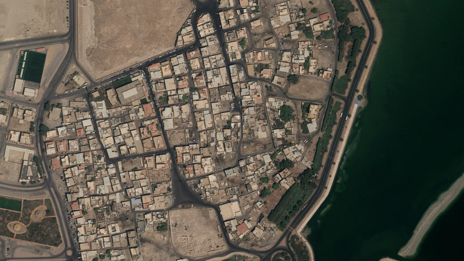
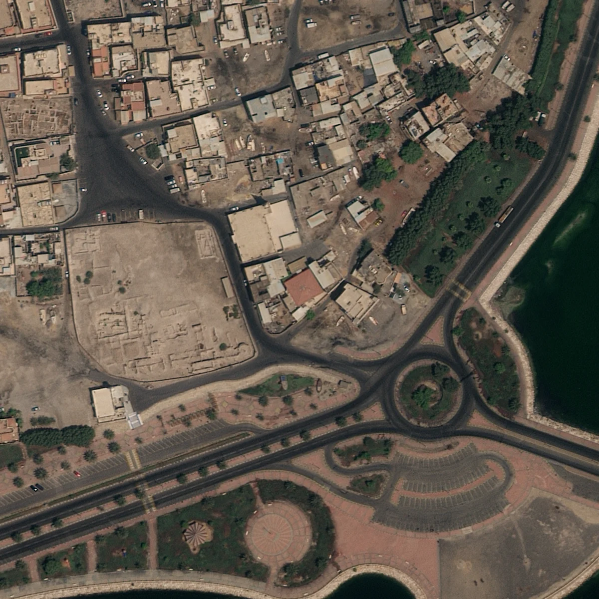
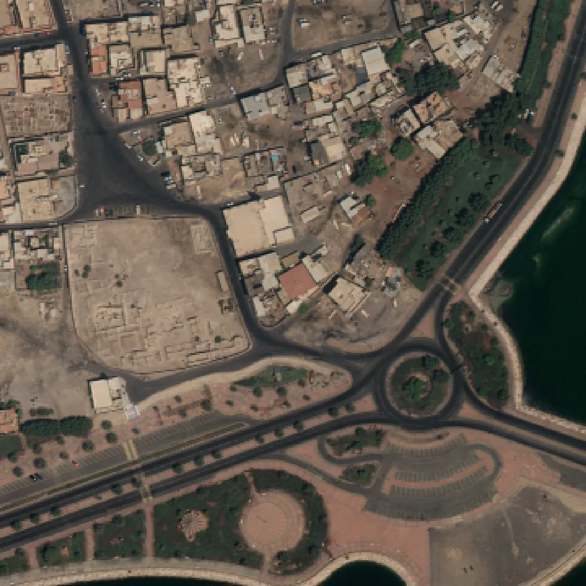
So here are real pixels. This is 360 metres of the old town of Darin, on Tarout Island in Saudi Arabia, from a 30 cm Beijing-3N capture we processed in August 2023. The coarser rungs are the same capture block-averaged to each pixel size, which isolates the one thing this post is about. A real 10 m sensor would also differ in bands and radiometry, and a real 10 m image would look a little worse than this rung, not better.
 0.3 m
0.3 m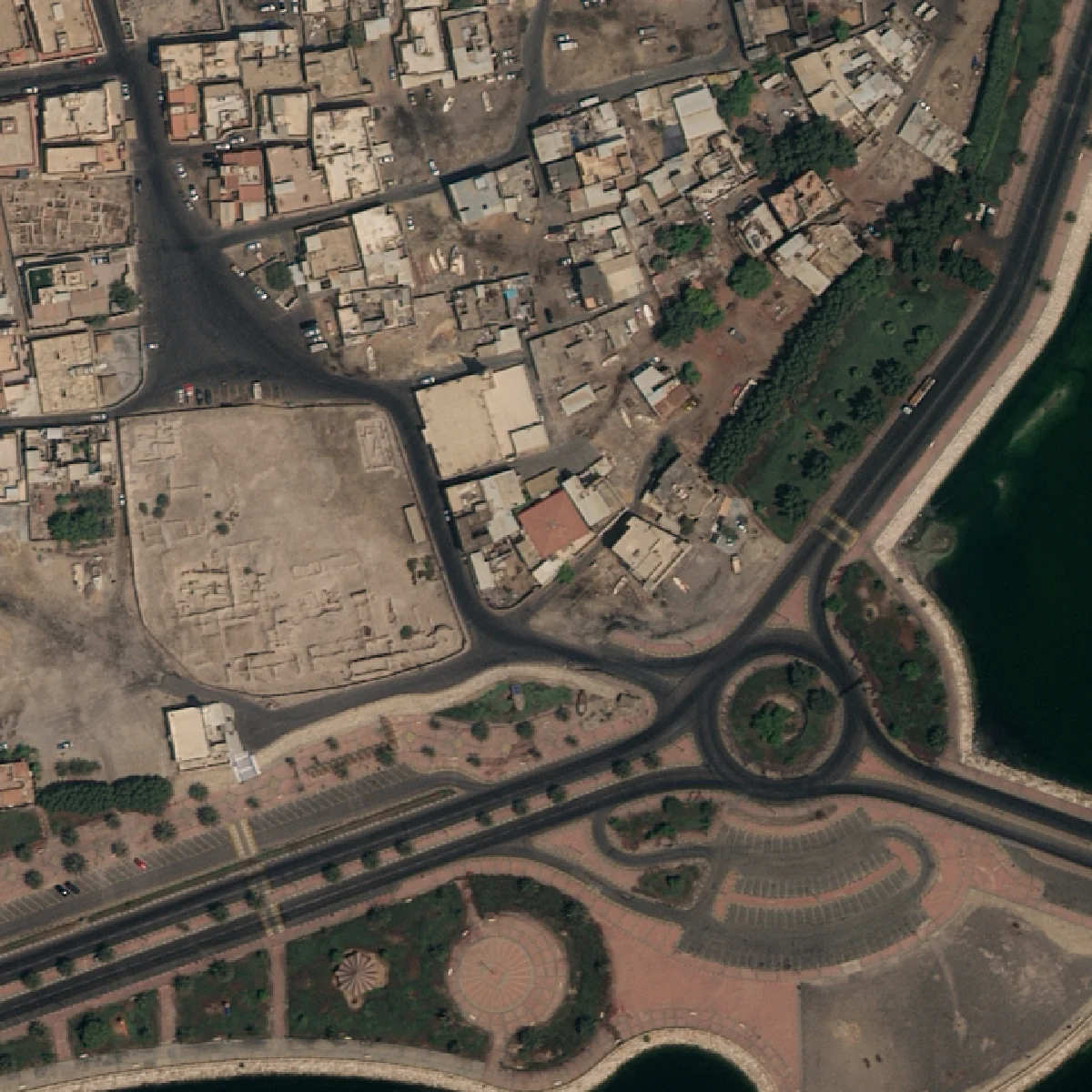
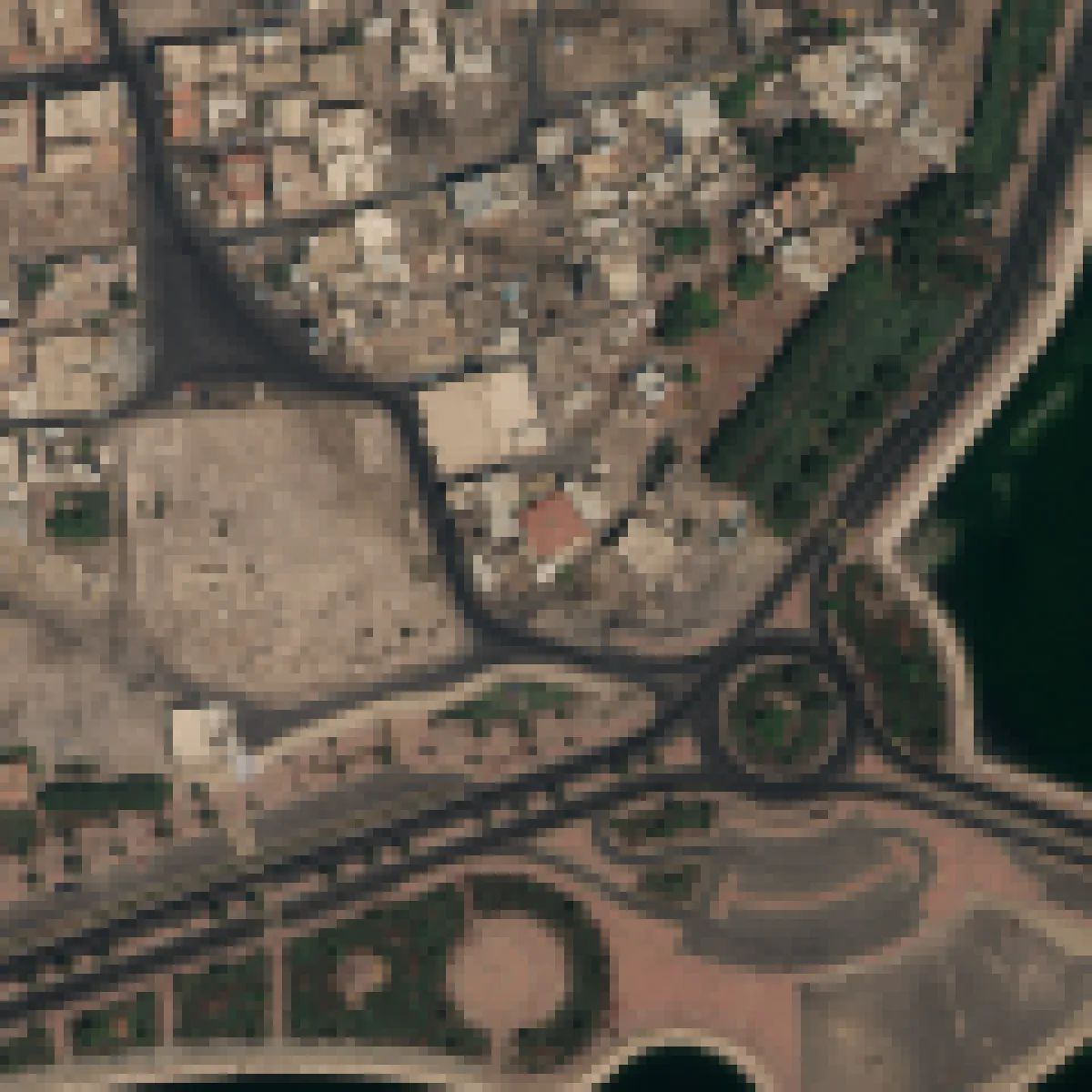
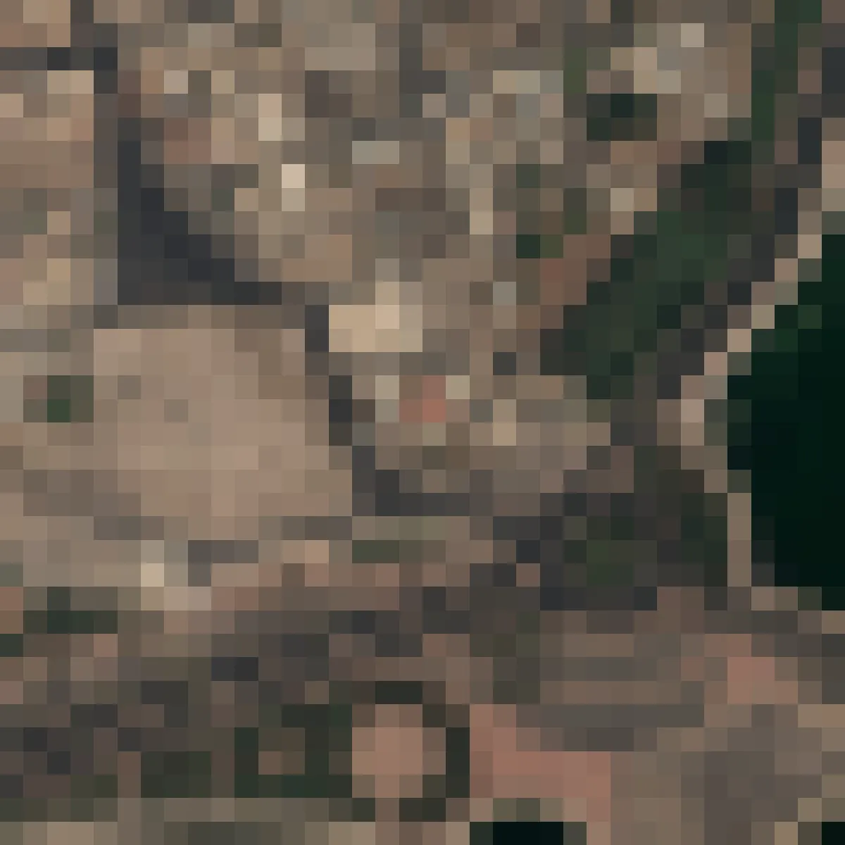

Native pixel. Cars, palm trees and lane markings are separate objects. 1.44 million pixels in the frame.
The same 360 metres is 1.44 million pixels at 30 cm and 144 pixels at 30 m. That factor of ten thousand is the whole economics of the industry in one number, and it is why the rest of this post keeps coming back to the question of which rung you need.
What You Can See at 30 cm, 50 cm, 1 m, 3 m and 10 m
Work through the ladder with a car in mind, since cars are the object people most often ask about. A parked car is about 4.5 m long and 1.8 m wide. At 30 cm that is a 15 by 6 pixel object with a visible windscreen, a colour, and a shadow that tells you the sun angle. At 50 cm it is 9 by 4 pixels: countable, colourable, no longer identifiable by make. At 1 m it is 4 by 2, a speck you can count in a car park if the contrast is good. At 3 m it is a pixel and a half, and it is gone.
Buildings hold on longer. A 12 by 10 m house is 40 by 33 pixels at 30 cm and still 4 by 3 pixels at 3 m, which is enough to know it is there and roughly how big. At 10 m the same house is one pixel mixed with whatever surrounds it. Roads are the last thing to go, because they are long: a 7 m road is a two-pixel line at 3 m and a faint darker streak in mixed pixels at 10 m, which is why street grids are still readable as texture in Sentinel-2 imagery of cities.
| Pixel size | What one pixel shows | Sensors through Geopera | Indicative archive price (USD/km²) |
|---|---|---|---|
| 30 cm | Cars as separate objects, lane markings, roof detail | WorldView-3, WorldView Legion, Beijing-3N, SuperView Neo | $17 to 26 |
| 40 to 50 cm | Countable cars, building footprints, stockpiles | KOMPSAT-3A, SuperView-1, Beijing-3A, Perascope 50 cm | $8 to 18 |
| 75 cm to 1 m | Buildings, roads, site layout | Perascope 75 cm, TripleSat, GaoFen-2 | $4 to 10 |
| 2 to 3 m | Fields, city blocks, large structures | GaoFen-1 | $1 to 6 |
| 10 m | Field-scale vegetation, land against water | Sentinel-2 (free, in Pera Portal) | Free |
| 30 m | Regional land cover; a sports field is one pixel | Landsat 8 and 9 (free) | Free |
Price bands are the industry archive ranges from our cost guide, not a quote. Tasking a new capture runs roughly 50 to 100% above archive at every tier.
111,111
pixels per hectare at 30 cm
100
pixels per hectare at 10 m
1,111×
more pixels, 30 cm against 10 m
89 MB
per km² at 30 cm, 4 bands, 16-bit
The data volume line is worth a pause. A 30 cm order is not only dearer per square kilometre, it is heavier: the Darin mosaic this figure came from is 809 million pixels for an 8.3 by 8.7 km frame. If your workflow is a laptop and a GIS, 50 km² of 30 cm imagery is a real file, and 500 km² of it is a storage decision.
The Highest Resolution Satellite Imagery Available in 2026
The finest native pixel any commercial optical satellite sells today is 30 cm-class. Through Geopera that means WorldView-3 at 31 cm, WorldView Legion, which reached six satellites when Legion 5 and 6 launched in February 2025, Beijing-3N at 30 cm, and SpaceWill’s SuperView Neo at 30 cm across four satellites. Behind them sits a deep 40 to 50 cm tier: KOMPSAT-3A at 40 cm, SuperView-1 and Beijing-3A at 50 cm, and our own Perascope constellation at 50 and 75 cm, which is where most site-monitoring programmes settle once they price the difference.
You will also see 15 cm advertised. Vantor’s 15 cm HD product, and the HD 3D line it launched in July 2026, are processed products built from 30 cm-class captures, not 15 cm pixels collected from orbit. They can look sharper and they can be useful. They are not a new rung on the ladder in the sense the figure above uses. Below 30 cm from space, the light collected per pixel and the optics needed to focus it run into limits that money has not moved in over a decade: WorldView-3 launched in 2014.
If the thing you need to see is smaller than a car, the answer is not a sharper satellite. It is an aircraft or a drone, at 5 to 15 cm and half a centimetre respectively, and our drone, aerial and satellite comparison works through when each earns its cost.
Free High-Resolution Satellite Imagery: What Exists and What Doesn’t
Three things get called free high-resolution satellite imagery, and only one of them is what the searcher usually means.
Web basemaps. Google Earth, Google Maps and their peers show sub-metre imagery of most of the inhabited world, much of it aerial rather than satellite, all of it a mosaic of unknown dates, licensed for viewing and not for measurement or redistribution. For looking, it is hard to beat, and it is free. For a report, a regulator, a before-and-after, or any measurement, it has no capture date and no accuracy statement, which is the line our Google Earth versus commercial imagery comparison draws in detail.
Free public missions. Sentinel-2 at 10 m and Landsat at 30 m are free, dated, calibrated, and global, and they are the right answer for most vegetation and land-cover questions. They are the bottom two rungs of the ladder, and the ladder shows what that means for a house or a car. Our country guides for Australia, the UK and elsewhere list where to get them.
Disaster releases. Operators release sub-metre imagery free during major disasters, usually under a non-commercial licence. Vantor released the WorldView-3 stereo strips behind the Bhote Koshi flood reconstruction in August 2026, and that is the only way we know to get 30 cm pixels of a specific place for nothing. It is not a plan you can build a project on.
So the plain statement: there is no free 30 cm image of your site on the date you need. What there is, is a free way to find out whether one exists in an archive and what it would cost.
How to Buy High-Resolution Satellite Imagery
Buying comes down to four decisions, and the general version is in our guide to buying satellite imagery. The high-resolution-specific version is shorter.
Archive or tasking. Every commercial operator keeps its past captures, and over populated areas the 30 to 50 cm archive is deep and cheap relative to a new capture. Search it first. If the newest scene is too old or too cloudy, task a new one, with a capture window and a cloud ceiling written on the order, and expect 50 to 100% over the archive rate.
Which rung. Take the smallest object you need to count, divide by three, and that is roughly the pixel size you need to count it reliably. Cars want 50 cm or better, buildings and stockpiles are fine at 75 cm to 1 m, and paddocks are fine at 10 m, which is free. Buying 30 cm for a paddock is the mistake we see most. On the mid-band archive rates above, 100 km² costs roughly $2,150 at 30 cm against $1,300 at 50 cm, for detail the paddock never uses.
Minimums and processing. Minimum order areas are common, often 25 km² for archive and 50 to 100 km² for tasking, so a 5 km² site pays for 25. Processing is where quotes diverge: orthorectification, pansharpening and atmospheric correction add 30 to 80% at providers that bill them separately. The 30 cm colour image in the figure above is a pansharpened product, the 30 cm panchromatic band fused with 1.2 m colour bands, and without that step you would be choosing between sharp and grey or coloured and soft.
Licence. Single-user is the default. Organisation-wide use and derived products usually need to be written in, and regulators and clients almost always need derived-product rights.
Our own rate card is on the pricing page: archive from AUD $3 per km² and tasking from AUD $14 per km², with the full processing chain included in the rate. We publish it so that this comparison can be done before anyone talks to sales.
How We Handle High-Resolution Imagery at Geopera
Every rung of the ladder from 30 cm to 10 m is searchable in Pera Portal under one account: WorldView-3 and Legion from Vantor, Beijing-3 from 21AT, SuperView from SpaceWill, our own Perascope constellation, and free Sentinel-2, each result showing its pixel size, capture date, cloud cover and per-km² price before you commit to anything. Every order runs the same processing chain, so a 30 cm scene and a 10 m scene arrive the same way: orthorectified, pansharpened where the sensor allows, atmospherically corrected, as a Cloud Optimized GeoTIFF. The Darin mosaic in this post is what that chain produces from three raw captures.
If you’d rather test the product on your own site than take our word for the ladder, you can apply for a processed sample. We review applications and talk through the use case first, partly to make sure the rung is right before anyone spends money on the wrong one.
Frequently Asked Questions
What is high resolution satellite imagery?
High-resolution satellite imagery has a ground sample distance of about 1 m or finer, meaning each pixel covers 1 m or less of ground. Very high resolution is below 1 m, with 30 cm the finest sold commercially in 2026. At 30 cm individual cars, lane markings and roof details are visible. At 1 m buildings and roads are clear but vehicles are specks.
What is the highest resolution satellite imagery available?
The highest native resolution sold commercially is 30 cm-class, from WorldView-3 (31 cm), WorldView Legion, Beijing-3N and SuperView Neo. Products marketed at 15 cm are processed from 30 cm-class captures rather than collected at 15 cm. For finer detail, aerial imagery at 5 to 15 cm or drones at about half a centimetre are the practical options.
Is there free high resolution satellite imagery?
Not for a chosen site and date. Web basemaps such as Google Earth show sub-metre imagery free for viewing, but it is an undated mosaic licensed for looking, not measuring. Free public missions are Sentinel-2 at 10 m and Landsat at 30 m. Operators release sub-metre imagery free only during major disasters, under non-commercial terms.
How do I get high resolution satellite images of a specific location?
Search a commercial archive over your polygon first: Pera Portal shows available 30 cm to 1 m scenes with dates, cloud cover and per-km² prices. If nothing recent exists, task a new capture with a capture window and a cloud ceiling. Archive orders are often delivered the same day. Tasking waits for the satellite and the weather.
How much does high resolution satellite imagery cost?
Typical 2026 archive prices are about $17 to 26 per km² at 30 cm and $8 to 18 per km² at 50 cm, with tasking 50 to 100% higher. Minimum order areas of 25 km² for archive and 50 to 100 km² for tasking are common. Geopera’s published rate card starts at AUD $3 per km² for archive and AUD $14 for tasking, processing included.
It would be easy to read the ladder as an advertisement for the top rung, and we do sell it. It is closer to the opposite. Resolution is the spec you pay for twice, once per square kilometre and again in every byte you store and every hour an analyst spends moving it, and the payment goes up with the square of the number. The right pixel is the biggest one that still shows the thing you need to count. Everything finer than that is a photograph you are paying to look at.
