Geopera — Satellite Imagery and Geospatial Analytics
The teams shaping the future
choose better data
Satellite imagery, analytics, and monitoring for the world's most ambitious projects.
How Geopera works
Define your area
Draw or upload your area of interest in Pera Portal. Pricing is instant and up front.
Captured from orbit
We task the best satellite for the job — or pull from 100+ sensors of archive, often the same day.
Processed automatically
Every pain of raw imagery, fixed without a single manual step — in hours, not weeks:
- Captures co-registered
- Atmospherically corrected
- Aligned to your control
- Clouds routed out
- Colours harmonised
Analysis-ready delivery
Download or stream it straight into your workflow. Ready to use, the moment it lands.
Trusted by
Products
High Resolution Imagery
Task a satellite to capture your area of interest in just a few clicks, set up recurring monitoring, and purchase archive imagery from our vast archive of data.
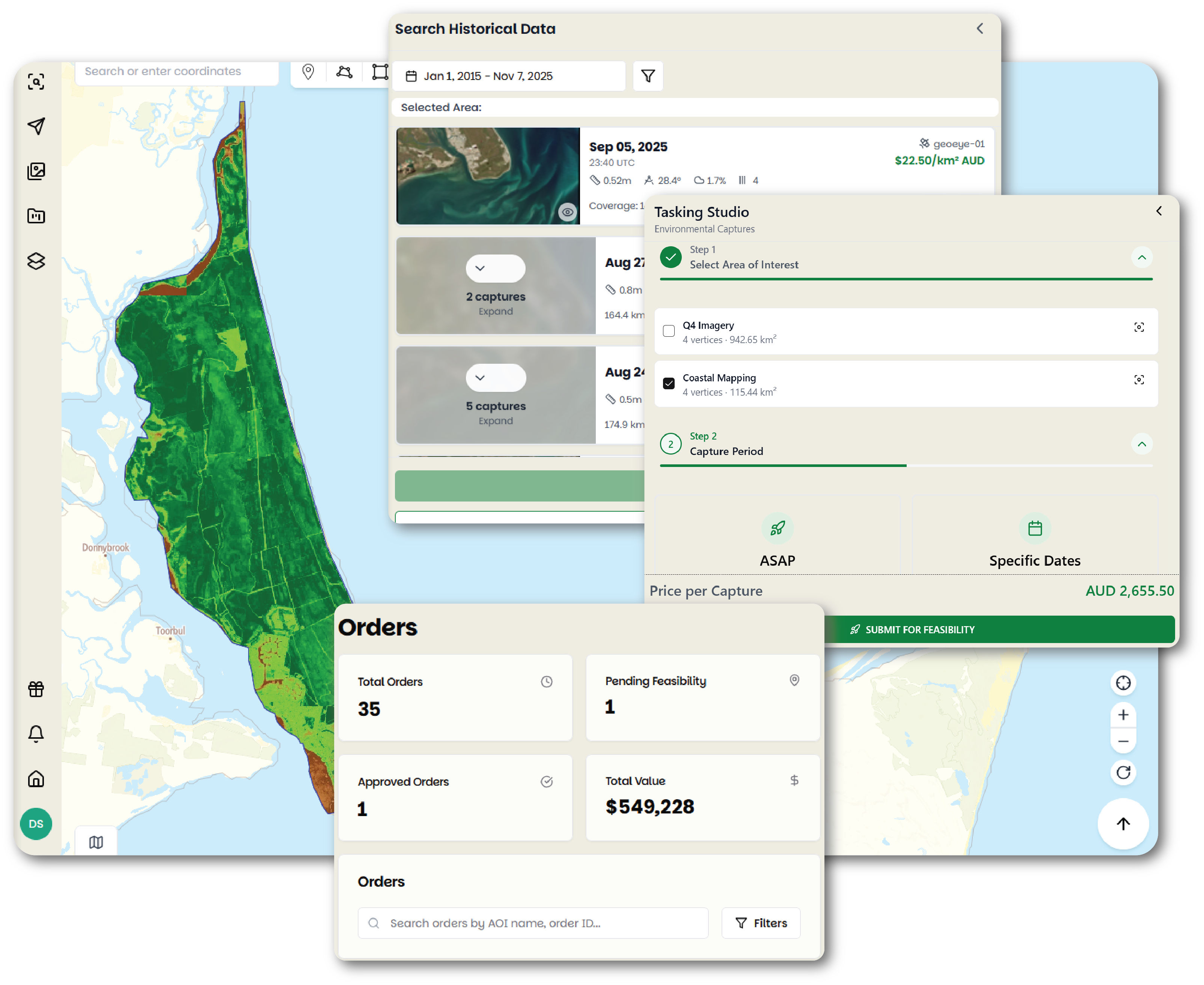
Analytics & Monitoring
Turn imagery into answers. Run change detection, vegetation, and water-quality analytics, then set up recurring monitoring that watches your sites and reports change over time — all in Pera Portal.
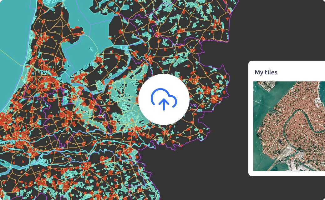
Image Hosting
Discover how Geopera simplifies GIS data management with secure hosting and instant WMTS streaming. Access your geospatial data through our global network while maintaining enterprise-grade security, all with automatic endpoint creation and optimized memory usage.
The only platform you need for satellite imagery, analytics, and monitoring
Access the exact data you need for your projects
Effortlessly access a comprehensive archive of historical satellite imagery to support your environmental projects.
- Full archive visibility: Get a full overview of all available archive imagery on the dates you require
- Transparent Pricing: Our clear, competitive and instant pricing lets you plan and budget your environment monitoring with ease
- Wide range of data sources: Leverage imager from over 100 satellites, enabling deeper analysis of environmental conditions across diverse ecosystems


Let us show you how good satellite data can be
Explore our products or get in touch with our team to find the perfect solution for your geospatial needs.