
Enterprise
One account and one invoice for every imagery order
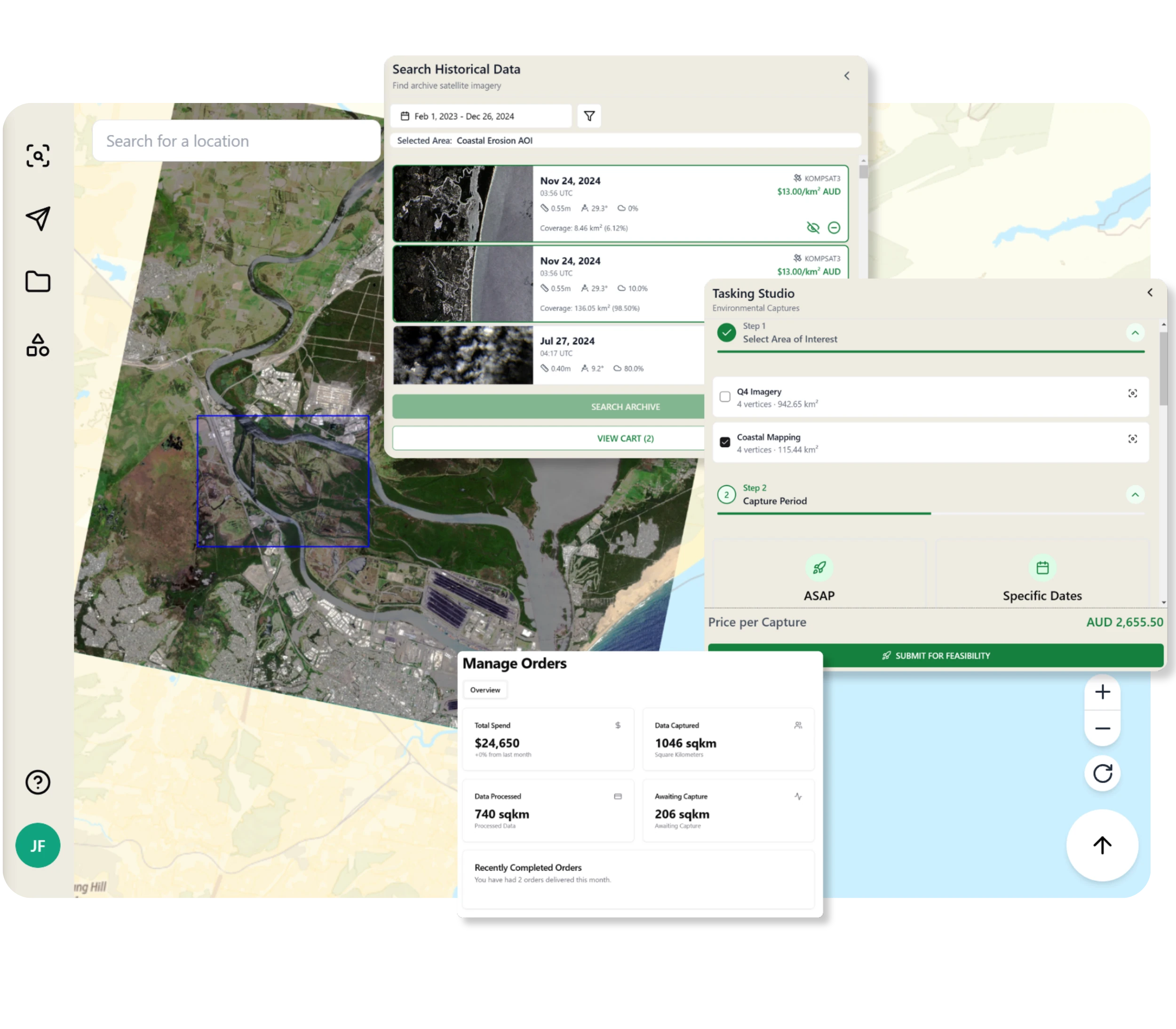
We operate no constellation of our own, so we sell you the right sensor, not our sensor. Your teams order archive and tasking from 100+ satellites in one place, prices are published per km² of your area of interest, and finance deals with one supplier.
100+
satellites, one account
$3–55
per km², rates published
72
countries, 12 regions
<24 h
most orders deliver
One account, one invoice
Archive and tasking from 100+ satellites are ordered through the same account. Your finance team deals with one supplier and one invoice instead of a separate contract with each satellite operator.
Prices you can budget
The rate card is public, priced per km² of your area of interest rather than per capture. Archive runs from $3 to $39 per km² depending on resolution, tasking from $14 to $55, quoted in AUD before tax with approximate conversion to USD and EUR. If several captures cover your AOI, the price does not change.
Processing in that rate
Every order runs through the same automated chain: ortho correction, alignment, pansharpening, colour balancing, and mosaicing, with nothing manual between stages. That gapless chain is Legato and it costs nothing extra. A delivery is only described as Legato-processed once the run passes automated QC: seam colour difference of 0.5 ΔE or less across the block, geometry and radiometry checks passed, and 100% clean coverage.
Every order in one list
Each order carries a type, a project, a status, and a total. Anyone with access to the account can see what was ordered, what it cost, and where it is, without emailing a rep. Most orders deliver within a day.
Direct answers for procurement
Security questionnaires, licensing terms, and export-control questions go to [email protected]. They reach the people who write the answers rather than a form queue.
Checking quality first
We prepare processed sample data over your own area of interest and send the QC report behind it. Samples are allocated by application: tell us about the project, we set up a short call to understand what your team needs to see, and we prepare the sample against that.
Where we deliver
We currently deliver to 72 countries across 12 regions. Licensing terms and tasking restrictions for sensitive regions are published before you order.
Fitting your systems
The catalogue is STAC 1.0 GeoJSON. Tiles stream into QGIS and ArcGIS over WMTS and XYZ with an API key, deliveries are Cloud Optimized GeoTIFFs, and there are typed Python and TypeScript SDKs.
Moving from another platform
If your team already buys imagery through another platform, authentication, catalogue search, ordering, tasking, and processing calls map onto ours. We will walk your developers through the differences.
Get started
Put the account in front of your team
Talk to us about your areas and cadence, or start in the portal today.