How Much Does Satellite Imagery Cost in 2026?
Real satellite imagery prices per km2 by resolution tier. Archive vs tasking costs, hidden processing fees, and what you actually end up paying.
Summary
- Commercial satellite imagery ranges from ~$2/km2 to $55+/km2 depending on resolution, whether you’re buying archive or tasking new captures, and your licensing needs.
- Archive imagery costs 40-60% less than new tasking. If someone already photographed your area, you save substantially.
- The brochure price isn’t what you’ll actually pay. Processing fees add 30-80% at most providers. Minimum order areas mean you might buy 25km2 when you only need 2km2. Multi-user licensing adds another 30%.
- Free satellite imagery exists at lower resolutions: Sentinel-2 at 10m (ESA), Landsat at 30m (USGS), and now NISAR at 5-10m for SAR applications.
- Some providers include processing in their price. Most don’t. This single factor can swing your total cost by thousands of dollars.
Try finding satellite imagery pricing online. Go ahead. Pick any major provider’s website and look for actual numbers.
You’ll find “Contact Sales.” Or “Request a Demo.” Or “Get a Quote.” Maybe a “Starting at…” followed by no actual detail.
This is an industry that sells data products at scale, and almost nobody publishes what they charge. They want you on a sales call before you know whether you’re looking at $5/km2 or $50/km2. For a technology business in 2026, the pricing opacity is genuinely wild.
We publish our pricing. Openly. With actual numbers. Because we think you should know what things cost before committing to a conversation. So here’s everything we know about what satellite imagery costs across the industry — not just from us.
Resolution Is the Biggest Cost Driver
Two factors determine roughly 80% of your satellite imagery cost. Resolution is the first, and it’s the big one.
The relationship isn’t linear. Going from 3m to 1m resolution roughly doubles the price. Going from 1m to 50cm doubles it again. And the jump from 50cm to 30cm? Nearly doubles once more.
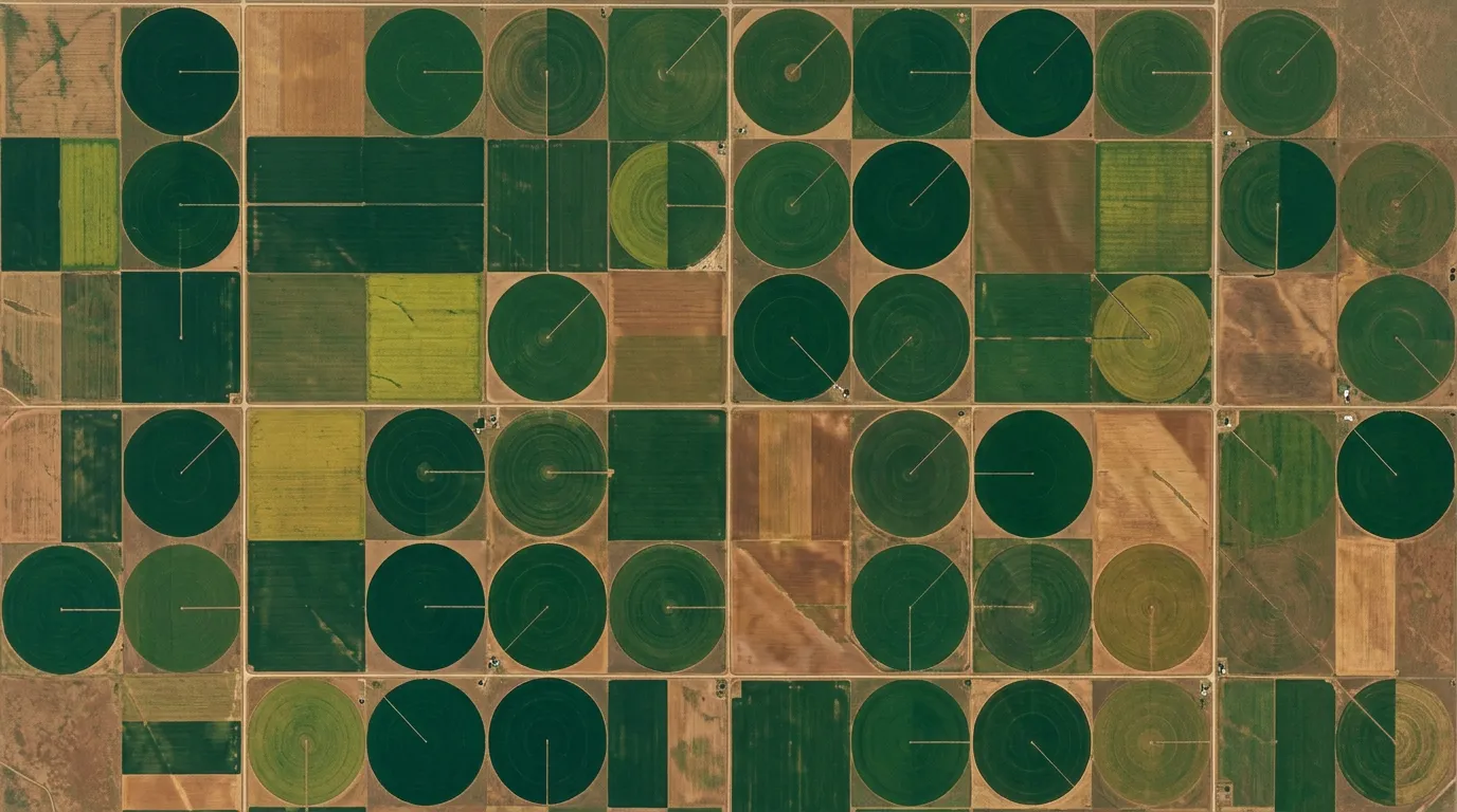
At 30cm, you can identify the make of a car in a parking lot. At 3m, you can tell there’s a parking lot. At 10m, you can tell there’s a commercial area. Different projects need different levels of detail, and paying for 30cm when 1m would do is like hiring a helicopter when a drone would get the job done.
The common mistake? Defaulting to the highest resolution available “just in case.” We see this constantly. Someone orders 30cm imagery for a vegetation monitoring project where 50cm or even Sentinel-2’s free 10m data would give them everything they need.
Archive vs Tasking: The 50-100% Price Gap
The second big factor. And it catches more people off guard than it should.
Archive imagery already exists. At some point in the past, a satellite flew over your area and captured an image. You’re buying access to that existing data. Delivery is often same-day.
Tasking means you’re asking a satellite operator to point their camera at your specific location on a future date. You’re essentially booking a photoshoot from space.
The price difference is dramatic:
| Archive | Tasking | |
|---|---|---|
| Typical cost (50cm) | $8-18/km2 | $15-35/km2 |
| Typical cost (30cm) | $17-26/km2 | $25-55/km2 |
| Minimum order area | 25 km2 | 50-100 km2 |
| Delivery time | Hours to days | Days to weeks |
| You control the date? | No | Yes |
And within tasking, there’s often a further split between “flexible” and “assured.” Flexible means the operator will try to capture your area but makes no guarantee — if clouds roll in or a higher-priority customer needs the slot, you wait. Assured means they commit to delivering, and it can cost 3-4x more than flexible.
The Hidden Costs Nobody Warns You About
Here’s where the published per-km2 rates get misleading. The price you see on a rate card or quote is often just the starting point.
Processing fees: the 30-80% surprise
Raw satellite imagery needs orthorectification, pansharpening, atmospheric correction, and potentially mosaicking before you can actually use it for analysis. Most providers charge separately for this. The processing markup typically adds 30% to 80% on top of the base imagery price.
So that $15/km2 quote for 50cm imagery? After processing, you’re looking at $20-27/km2. On a 100km2 order, that’s an extra $500-$1,200 nobody mentioned during the sales call.
Minimum order areas: paying for what you don’t need
You can’t buy 1km2 of high-resolution imagery from most providers. Minimum order areas are typically 25km2 for archive and 50-100km2 for tasking. Some go as high as 500km2 for medium-resolution tasking.
What that means in practice: if you need imagery of a 5km2 mine site, you’re paying for 25km2 at minimum. At $15/km2, that’s $375 instead of $75. A 5x overpurchase that nobody flags at quote stage.
Licensing: the 30% you didn’t budget for
The base price assumes a single user accessing the data for internal purposes. Need two people to look at it? That’s usually a 30% uplift. Government use? Additional uplift. Want to include imagery in a published report? Different licensing tier entirely.
Most buyers don’t think about licensing until the contract shows up. By then, the budget’s already approved at the “base” price.
Cloud cover specs: paying more for clear skies
Standard pricing usually assumes 10-15% cloud cover tolerance. Want guaranteed less than 5% cloud cover? Expect a 25% uplift. Cloud-free? Even more. If you’re working in tropical regions where clear skies are rare, these uplifts add up fast.
A Real-World Cost Breakdown
Let’s walk through a real example. You need 30cm resolution, pansharpened imagery of a 50km2 mining concession. Archive from the last 6 months, less than 10% cloud cover.
Scenario A: Traditional provider with separate processing
- Base imagery: 50km2 x $22/km2 = $1,100
- Processing (ortho + pansharp + atmos): ~50% uplift = $550
- Standard licensing (single user): included
- Total: ~$1,650
Scenario B: Provider with lower-res but cheaper option (50cm)
- Base imagery: 50km2 x $8/km2 = $400
- Processing: ~50% uplift = $200
- Total: ~$600
Scenario C: Provider that includes processing (like Geopera)
- All-in price: 50km2 x per-km2 rate from our pricing page
- Processing: included. $0 extra.
- Total: Just the imagery cost. No surprises.
The gap between Scenario A and Scenario B is nearly 3x, for imagery that’s genuinely good enough for most monitoring applications. And the gap between any traditional provider and one that includes processing can save hundreds to thousands depending on order size.
Whether the jump from 50cm to 30cm justifies $1,000+ depends entirely on your use case. For mining rehabilitation monitoring, 50cm is usually plenty. For counting individual structures in an urban damage assessment, you probably need 30cm.
When Free Imagery Is Good Enough
Not every project needs commercial data. We say this even though we sell the stuff, because recommending expensive imagery for a project that Sentinel-2 could handle would be dishonest.
| Source | Resolution | Revisit | Cost | Best For |
|---|---|---|---|---|
| Sentinel-2 (ESA) | 10m | 5 days | Free | Agriculture, land use, vegetation indices |
| Landsat 8/9 (USGS) | 30m | 16 days | Free | Long-term change detection, environmental |
| Sentinel-1 (ESA) | 5-40m | 12 days | Free | All-weather SAR monitoring |
| NISAR (NASA/ISRO) | 5-10m | 12 days | Free | Ground deformation, forestry (new in 2026) |
We’ve written free satellite data guides by country covering where to access all of this.
The honest take: if you’re monitoring crop health across a large agricultural area, Sentinel-2 at 10m is excellent and costs nothing. If you need broad environmental change detection over decades, Landsat’s 40+ year archive is unbeatable. But if you need to identify individual trees, assess building-level damage, or read the text on a shipping container, you need commercial resolution.
How to Not Overpay
After processing thousands of imagery orders, here’s what we’ve learned:
Check archive first. Always. The 50-100% price premium for tasking only makes sense when you genuinely need a specific capture date. For most projects, archive imagery from the last few months works perfectly.
Match resolution to your actual need. The most common waste we see is people buying 30cm imagery for projects where 50cm or even 1m would deliver identical analytical outcomes. Ask yourself: “What’s the smallest thing I need to identify?” and pick the resolution that just covers it.
Ask about processing before you commit. If a provider quotes base imagery cost without mentioning processing, get the all-in number. Then compare all-in prices across providers, not headline rates.
Watch minimum order areas. If you need 5km2, find a provider with minimums that don’t force you to buy 100km2. Some modern platforms let you order exactly the area you need.
Consider non-Western satellite providers. Several Asian constellations now offer 50cm archive at $6-8/km2, undercutting traditional Western providers by 40-50%. The quality has improved enormously in recent years, and at Geopera we offer imagery from multiple providers through our Pera Portal so you can compare options.
For transparent, all-in pricing with processing included, check our pricing page. For available imagery over your specific area, browse the Pera Portal. And if you’d rather just tell someone what you need, talk to our team.
Frequently Asked Questions
How much does satellite imagery cost per square kilometre?
Commercial satellite imagery ranges from about $2/km2 (1.5m resolution, archive) to $55+/km2 (30cm stereo, new tasking). The most commonly purchased tier — 50cm archive — typically falls between $8-18/km2 depending on provider. Free options exist at 10m resolution (Sentinel-2) and 30m (Landsat).
Why do most satellite imagery providers hide their pricing?
The industry traditionally uses enterprise sales models where pricing is negotiated per deal. Providers argue that pricing “depends on requirements,” but the real reason is that opacity enables higher margins. A few modern platforms now publish transparent pricing. We’re one of them — our rates are on our pricing page.
Does satellite imagery processing cost extra?
At most traditional providers, yes. Orthorectification, pansharpening, and atmospheric correction typically add 30-80% to the base imagery cost. Some providers include all processing at no extra charge — at Geopera, every order ships fully processed and analysis-ready. Always ask whether the quoted price includes processing.
What is the minimum order for satellite imagery?
Minimum order areas vary. Most providers require 25km2 for archive orders and 50-100km2 for tasking. Some medium-resolution products have 500km2 minimums. A few modern platforms have reduced or eliminated minimums, letting you order exactly the coverage you need without paying for excess area.
Is free satellite imagery good enough for commercial projects?
For many applications, yes. ESA’s Sentinel-2 provides free 10m resolution imagery with 5-day revisit, which is sufficient for regional agriculture monitoring, land use classification, and broad environmental tracking. USGS Landsat offers free 30m data going back to 1972. For projects requiring sub-metre detail — infrastructure inspection, urban mapping, property-level analysis — commercial imagery is necessary.
Related Articles

How to Buy Satellite Imagery in 2025
Complete guide to purchasing commercial satellite imagery, including procurement best practices.
Best Satellite Imagery for Every Application
Guide to selecting the optimal satellite imagery for your specific application needs.
Why We Process Every Image
Why professional-grade processing is essential and how it affects your analysis outcomes.