Drone vs Aerial vs Satellite Imagery: Which to Use When
Drone vs aerial vs satellite imagery compared on resolution, coverage, cost shape and access, with a decision framework for choosing the right platform.
Summary
- Drone, aerial and satellite imagery solve different problems, and the deciding variables are area size and revisit need, not image quality in the abstract.
- Drones win below roughly a square kilometre: 0.5 to 5 cm detail, flown on demand, but every hectare costs pilot time and you need legal access to the site.
- Crewed aerial survey wins for metro-scale visual base maps: 5 to 15 cm resolution flown in campaigns, typically a few times a year over cities, with thin coverage outside them.
- Satellites win on large areas, remote or inaccessible sites, frequent revisit, and history: 30 cm to 10 m resolution over any coordinates on Earth, with archives reaching back decades.
- Most serious monitoring programmes end up combining platforms: satellite for the standing record, drone or aerial where centimetre detail earns its cost.
A survey drone in standard mapping mode covers something like five square kilometres in a good day. At that pace, one drone mapping the Shire of East Pilbara in Western Australia, all 372,000 square kilometres of it, would still be flying in the 2220s. A satellite constellation photographs the whole shire before lunch, and did so yesterday as well.
Flip the comparison and it inverts just as hard. Ask that satellite to count rivets on a conveyor gantry and it can’t. The drone reads the serial number.
That’s the honest shape of the drone vs aerial vs satellite imagery question: there is no best platform, only a best platform for a given area, detail level, and repeat schedule. Buyers who get this wrong usually overpay in one of two directions, either flying drones over areas that satellites cover for a fraction of the price, or buying satellite pixels for a job that needed millimetres. The rest of this post is the decision, worked through properly.
What Actually Separates the Three Platforms
Altitude, mostly. Everything else follows from it.
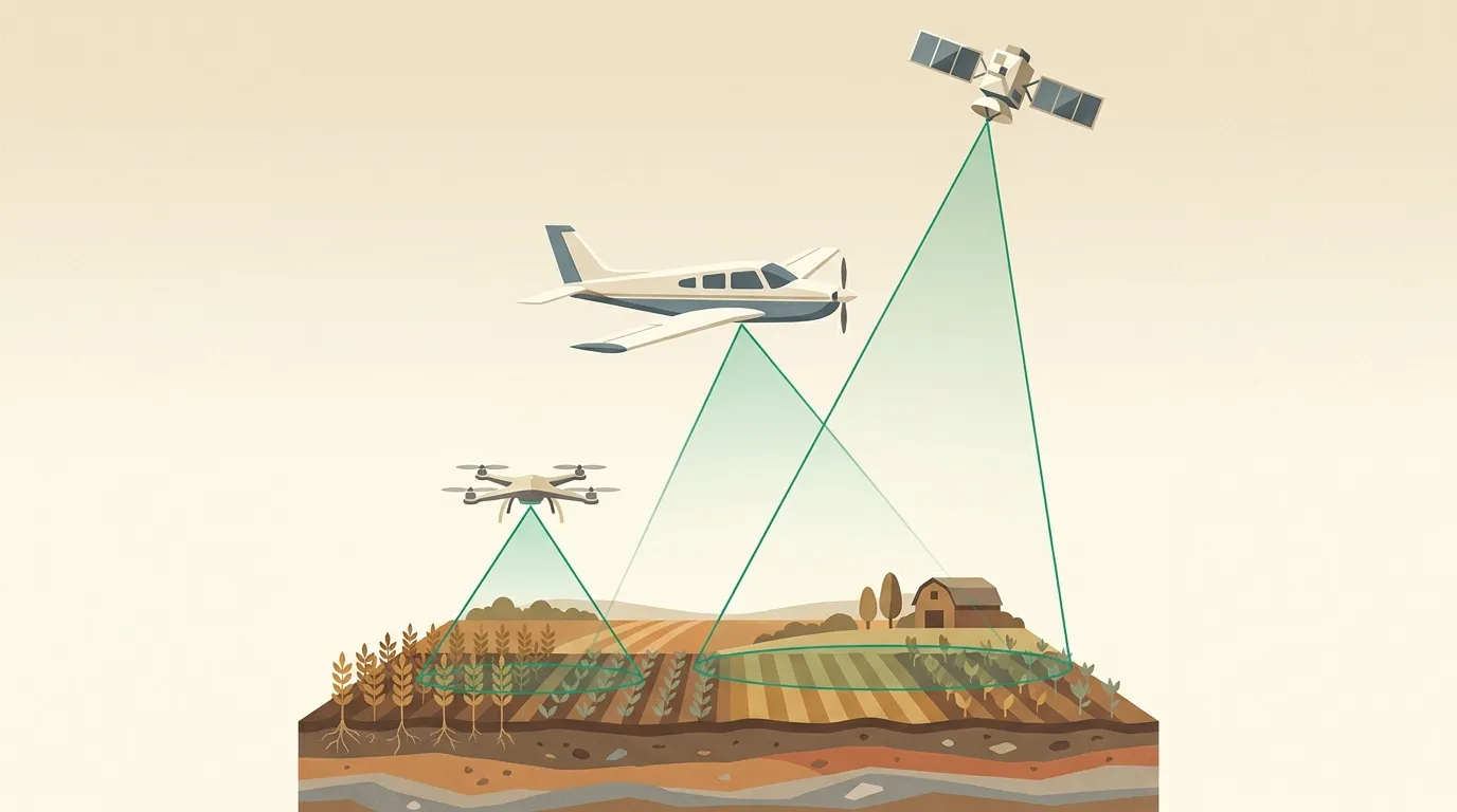
A drone flies at 50 to 120 metres, so each pixel covers half a centimetre to a few centimetres of ground. A survey aircraft flies at a few thousand metres and delivers 5 to 15 cm pixels across a whole city in a campaign. An imaging satellite sits several hundred kilometres up: commercial resolution runs from 30 cm at the sharp end to 10 m on free public missions like Sentinel-2, and a single pass can image a swath tens of kilometres wide.
| Platform | Typical resolution | Coverage per day | Ground access needed | Cloud | Historical archive | Cost shape |
|---|---|---|---|---|---|---|
| Drone | 0.5-5 cm | 1-10 km² | Yes, plus flight rules | Flies under it | Starts when you start | High per km², low per visit |
| Crewed aerial | 5-15 cm | Hundreds of km² | No, airspace only | Mostly under it | Campaign years only | Mid; sold via programmes |
| Satellite | 30 cm - 10 m | Entire regions | None at all | Blocked (optical) | Back to 1972 via Landsat | Lowest per km² at scale |
Two rows of that table deserve a closer look, because they decide more procurements than resolution does.
Access. A drone needs someone standing near the site with legal permission to fly, under rules like CASA’s in Australia. Crewed aircraft need airspace clearance. A satellite needs nothing: not permission, not access, not a person in the country. For land you don’t control, sites across a border, offshore assets, or anywhere a travel budget dies, that row settles the argument by itself.
History. Imagery you didn’t order can’t be flown retrospectively. A drone archive begins the day your programme does. Satellite archives already exist: Landsat has imaged the planet since 1972 and Sentinel-2 has covered it at 10 m since 2015, so a dispute about what a site looked like in 2019 can be answered this afternoon. For baselines, legal evidence, and change analysis, the archive is the product.
When a Drone Wins
Below about a square kilometre, with detail doing the earning, nothing touches a drone. Sub-5 cm pixels resolve individual plants, cracked pavement, corroded fittings, stockpile toes. Photogrammetry from a well-flown drone survey yields elevation models at centimetre accuracy that satellite stereo can’t approach. And the drone flies under cloud, on your schedule, the same afternoon you decide you need it.
The costs are real, though, and they’re not mainly the hardware. A licensed operator, site access, flight approvals, and processing time all scale with every visit and every site. One quarry, monthly: entirely sensible. Forty quarries across three states, monthly: now you’re running an aviation programme, and the spreadsheet stops being funny.
When Crewed Aerial Wins
Aerial survey occupies the middle deliberately. Cities and growth corridors get flown in organised campaigns at 5 to 10 cm, which is sharp enough to read driveways, roof condition and kerb lines across an entire metro at once. For councils, insurers and utilities that need a consistent visual base map of a city a few times a year, these programmes are mature, well priced, and very good at exactly that.
The limits are the flip side of the model. Coverage concentrates where the subscriber density is: capital cities and large regional centres, flown on the programme’s calendar rather than yours. Between campaigns nothing updates. Outside the flown footprint, which for a mining region or agricultural shire can mean everywhere that matters to you, there’s simply no data to buy.
When a Satellite Wins
Satellites hold the rest of the map: the large, the remote, the frequent, and the historical.
Which platform, for what job
Work through the axes and the pattern is mechanical. Once an area passes a few tens of square kilometres, per-km² pricing beats mobilising anything with a pilot. Once revisit passes a few times a year, the platform that’s already overhead beats the one that needs scheduling: modern constellations pass over most coordinates daily, and tasking a fresh capture is an order form rather than a logistics plan. And the moment a site is inaccessible, the other two platforms leave the board entirely.
Resolution is the trade you’re actually making. At 30 cm you can count vehicles, buildings, containers and cleared land; you can’t read a serial number or map a crack. The practical question isn’t “is satellite imagery sharp enough?” in general, it’s whether your measurement survives at 30 or 50 cm. Most monitoring measurements do. Our guide to choosing the right satellite covers that decision once you’re on this side of the map.
Cloud is the other trade: optical satellites can’t see through it, drones fly under it. In the wet season over the tropics that matters, and a programme that needs guaranteed capture windows plans around it with tasking windows or accepts the gap.
The Decision in Practice
Three worked examples, deliberately generic.
A 40-hectare quarry, monthly compliance photos. Genuinely contestable. A local drone operator gives you centimetre detail; a 50 cm satellite subscription gives you the record without anyone driving out. If the measurement is “has the disturbed footprint grown”, satellite wins on cost and consistency. If it’s “is that bench cracking”, drone.
A 300-site infrastructure portfolio, quarterly. Satellite, and it isn’t close. Twelve hundred drone mobilisations a year is a business, not a monitoring programme. One archive-plus-tasking arrangement covers every site in the same quarter at a knowable per-km² price.
A flood response across three shires. Satellite first, because it’s the only platform that can see the whole event this week, then drones on the specific assets the imagery flags. Which is the general pattern hiding in all three examples: the platforms stack. Satellite carries the standing record; the closer platforms spend their higher cost only where the record says to look.
That stack is the part most platform-versus-platform articles miss. We sell the satellite layer, so weigh our view accordingly, but the strongest monitoring programmes we see run exactly this way: a consistent satellite baseline over everything, processed to be analysis-ready on arrival, with drone or aerial detail commissioned as the baseline demands. Through one account, that baseline spans 100+ satellites with the price per km² published before any order goes in.
Frequently Asked Questions
What is the difference between aerial and satellite imagery?
Aerial imagery is captured from crewed aircraft at a few thousand metres and resolves 5-15 cm over campaign areas such as cities. Satellite imagery is captured from orbit at 30 cm to 10 m resolution, covers any location on Earth, and carries archives reaching back decades.
Is drone imagery better than satellite imagery?
For sites under about a square kilometre where you need sub-5 cm detail and have legal access, yes. For large areas, multiple sites, inaccessible land, or frequent revisit, satellite imagery costs less per km² and needs no one on the ground.
How accurate is satellite imagery compared to aerial?
Commercial satellite imagery resolves 30-50 cm per pixel against 5-15 cm for aerial survey, so aerial shows finer detail. Positional accuracy after orthorectification is comparable for both: a few metres or better, depending on processing and ground control.
Is satellite imagery cheaper than aerial photography?
Per square kilometre at scale, yes. Satellite archive imagery is priced per km² of your area, with no mobilisation, flight or crew costs. Aerial campaigns are cost effective mainly within their subscribed metro footprints; outside them, satellite is usually the cheaper source.
When should you use aerial vs satellite imagery?
Use crewed aerial when you need 5-10 cm detail across a metro area that an existing campaign already covers. Use satellite when the area is large, remote, outside flown footprints, needs frequent revisit, or needs a historical baseline from the archive.
