How to Add Satellite Imagery to QGIS: The 2026 Guide
Three ways to add satellite imagery to QGIS: XYZ tiles, QuickMapServices and GeoTIFFs, plus the licensing trap most tutorials skip.
Summary
- There are three ways to add satellite imagery to QGIS: an XYZ tile connection, the QuickMapServices plugin, or loading a GeoTIFF file directly. Each suits a different job
- The Google satellite XYZ URL that most tutorials hand out isn’t licensed for professional use. Google’s terms require access through its official APIs, and a scraped tile endpoint isn’t one of them
- The Sentinel-2 cloudless basemap from EOX (the pretty one in QuickMapServices and most browser GIS tools) is licensed CC-BY-NC-SA: fine for a hobby map, not for client work
- Actual Sentinel-2 data is genuinely open. Download it free from Copernicus, use it commercially, get 13 spectral bands at 10 m resolution
- The moment you need to pick the capture date or see 30 cm detail, you load a commercial GeoTIFF. Delivered analysis-ready, it drags straight onto the QGIS canvas like any other raster
There’s a tile URL that gets pasted into QGIS thousands of times a day. It starts with mt1.google.com, it ends with a satellite basemap appearing behind your vector layers, and nearly every guide on how to add satellite imagery to QGIS hands it out like a Tim Tam at smoko.
Almost none of them mention that Google never agreed to any of this.
That’s the gap in most QGIS satellite imagery tutorials. The mechanics are easy, and we’ll cover all of them below. The part that bites people is what you’re allowed to do with each imagery source once it’s on your canvas. Get that wrong and your beautiful map becomes something you can’t legally put in the report it was made for.
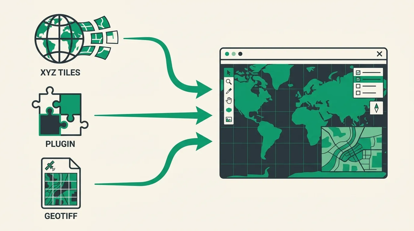
The Three Ways to Get Satellite Imagery into QGIS
Every method you’ve ever seen boils down to one of these:
1. XYZ tile connections. You give QGIS a URL template, and it streams pre-rendered image tiles from someone’s server as you pan and zoom. In the Browser panel, right-click XYZ Tiles → New Connection, paste a URL, name it, and drag it onto the canvas. Done in thirty seconds.
2. The QuickMapServices plugin. Same streaming idea, but with a curated menu instead of hunting for URLs. Install it from Plugins → Manage and Install Plugins, then go to Web → QuickMapServices → Settings → More services → Get contributed pack to unlock the full catalogue of several dozen basemaps. This is the answer to “what’s the best QGIS satellite imagery plugin” in basically every forum thread since 2016, and fair enough.
3. Loading a raster file. A GeoTIFF, a Cloud Optimised GeoTIFF (COG), a JPEG2000 from a Sentinel download. Drag it into the Layers panel. That’s it. No plugin required, and no tile server that can vanish out from under a half-finished project.
The first two rent you a view. The third one hands you data.
That distinction sounds pedantic until you try to do real work. A streamed tile is a compressed picture of imagery, served at whatever zoom level you asked for, captured whenever the provider felt like it. A GeoTIFF is the measurement itself: every band, every pixel value, at native resolution, with a capture timestamp you can put in a report.
The Google Satellite Trick, and Why Pros Quietly Avoid It
The famous URL points QGIS at the tile endpoint that feeds Google Maps. It works. The imagery looks great, because in cities it’s often aerial photography at better than 15 cm.
Four problems, in ascending order of how much they’ll hurt you:
You can’t pick the date. Google’s basemap is a mosaic stitched from many sources and capture dates. The paddock on your screen might be from March. The neighbouring one, from three years ago. For change detection or anything time-sensitive, that’s disqualifying, and we’ve covered why in our guide to satellite change detection.
It’s a picture, not data. Compressed RGB with the near-infrared band stripped out, which rules out NDVI and every other vegetation index before you start.
Positional accuracy is unknown. The mosaic is optimised to look right, not to meet survey standards. If you’re digitising boundaries off it, you’re inheriting error nobody quantified for you. Our post on orthorectification explains where that error comes from.
The licence. Google Maps Platform terms require accessing Google’s map content through its official APIs and SDKs. A raw tile endpoint scraped into a desktop GIS isn’t covered, and the terms explicitly restrict creating derived datasets from Maps content. Tracing features off Google satellite tiles and shipping the result to a client is exactly that.
Will Google send lawyers after your council flood study? Almost certainly not. But “our evidence base violates the imagery provider’s terms of service” is a sentence you never want to hear in an audit or a courtroom. Bing and Esri tiles carry their own restrictions too. Always read the terms of whatever streams onto your canvas.
It works right up until it matters that it doesn’t.
Free Satellite Basemaps You Can Actually Use at Work
Good news: the properly licensed free options are better than most people think. You just need to know which layer is a pretty picture and which is open data.
Sentinel-2 cloudless by EOX is the gorgeous, gap-free global mosaic you’ve seen in QuickMapServices and, lately, in the new wave of browser GIS tools (GeoLibre ships it as a default basemap, for one). One caveat: the recent annual layers are licensed CC-BY-NC-SA 4.0. Non-commercial. Lovely for a portfolio piece or a community project, not for paid work unless you buy a commercial licence from EOX directly.
Sentinel-2 itself is the real prize. The European Space Agency’s Copernicus programme publishes it under a genuinely free and open licence: commercial use allowed, attribution requested. Every point on Earth, revisited every five days, 13 spectral bands, 10 m resolution in the visible and near-infrared. Download scenes from the Copernicus Data Space Ecosystem and load them as rasters. Now you own the pixels and the licence question evaporates.
Landsat goes one better on licensing: US government public domain, no strings at all. 30 m multispectral, 15 m panchromatic, and an archive stretching back to 1972 that makes it the default for long-term change studies.
OpenAerialMap offers openly licensed drone and aerial imagery, patchy in coverage but sometimes spectacularly detailed where volunteers have flown.
Ten metres per pixel, for the record, means a Sentinel-2 pixel is roughly a tennis court. You can watch a crop stress out or a dam draw down. You cannot see a car or a fence line. We’ve ranked all of these and more in our roundup of the best free sources of satellite data.
When Streamed Tiles Stop Being Enough
Somewhere along the way, most QGIS users hit the same wall. The project stops being “I need something behind my vectors” and becomes “I need to prove something.” Tiles can’t do that. Data can.
Here’s the honest comparison:
| Option | Resolution | You pick the date? | Bands | Licensed for client work? | Cost |
|---|---|---|---|---|---|
| Google satellite (XYZ) | Varies by location | No, undated mosaic | RGB picture only | No, terms don’t allow it | Free |
| Sentinel-2 cloudless (EOX) | 10 m | No, annual mosaic | RGB picture only | Non-commercial only | Free |
| Sentinel-2 (downloaded) | 10 m | Any archive date, 5-day revisit | 13 spectral bands | Yes, open licence | Free |
| Landsat (downloaded) | 30 m (15 m pan) | Archive back to 1972 | 11 bands | Yes, public domain | Free |
| Commercial archive or tasking | 30-75 cm | Yes, including new captures | Multispectral + pan | Yes, explicit licence | Paid |
The pattern in that table is worth saying out loud: the free streamed options fail on licensing, and the free downloadable options are properly licensed but capped at 10 m. The moment your job needs both a clean licence and sub-metre detail (a stockpile volume, a disturbance boundary for a regulator, an asset inspection, a footprint worth digitising), you’ve arrived at commercial imagery whether you like it or not.
The good news is that commercial data arrives the same way a Sentinel download does. It’s just a raster.
Getting 30 cm Imagery onto Your QGIS Canvas
An ordered scene from a commercial satellite lands as a GeoTIFF or COG. You drag it into QGIS. There is no step three. COGs will even stream straight from cloud storage over a URL, so you get tile-style convenience with actual data underneath.
What matters is the state the file arrives in. Plenty of the industry delivers raw or semi-processed imagery and leaves the orthorectification, pansharpening and atmospheric correction to you, or charges 30-80% extra to do it. That’s a day of specialist work before the image is safe to measure from.
We built Geopera to skip that entire stage. Every order through Pera Portal is delivered orthorectified, pansharpened and atmospherically corrected at no extra cost, ready to drop into QGIS and analyse. You can search archive imagery or task a fresh capture across satellites from multiple operators (WorldView at 30 cm, Beijing-3, Perascope, SuperView, plus Wyvern’s hyperspectral sensors) and the pricing is published openly, so you can cost a project without sitting through a sales call.
If you’re not sure whether your job needs 30 cm tasking or whether free Sentinel-2 will carry it, ask us. We’ll tell you honestly, including when the answer is “keep your money and download Sentinel.” And if you’re weighing up the whole market first, our guide to buying satellite imagery walks through the questions worth asking any provider.
Your QGIS canvas doesn’t care where the raster came from. Regulators, clients and lawyers very much do.
Frequently Asked Questions
How do I add satellite imagery to QGIS?
Three ways: create an XYZ Tiles connection in the Browser panel and paste a tile URL, install the QuickMapServices plugin for a curated basemap menu, or load a GeoTIFF directly by dragging it into the Layers panel. Downloaded rasters give you data; the other two stream pictures.
How do I add Google satellite imagery to QGIS?
Technically, via an XYZ Tiles connection pointing at Google’s tile endpoint. Be aware that Google’s terms require access through official APIs, so this method isn’t licensed for professional or commercial mapping, and the mosaic has no capture date you can verify or cite.
What is the best QGIS satellite imagery plugin?
QuickMapServices is the standard choice. Install it, then use Settings → More services → Get contributed pack to unlock dozens of basemaps including Sentinel-2 cloudless. Check each layer’s licence before using it in paid work, since several popular ones are non-commercial.
How do I get high resolution satellite imagery into QGIS?
Order it as a GeoTIFF or Cloud Optimised GeoTIFF from a commercial provider, then drag the file into QGIS like any raster. Commercial sensors such as WorldView-3 or Beijing-3 deliver 30 cm resolution with a capture date you choose, licensed for professional use.
Can I use free satellite imagery commercially in QGIS?
Downloaded Sentinel-2 and Landsat data, yes: Copernicus data is free and open with attribution, and Landsat is public domain. Streamed basemaps mostly no: Google’s tiles sit outside its licence terms and EOX Sentinel-2 cloudless is non-commercial without a paid licence.
