
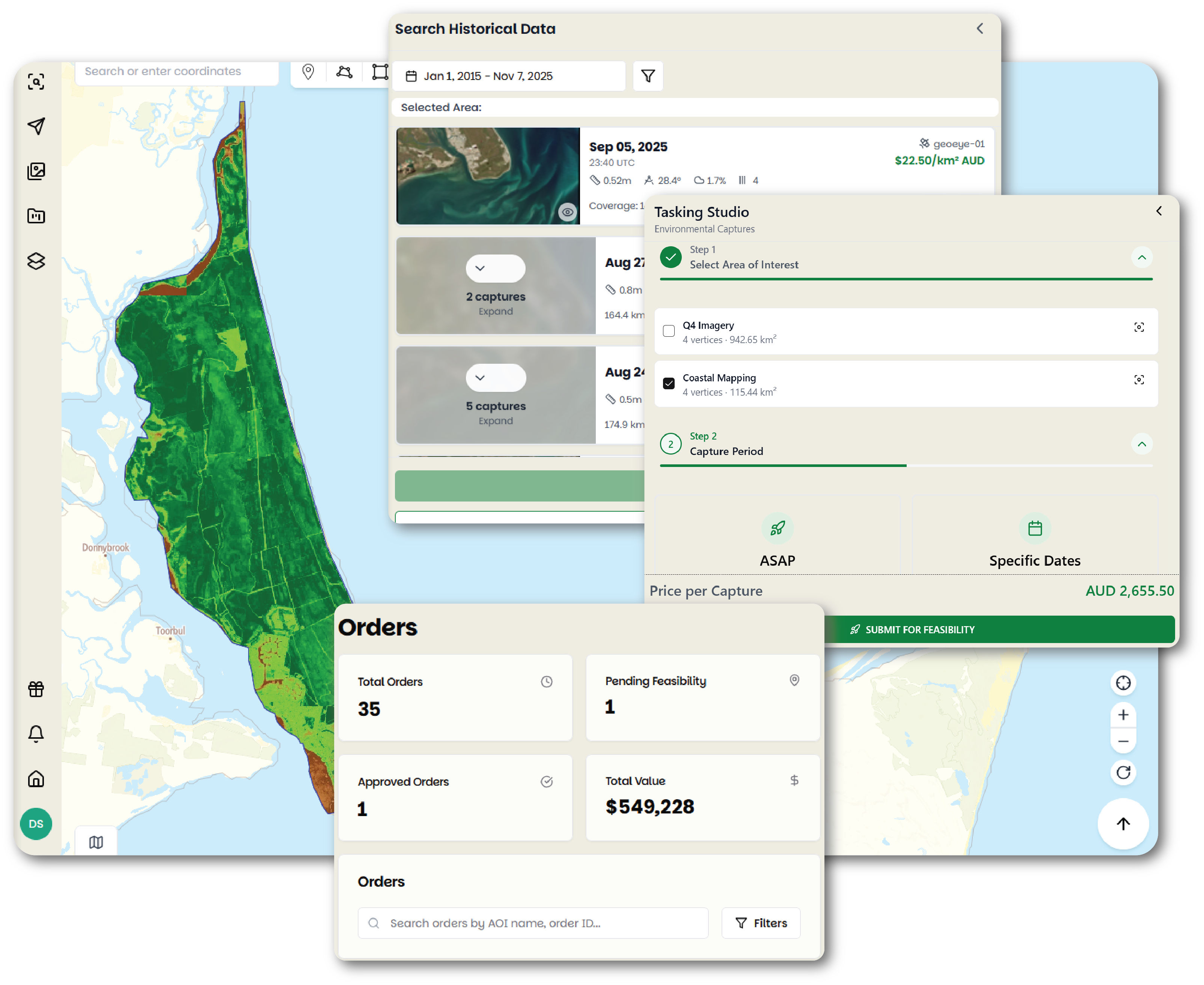
01One order list
Archive and tasking orders sit in the same table. Each carries its own status: feasibility, awaiting capture, processing, pending payment, completed. Nobody has to email to find out where an order got to.
Pera Portal
Pera Portal is the account you buy satellite imagery from. Archive orders, tasking orders, the processed deliveries, and your own uploaded rasters all sit in the same place.
Search what has already been captured over your site, read each scene on its own metadata, and buy only the ones that work.
Order a new capture when nothing already in the archive is recent enough or clear enough over the ground you care about.
Change detection across two acquisitions of the same area, plus vegetation and water analytics, run on imagery that is already in the account.
Upload a raster and the portal publishes it as a WMTS endpoint, next to the imagery you ordered from us.
Archive and tasking orders sit in the same table. Each carries its own status: feasibility, awaiting capture, processing, pending payment, completed. Nobody has to email to find out where an order got to.
Every delivery runs through Legato, our automated processing chain, and has to pass an automated quality check before it is released. There is no separate processing job for your team to schedule or pay for.
Most orders deliver in under 24 hours. As of August 2026 the average across orders was 3 hours.
The delivery sits in the project it was ordered under, beside the area of interest it covers and any earlier orders over the same ground.
One organisation account holds every project, order, and invoice, so departments stop buying the same imagery twice. What the enterprise setup includes is on its own page.
The same search, ordering, and delivery run over an API, with typed Python and TypeScript SDKs and signed webhooks for order events.
What we can show you about access control and how deliveries are verified is on the trust page. Anything a security review needs beyond that comes from us directly.
Get started
Draw an area in the portal to see what it costs, or talk to us about how your team buys imagery.