Vegetation Management in Australia Using Satellite Data
How satellite imagery is transforming vegetation monitoring and management across Australias diverse landscapes with focus on high-resolution options.
TL;DR: Satellite imagery has revolutionized vegetation management across Australia, offering cost-effective monitoring for properties of any size. While free satellite data works for many applications, high-resolution commercial imagery delivers superior results for compliance verification, carbon projects, and precision agriculture. Geopera provides access to both, including cost-effective 50cm imagery and specialized SWIR data.
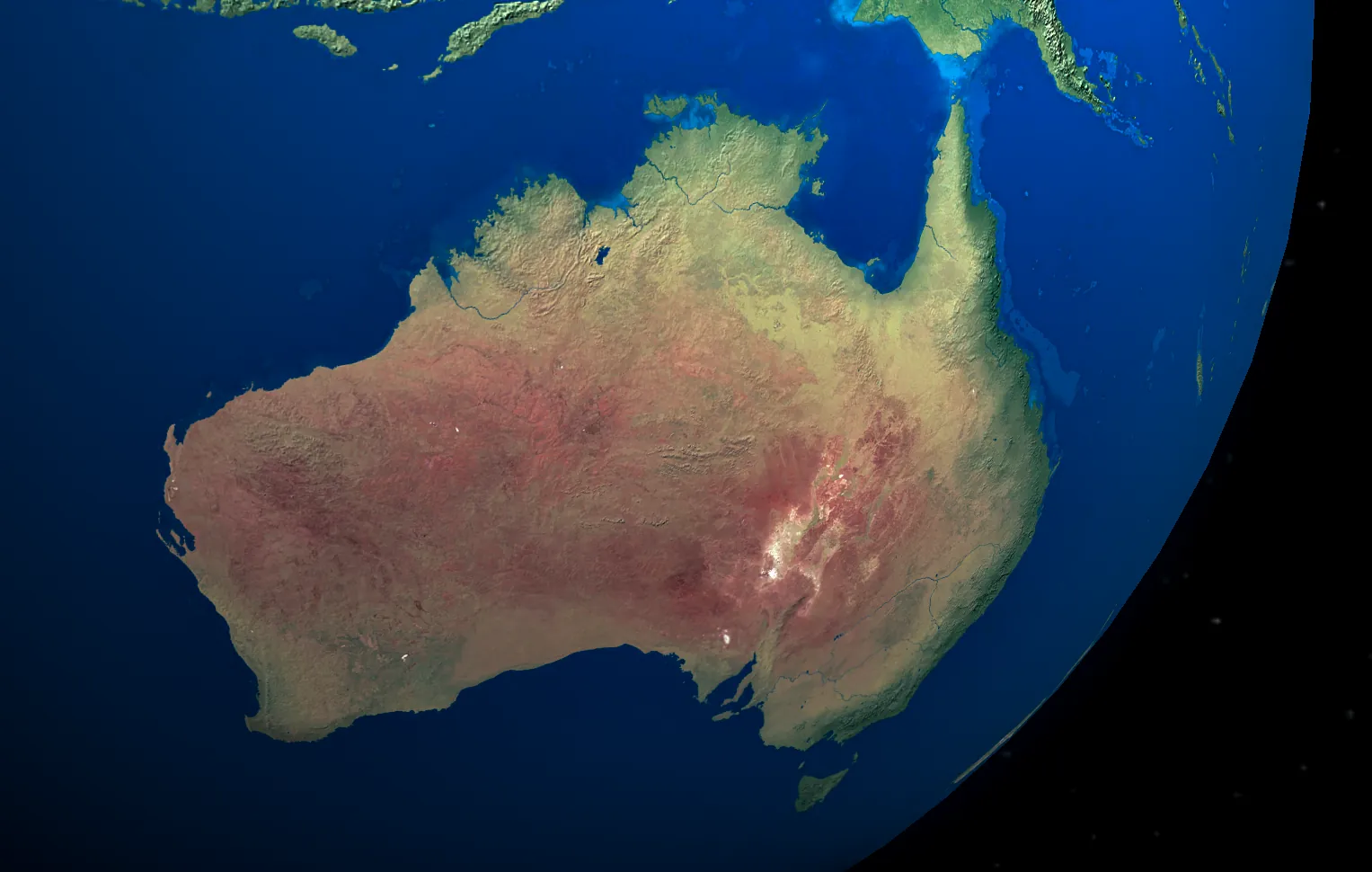
Australia’s vast landscapes present unique challenges in vegetation management. Traditional ground surveys are expensive and time-consuming, often missing critical changes. Satellite monitoring has emerged as the game-changer, providing frequent, detailed views of vegetation at any scale. This blog explores why satellite data is transforming how we monitor Australia’s vegetation and when higher-resolution commercial options deliver additional value.
The Challenge of Vegetation Management in Australia
Managing vegetation across Australia’s diverse ecosystems is no small feat. From dense tropical forests in Queensland to arid rangelands in Western Australia, each environment presents unique monitoring challenges. Traditional approaches like on-ground surveys and aerial photography are not only costly but also provide just a snapshot in time.
Environmental regulators, land managers, agricultural enterprises, and mining companies all face similar questions: Where is vegetation being lost or gained? How healthy is the existing vegetation? Are compliance requirements being met? Answering these questions efficiently and accurately requires a more comprehensive approach.
Enter satellite-based monitoring—a method that combines broad coverage with frequent revisits to provide unprecedented insight into vegetation dynamics. While there are free satellite data sources available, commercial high-resolution imagery is essential for any serious vegetation management project. Understanding the limitations of free data helps organizations avoid costly missteps and achieve reliable results.
The Power of Satellite-Based Vegetation Monitoring
1. Near Real-Time Clearing Detections
Satellite advantage: Detect clearing activities within days instead of months.
A Queensland mining company saved $350,000 in potential fines when satellite imagery alerted them to contractors clearing beyond approved boundaries. The early detection allowed immediate intervention before regulators became involved.
Resolution matters: Free Sentinel-2 imagery (10m resolution) can only detect massive clearings, while commercial high-resolution imagery (50cm) reveals individual trees and small disturbances—critical for legal compliance and early intervention on projects of any meaningful size.
The Queensland Government’s Statewide Landcover and Trees Study (SLATS) demonstrates the power of consistent satellite monitoring. After implementing satellite-based enforcement, regulated forest clearing decreased by 64% over four years—proof that when landholders know satellite “eyes in the sky” are watching, compliance improves dramatically.
2. Precision Vegetation Health Assessment
Satellite advantage: Identify stressed vegetation before visible symptoms appear.
A Western Australian cattle station increased weight gains by 12% after implementing satellite-based pasture rotation. By monitoring vegetation health via NDVI, they optimized grazing patterns and prevented overutilization.
Resolution matters: Free satellite data provides only the most basic broad-scale health trends, while commercial imagery with additional spectral bands (including Short-Wave Infrared) delivers the detail needed for real-world applications, detecting subtle moisture differences and early disease indicators across agricultural operations and rehabilitation projects of any significant scale.
For agricultural enterprises, this translates to early problem detection. Stressed vegetation appears in satellite data up to two weeks before visible symptoms develop. This early warning system allows for targeted intervention—whether it’s adjusting irrigation, treating disease outbreaks, or rotating grazing—before productivity losses occur.
Our Red Edge remote sensing capabilities take this a step further by providing enhanced sensitivity to chlorophyll content, giving users even earlier detection of plant stress.
3. Superior Carbon Project Verification
Satellite advantage: Verify carbon sequestration remotely without expensive field campaigns.
A carbon farming project in Queensland secured premium pricing (15% above market rates) by providing investors with detailed satellite evidence of vegetation growth over time.
Resolution matters: Small-scale projects or those requiring tree-level verification benefit from commercial high-resolution imagery that can demonstrate exact changes in canopy cover and tree counts.
Carbon project developers must provide credible evidence of vegetation increases compared to historical baselines. With decades of historical satellite imagery available, developers can establish these baselines and then verify ongoing improvements. While some projects might use free satellite data for initial scoping, any serious carbon project requires commercial imagery for reliable verification that will stand up to investor scrutiny and regulatory requirements.
4. Invasive Species and Fire Risk Management
Satellite advantage: Identify emerging threats across vast areas.
A regional council reduced herbicide use by 40% by targeting specific areas where satellite imagery revealed early-stage weed infestations, rather than treating entire regions uniformly.
Resolution matters: Broad invasive patterns are barely visible in free imagery and typically only after significant spread has occurred. Early detection of invasion fronts—when intervention is most cost-effective—absolutely requires the detail that only commercial imagery provides.
Fire management agencies are increasingly using satellite data to assess fuel loads and prioritize controlled burning activities. By combining vegetation indices with seasonal data, they can identify areas where dry biomass presents the highest risk, directing limited resources to where they’ll have the greatest impact.
When to Use Free vs. Commercial Imagery
Free Satellite Data Has Limited Applications:
- Initial exploratory mapping of very large regions (>10,000 hectares)
- Basic educational and research purposes with severe budget constraints
- Simple background context for more detailed analysis
- Non-critical vegetation trend monitoring where precision isn’t essential
Free data from satellites like Sentinel-2 (10m resolution) or Landsat (30m resolution) can provide a basic overview, but serious projects typically require the detail and reliability of commercial imagery.
High-Resolution Commercial Imagery Adds Value When:
- Legal compliance requires detailed evidence
- Monitoring small properties or features
- Detecting early clearing or disturbance
- Carbon projects need tree-level verification
- Precision agriculture applications
- Early invasive species detection
Commercial satellites like WorldView-3 (30cm resolution), JL1-50cm, and others provide extraordinary detail that can make the difference in critical applications. For instance, environmental consultants preparing legal evidence often require commercial imagery that can clearly show individual trees or small areas of impact.
Real-World ROI from High-Resolution Satellite Monitoring
The investment in commercial satellite imagery typically delivers returns far exceeding costs:
- Compliance assurance: A single avoided fine can cover years of monitoring costs
- Field survey reduction: One agricultural client replaced $75,000 in annual aerial surveys with $25,000 in satellite monitoring while increasing frequency
- Carbon premium: Projects with detailed verification consistently command 10-15% higher prices
- Precision intervention: Targeted remediation based on detailed imagery reduced treatment costs by 30-40% versus grid-based approaches
For mining companies in particular, consistent satellite monitoring provides powerful evidence of regulatory compliance. One Queensland operation estimated that their quarterly satellite monitoring program cost less than 5% of what a single environmental violation would have cost in fines, legal fees, and remediation—not counting reputational damage.
Understanding Satellite Vegetation Analysis Techniques
Satellite vegetation monitoring uses several key techniques to extract meaningful insights:
1. Multi-Spectral Analysis
Satellites see beyond the visible spectrum, capturing light in bands invisible to the human eye. Sensors can detect near-infrared, short-wave infrared, and other wavelengths that reveal vegetation health, moisture content, and species composition.
This capability allows analysts to differentiate between healthy and stressed vegetation, identify specific plant communities, and even detect early signs of disease or nutrient deficiencies.
2. Time Series Analysis
The real power of satellite monitoring comes from consistent observation over time. By comparing images from different dates, analysts can detect:
- Gradual trends: Long-term vegetation decline or improvement
- Seasonal patterns: Normal growth cycles vs. abnormal changes
- Sudden changes: Clearing, fire impacts, or flood damage
These temporal patterns often reveal issues that might be missed in a single snapshot, making satellite monitoring superior to infrequent field visits or aerial surveys.
3. Machine Learning Classification
Advanced machine learning algorithms can classify vegetation types, estimate biomass, and detect changes automatically across vast areas. These techniques are becoming increasingly sophisticated, allowing for automated alerting when unexpected vegetation changes occur.
The Geopera Advantage
Geopera provides the most comprehensive satellite access in Australia, with unique benefits:
- Complete coverage: Access to both free public satellites and the latest commercial sensors
- Cost-effective high-resolution: Australia’s most competitive pricing on 50cm imagery
- Specialized capabilities: Advanced options including WorldView-3 SWIR for superior vegetation analysis
- Analysis-ready data: Receive processed, ready-to-use imagery without technical complexity
- Flexible solutions: Scale from free options to premium imagery based on your specific needs
Our clients across environmental, agricultural, mining, energy, and government sectors benefit from Geopera’s unique approach: providing the right satellite data for each specific need, rather than a one-size-fits-all solution.
Industry Applications
Mining and Resources
Mining operations must comply with strict vegetation management requirements, including buffer zones, rehabilitation targets, and clearing limits. Satellite monitoring provides auditable evidence of compliance while identifying any issues early.
One Queensland mine used high-resolution monitoring to demonstrate successful rehabilitation progress, securing early release of environmental bonds worth over $5 million. The detailed imagery provided regulators with confidence that revegetation was meeting or exceeding requirements.
Agriculture and Pastoral
From broad-acre cropping to intensive horticulture, agricultural enterprises use satellite data to optimize production and demonstrate sustainable practices.
A Northern Territory cattle station implemented satellite-based pasture monitoring across 180,000 hectares, allowing precise rotation of cattle based on actual vegetation conditions rather than fixed schedules. The result was a 15% increase in carrying capacity while improving land condition—a win-win for profitability and sustainability.
Environmental Management
Conservation organizations and environmental consultants use satellite monitoring to track ecosystem health, detect threats, and prioritize management actions.
One project in the Kimberley initially tried free imagery but quickly upgraded to commercial high-resolution data when they realized the limitations. Using proper commercial imagery, they monitored the impact of a controlled burning program across a 63,000 sq km area. The detailed data revealed a 60% reduction in late-season wildfires and corresponding improvements in vegetation diversity—powerful evidence that secured continued program funding.
Take Action: Elevate Your Vegetation Management
Satellite monitoring has transformed vegetation management from reactive to proactive, saving time and money while improving environmental outcomes. Whether you’re managing a small property or millions of hectares, there’s a satellite solution that fits your needs and budget.
Ready to see the difference? Contact Geopera today to discuss how satellite imagery can transform your approach to vegetation management. Our team will help you determine whether free public data meets your needs or if commercial imagery would deliver superior results for your specific application.