Historical Satellite Images of Australia: Accessing The Old Data
Discover how to access and utilize historical satellite imagery of Australia for environmental monitoring, urban planning, and natural disaster analysis.
A Quick Intro
Collections of historical satellite images allow comparing the present and the past of Australia’s unique landscape to detect changes, make predictions, and mitigate losses. There are multiple sources providing historical satellite imagery, with varying access options and capabilities. For commercial historical satellite images with the most comprehensive archive available, Geopera’s Pera Portal offers unparalleled access to historical aerial and satellite imagery of Australia at the most competitive prices in the market.
A Timeline of Old Satellite Images
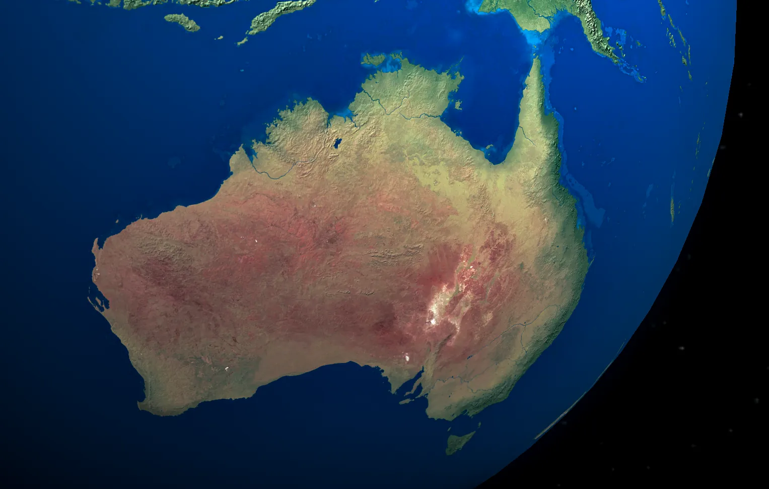
The Landsat program is the longest-ever mission that has been retrieving imagery from space for over 50 years by now. It can flaunt the biggest data collection so far (billions of historical satellite images), including comprehensive coverage of Australia’s vast and diverse landscape. The oldest of these images date back to 1972 when Landsat-1 was launched.
Six more Landsat satellites joined their predecessor over time thanks to USGS and NASA to provide glimpses from space every 14 to 16 days. The last ones, Landsat-7 and Landsat-8, have been operating since 1999 and 2013, respectively, capturing remarkable historical satellite imagery of Australia’s changing environment.
Later, Landsat’s Earth observation initiative was supported by Terra and Aqua MODIS (NASA and USGS), Sentinel-1 and Sentinel-2 (ESA), CBERS (China and Brazil governments), and more. Australia has benefited significantly from these missions, which have documented everything from the expansive Outback to the lush rainforests of Queensland.
Landsat 1-5 have completed their missions, contributing to the precious database of historical satellite imagery of Australia. The others are still on-orbit enriching historical collections with the latest remote sensing data (optical and radar) of the Australian continent.
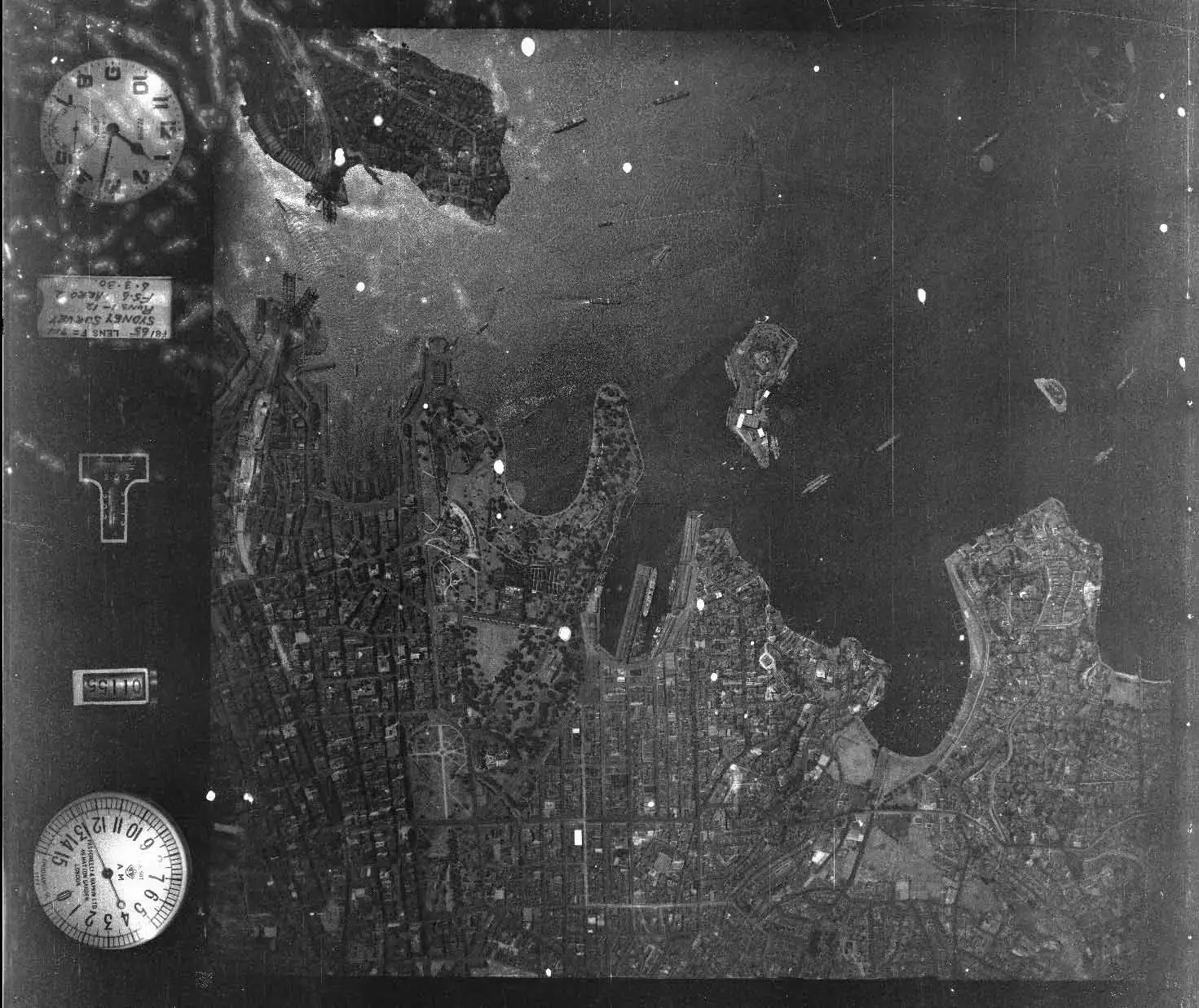
Why are old satellite images black and white?
Nearly all satellite-derived imagery is black and white initially, including historical satellite images. They gain colours only after processing with certain filters (colour transformations in spatial analysis). For example, false colour imagery is assigned conditional colours. Natural colour imagery is processed with RGB filters (red, green, and blue) – as perceived by the human eye.
Where To Find Free Old Satellite Images of Australia?
For those looking for free historical satellite imagery of Australia, several government and public resources are available:
Geoscience Australia offers a range of data products through their Collection of Historical Aerial Imagery
QImagery allows users to view Old Aerial Images of Queensland dating back several decades
USGS Earth Explorer includes substantial coverage of Australia with historical landsat data dating back to the 1970s
Copernicus Browse gives access to more recent Sentinel-1 and Sentinel-2 data over Australia
While these free resources offer valuable data, they often come with limitations in terms of resolution, coverage, and analysis capabilities.
Accessing Premium Historical Satellite Images with Geopera’s Pera Portal
For professional applications requiring the most comprehensive historical satellite imagery, Geopera’s Pera Portal stands out as the premier commercial source. Geopera proudly maintains the most extensive archive of historical satellite data available for Australia, offered at the industry’s best prices.
Pera Portal specializes in providing commercial high-resolution historical satellite imagery that surpasses the capabilities of free alternatives. Visit portal.geopera.com to access our complete imagery toolkit. The platform offers:
- Unmatched historical depth – access to the most comprehensive archive of Australian satellite imagery available
- Superior resolution – commercial-grade imagery with resolutions down to 0.3 meters/pixel
- Complete national coverage – historical imagery covering all Australian territories and landscapes
- AOI-based pricing – pay by area, not by capture, allowing you to acquire multiple images of the same region at a significantly lower cost
The Geopera Advantage for Historical Satellite Imagery
Geopera’s Pera Portal is specifically designed for purchasing commercial historical satellite imagery with a streamlined acquisition process. Our innovative AOI-based pricing model means you can obtain multiple captures for cloud masking at the same price, making our offering substantially more cost-effective than traditional per-capture pricing models.
Our intuitive interface allows you to:
- Draw or upload your precise area of interest (AOI)
- Receive instant pricing based on your AOI size, not the number of images
- Specify exact date ranges for historical imagery
- Select from multiple resolution options based on project needs
- Review available imagery before purchase
- Receive professionally processed imagery in days, not weeks
The platform provides access to imagery from premium commercial satellites and archives, including some of the following sensors:
- Maxar WorldView Constellation
- Superview Satellite Series
- CGST Satellite 50cm & 75cm
- SIIS KOMPSAT Satellites
Applications of Commercial Historical Satellite Images in Australia
High-quality historical satellite imagery acquired through Geopera’s Pera Portal is vital for numerous professional applications across Australia:
Environmental Monitoring and Disaster Assessment
Commercial historical satellite images are essential for monitoring Australia’s environmental changes over time, including:
- Bushfire impact assessment – comparing before and after imagery of fire-affected regions
- Flood extent mapping – historical analysis of flood patterns in vulnerable areas
- Coastal erosion studies – tracking shoreline changes over decades
- Drought monitoring – examining landscape changes during drought cycles
Urban Development and Infrastructure Planning
Historical imagery provides critical insights for urban planners and developers:
- Urban growth analysis – tracking expansion of Australian cities and suburbs
- Infrastructure development – monitoring major construction projects over time
- Land use change detection – identifying conversion of natural areas to developed land
- Heritage preservation – documenting historical landscapes before development
Mining and Resource Management
Australia’s mining and resource sectors benefit tremendously from historical imagery:
- Site monitoring – documenting changes at extraction sites over time
- Exploration planning – evaluating historical landscape features for potential resources
- Compliance documentation – maintaining records of site conditions for regulatory purposes
- Rehabilitation tracking – comparing pre-mining conditions to restoration progress
Commercial Value of Historical Satellite Imagery
The investment in high-quality historical satellite imagery through Geopera’s Pera Portal delivers substantial returns for Australian businesses and organizations:
- Insurance assessment – supporting claims following natural disasters
- Investment due diligence – evaluating property and land conditions before acquisition
- Project planning – establishing accurate baselines for development projects
- Environmental impact studies – documenting conditions before and after significant activities
- Carbon Stock Assessment – Get more carbon carbons by increasing the accuracy of your carbon stock assessments
Accessing Australia’s Most Comprehensive Historical Satellite Imagery Archive
While free resources provide basic historical satellite data, Geopera’s Pera Portal offers the most comprehensive commercial archive available at industry-leading prices. Our collection features imagery with resolutions ranging from 0.3 to 2 meters/pixel, significantly outperforming free alternatives in terms of detail, coverage, and historical depth.
With our unique AOI-based pricing model, you’ll receive:
- Multiple images for your area at a fraction of traditional per-capture costs
- Faster delivery – processed imagery in days, not weeks
- Instant online pricing through our portal
- Access to the most extensive historical archive in Australia
Visit portal.geopera.com to explore our platform or contact our team at [email protected] to learn more about accessing Australia’s most comprehensive historical satellite imagery collection. Our experts will guide you through our unmatched archive and help you select the optimal imagery for your specific applications.