Why We Process Every Image
Discover how comprehensive satellite image processing transforms raw data into reliable, analysis-ready imagery that delivers accurate results for your critical projects.
Summary
We believe you shouldn’t have to choose between affordability and excellence. That simple principle drives everything we do.
Every Geopera order includes complete processing that transforms raw satellite data into immediately usable, analysis-ready imagery—at no extra cost. While processing is often treated as an additional service, we’ve made it our standard because we believe this is how satellite imagery should always be delivered.
Your time is valuable. Your projects matter. You deserve imagery that works perfectly from the moment you download it.
Why Satellite Images Need Processing
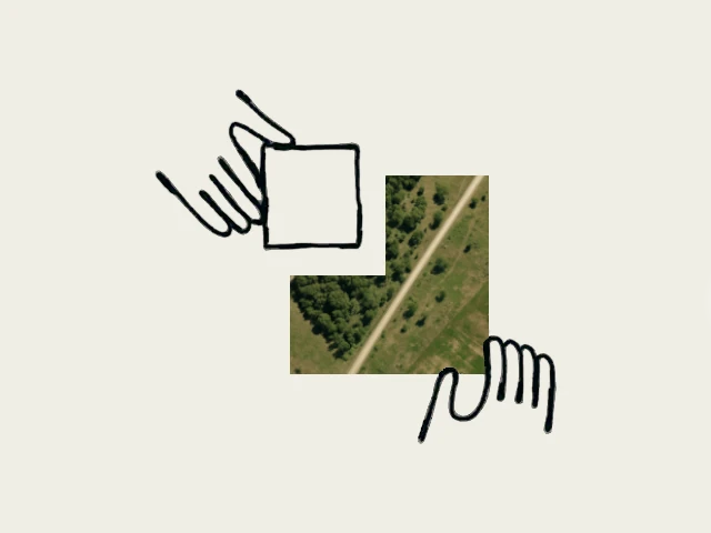
Here’s what many people don’t realise: satellite images straight from space require processing before they’re ready for professional work. Think of them like digital photos taken from a moving aeroplane—they’re distorted, the colours are affected by atmospheric conditions, and they don’t align properly with maps or GPS coordinates.
Processing transforms raw satellite data into something you can actually use. It corrects distortions, fixes colours, aligns images geographically, and combines different types of data to create the clear, accurate imagery you need for analysis.
Our Approach: Making Excellence Accessible
We’ve designed our business around a simple belief: excellent satellite imagery should be accessible to everyone.
Instead of treating processing as an expensive add-on, we’ve built it into our core service. This means you get:
✓ Professional-grade processing included with every order
✓ Transparent pricing with no hidden processing fees
✓ Imagery that’s immediately ready for analysis
✓ Consistent quality regardless of project size
The result: You can focus on your analysis and insights instead of wrestling with data preparation.
Making Your Life Easier: What Processing Actually Does
Let’s translate the technical jargon into what actually matters for your work:
Without processing, satellite imagery is like receiving:
- A puzzle with pieces that don’t fit together properly
- Photos where the colours change randomly between shots
- Maps where nothing lines up with your GPS coordinates
- Images so pixelated you can’t see important details
With our processing, you get:
- Images that align perfectly with your maps and GPS data
- Consistent, natural colours that show the world as it actually looks
- Crystal-clear detail that reveals everything you need to see
- Seamless coverage across large areas without visible boundaries
- Instant compatibility with any mapping software you already use
The bottom line: You can start analysing immediately instead of spending weeks trying to fix broken data.
How We Make It Work: Seven Steps That Save You Time and Money
Every image from Geopera’s platform goes through our comprehensive processing pipeline. Here’s what happens behind the scenes to make your life easier:
1. We Start With the Best
We work directly with satellite operators to get the highest quality raw data available. Think of this as buying ingredients from the farm instead of the grocery store—fresher, better, and with full knowledge of where it came from.
2. We Put Everything in the Right Place
Raw satellite images are geographically confused—like a map where the roads don’t match reality. Our location correction process fixes this completely, so when you click on a point in our imagery, your GPS will take you to that exact spot.
No more images that don’t line up with your existing maps or field locations.
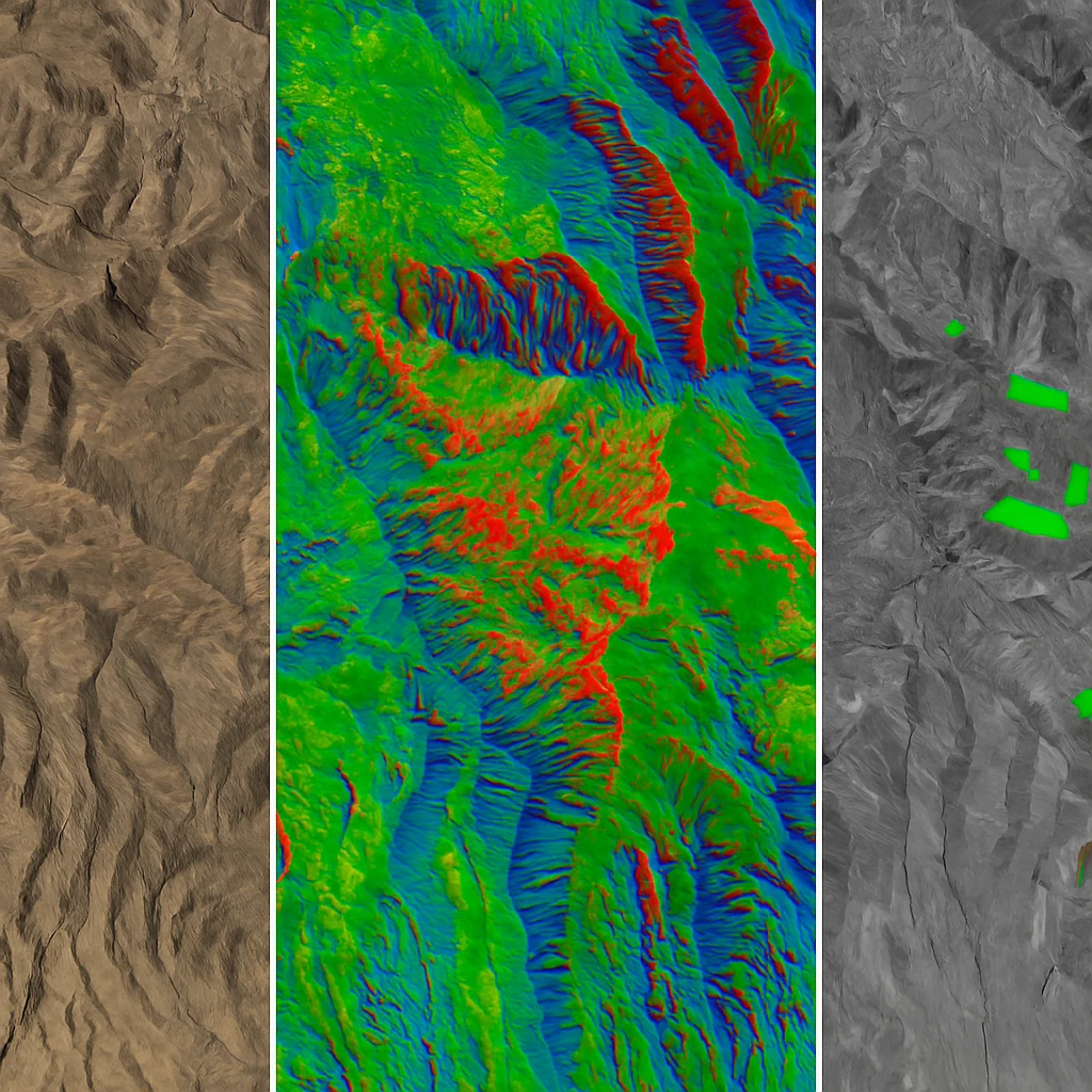
3. We Make Details Crystal Clear
Satellites capture two types of images: super-detailed black and white photos, and lower-detail colour photos. We intelligently combine these to give you both perfect detail AND full colour—something that would normally require expensive specialist software.
You get the clarity you need without the complexity you don’t want.
4. We Fix the Colours
Earth’s atmosphere acts like a dirty filter, making satellite images look hazy or strangely coloured. We automatically remove these atmospheric effects, so your imagery shows true, natural colours that match what you’d see standing on the ground.
5. We Stitch Large Areas Seamlessly
Need coverage of a large area? We automatically combine multiple satellite images into one seamless view, eliminating colour differences and visible boundaries. No more patchwork imagery that looks like a quilt.
6. We Check Everything Twice
Before any image reaches you, our automated systems verify that everything is perfect: colours are consistent, locations are accurate, and quality meets professional standards. If it’s not perfect, you don’t see it.
7. We Deliver It Ready to Use
Your imagery arrives in standard formats that work with any mapping software, complete with all the technical information you need. Download, open, and start working immediately.
No processing delays. No additional software required. No technical headaches.
Excellence as Standard
We believe you shouldn’t have to choose between affordability and excellence. That’s why comprehensive processing isn’t a premium add-on—it’s our standard for every order, from the smallest research project to the largest enterprise deployment.
We’ve designed our approach around what should be possible: high-quality satellite imagery that’s accessible, transparent, and immediately usable. When everyone on your team gets the same perfectly processed imagery, you eliminate confusion, reduce costs, and achieve better results.
Your Time Is Worth More Than Processing Data
Here’s what our approach eliminates from your workflow:
- Weeks spent learning complex processing software
- Budget uncertainty from processing fees and specialist tools
- Technical hurdles that delay project progress
- Inconsistent imagery quality across different orders
- Time lost troubleshooting data compatibility issues
Instead, you get: Imagery that works perfectly from day one, letting you focus on what actually matters—your analysis, your insights, your results.
The Simplicity You Deserve
Whether you’re monitoring agricultural health, tracking infrastructure changes, or conducting environmental assessments, complex technology should make your work simpler, not harder.
We handle the complexity so you don’t have to. Every technical challenge, every processing step, every quality check happens behind the scenes. You get professional-grade satellite imagery that just works—like it should have from the beginning.
Start With Perfect Data Today
The best projects start with perfect data. Why settle for anything less?
Browse our Pera Portal to instantly see what satellite imagery is available for your area. Every image comes with complete processing included—no surprises, no extra costs, no technical headaches.
Ready to experience satellite imagery that works perfectly from the moment you download it? Contact our team to see how we can make your next project easier, faster, and more successful.
FAQs About Satellite Image Processing
Q: What’s the difference between raw and processed satellite imagery?
A: Raw satellite imagery contains geometric distortions, atmospheric effects, and radiometric inconsistencies that make accurate analysis difficult. Processed imagery corrects these limitations to provide reliable, analysis-ready data.
Q: Why do some providers charge extra for processing?
A: Processing requires sophisticated algorithms, computational resources, and quality control systems. While some providers treat it as an optional service, we include comprehensive processing with every order because unprocessed imagery isn’t suitable for professional applications.
Q: How does processing affect imagery accuracy?
A: Proper processing significantly improves accuracy by correcting geometric distortions, atmospheric effects, and radiometric inconsistencies. Our processing typically achieves sub-pixel geometric accuracy and consistent radiometric quality across all delivery formats.
Q: Can I specify processing requirements for my project?
A: Our standard processing pipeline meets the requirements for most professional applications. For specialised needs, our team can discuss custom processing options that align with your specific analytical requirements.
Related Articles
Best Satellite Imagery for Every Application
Complete guide to selecting the optimal satellite imagery for your specific application needs and requirements.

How to Buy Satellite Imagery
Comprehensive guide to purchasing commercial satellite imagery, including pricing factors and procurement best practices.
What is Satellite Imagery?
Understanding satellite imagery technology, its various types, and commercial applications across industries.