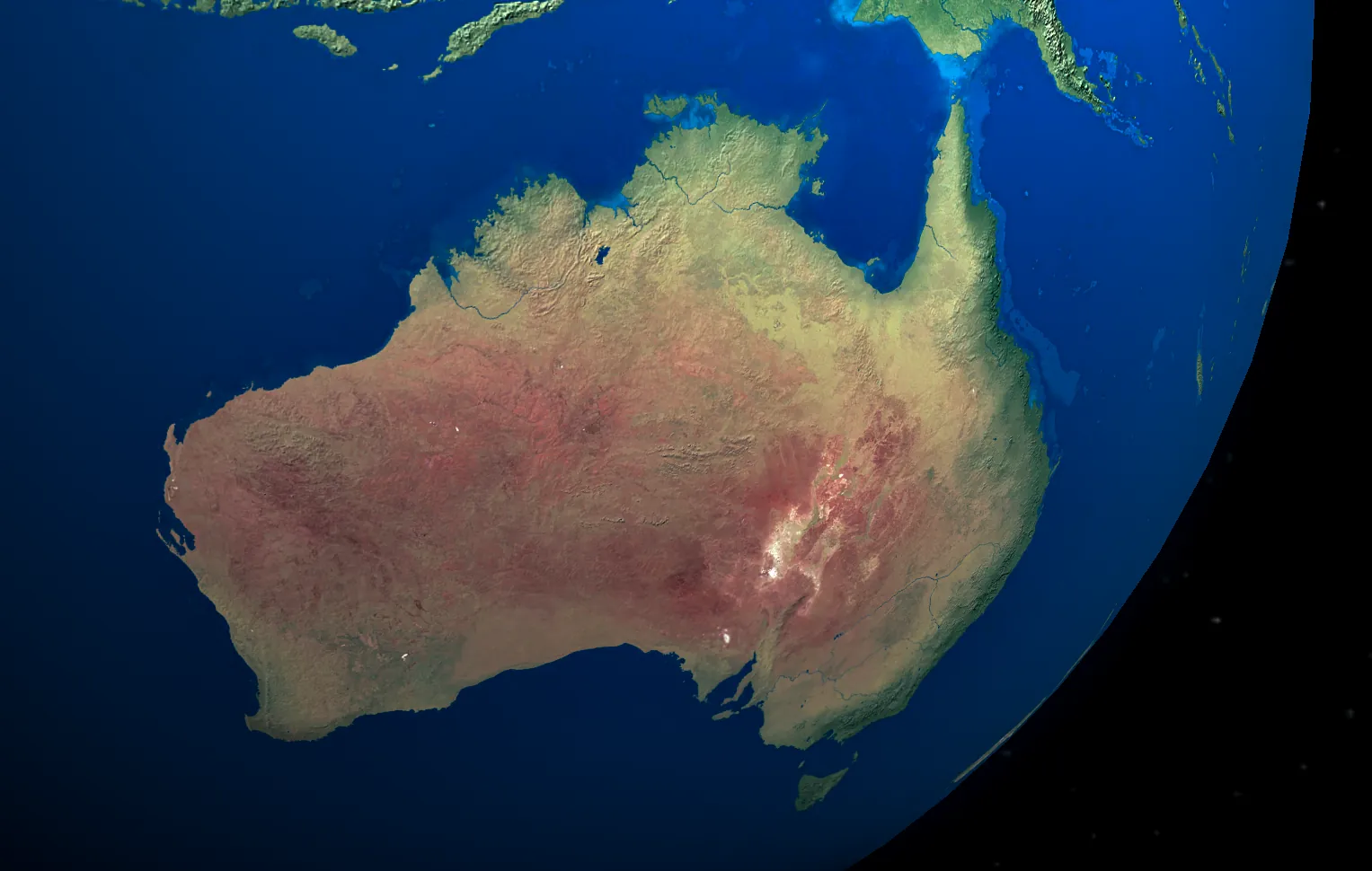
The Best Satellite Imagery for Every Application - A Complete Guide
Discover which satellite imagery is best for your specific needs, from high-resolution monitoring to specialised applications
Summary
When it comes to satellite imagery, there’s no one-size-fits-all solution. The “best” satellite imagery depends entirely on your specific use case, budget, and technical requirements. Here’s a quick reference guide to the best satellite imagery options for common applications:
- Highest Resolution: Maxar WorldView-3 with native 30cm resolution and 15cm super-resolution enhancement, allowing you to identify objects as small as individual vehicles
- Mineral Exploration: Maxar WorldView-3 SWIR with 16 spectral bands, including 8 SWIR bands which can detect mineral signatures like clay, alunite, and iron oxide that are invisible to standard optical sensors
- Hyperspectral Analysis: Wyvern Dragonette Series with up to 32 spectral bands (445-880nm range) providing detailed analysis of vegetation health and subtle environmental changes at a spectral resolution of 18-35nm
- Best Value: JILIN-1 50cm offering excellent quality-to-price ratio with archive imagery costing just 0.12c/acre (vs. 0.40-0.70c/acre for 30cm alternatives)
- Frequent Monitoring: WorldView Legion (daily revisits with 6 satellites), SuperView Neo (2-day revisit with 4 satellites), or JILIN-1 constellation (60+ satellites enabling multiple passes per day in many locations)
- Agriculture & Vegetation: WorldView-2 with 8 spectral bands including the critical Red Edge band that specifically targets chlorophyll content to detect early crop stress invisible to standard RGB or 4-band imagery. Read More Here
- Urban Planning & Infrastructure: SuperView Neo with 30cm resolution for identifying individual infrastructure elements and 4-satellite constellation enabling bi-weekly monitoring of development projects
- Disaster Response: WorldView Legion with 6-satellite constellation providing same-day response capability and 30cm resolution for detailed damage assessment
- Massive Area Coverage: JILIN-1 75cm with 50+ satellites and an impressive 150km swath width (6× wider than most high-resolution satellites), enabling continental-scale mapping in days rather than months
Introduction
Selecting the right satellite imagery is crucial for the success of your projects, whether you’re monitoring construction sites, exploring for minerals, or assessing agricultural health. With dozens of satellite constellations in orbit and varying specifications, navigating the options can be overwhelming.
This guide cuts through the complexity to help you understand which satellite imagery is truly the “best” for your specific application. We’ll examine the top contenders across different categories and explain exactly why certain satellites excel for particular uses.
Let’s dive into the world of commercial satellite imagery and find the perfect match for your needs.
Highest Resolution
When absolute clarity and detail are non-negotiable, Maxar WorldView-3 stands as the industry gold standard.
Why WorldView-3 Leads in Resolution:
- Native 30cm resolution (the highest commercially available)
- Super-resolution enhancement to 15cm through advanced processing
- Exceptional image quality with superior signal-to-noise ratio
- Precise geolocation accuracy (5m CE90 without ground control points)
Ideal Applications:
- Defense and intelligence
- Critical infrastructure inspection
- Detailed urban mapping
- Construction monitoring of high-value projects
- Archaeological studies requiring fine detail
Why This Satellite?: While 15cm super-resolution imagery comes at a premium price, it delivers details that simply aren’t visible in standard 50cm imagery, such as individual vehicles, small infrastructure elements, and even some larger equipment.
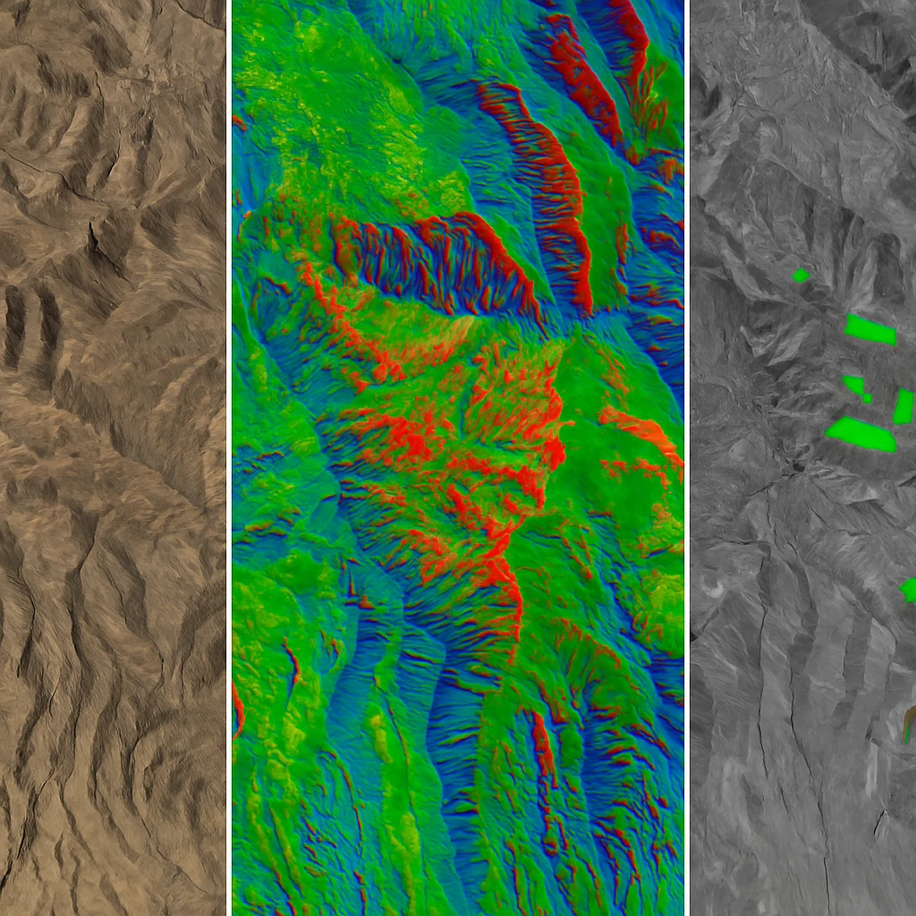
Mineral Exploration
For geological applications and mineral discovery, the specialised capabilities of Maxar WorldView-3 SWIR (Short-Wave Infrared) bands make it the undisputed leader.
Why WorldView-3 SWIR Excels for Minerals:
- 8 SWIR bands capturing data in the 1.0-2.5 μm range
- Ability to detect mineralogical content invisible to standard RGB sensors
- Can penetrate thin cloud cover, smoke, and haze
- Ideal for geological mapping and alteration detection
Ideal Applications:
- Mining exploration and prospecting
- Geological mapping
- Mineral alteration detection
- Lithological discrimination
- Assessment of drill targets
Why This Satellite?: The SWIR bands on WorldView-3 can detect specific mineralogical signatures like clay minerals, sulfates, and carbonates that are often associated with hydrothermal alteration and potential ore deposits.
Hyperspectral Analysis
For the most comprehensive spectral analysis, the Wyvern Dragonette Series hyperspectral satellites offer unmatched capabilities for detailed spectral discrimination.
Why Wyvern Hyperspectral Leads for VNIR Analysis:
- Dragonette-001: 23 spectral bands (500-800 nm range)
- Dragonette-002 & 003: 32 spectral bands (445-880 nm range)
- Exceptional spectral resolution (18-35 nm)
- Continuous spectral coverage vs. discrete bands
Ideal Applications:
- Advanced vegetation health assessment
- Pollution monitoring
- Water quality analysis
- Material identification
- Research applications requiring fine spectral discrimination
Why This Satellite?: While traditional multispectral satellites might offer 4-16 bands across a broad spectrum, Wyvern’s hyperspectral instruments provide continuous spectral coverage that can detect subtle differences invisible to other systems, such as early disease indicators in crops or specific pollutants in water bodies.
Best Value
For projects where budget efficiency matters, JILIN-1 50cm imagery delivers exceptional quality at a more accessible price point.
Why JILIN-1 50cm Offers the Best Value:
- High-quality 50cm resolution at significantly lower cost than 30cm alternatives
- 4 multispectral bands covering key applications
- Large constellation (10+ satellites) enabling good availability
- Excellent price-to-performance ratio
Ideal Applications:
- Regular construction monitoring
- Urban planning
- Land use classification
- Agricultural assessment
- Projects with limited budgets requiring reasonable detail
Why This Satellite?: For many applications, 50cm resolution is sufficient to identify buildings, infrastructure changes, and general landscape features. The cost savings with JILIN-1 often allow for more frequent monitoring or covering larger areas than would be possible with premium 30cm options.
Frequent Monitoring
When you need regular, consistent imagery of the same location, these satellite constellations offer the best revisit capabilities:
Maxar WorldView Legion
- Advantages: 6 satellites in orbit providing daily revisit capability
- Resolution: 30cm
- Coverage: Global with emphasis on high-demand areas
- Learn more about WorldView Legion
SpaceWill SuperView Neo
- Advantages: 4 satellites with 30cm resolution and coordinated coverage
- Resolution: 30cm
- Revisit: Every 2 days at mid-latitudes
- Learn more about SuperView Neo
JILIN-1 Constellation
- Advantages: Massive constellation with 10 satellites at 50cm and 50+ satellites at 75cm
- Resolution: 50cm-75cm
- Revisit: Daily or better in many areas
- Learn more about JILIN-1
Ideal Applications:
- Construction progress monitoring
- Change detection
- Dynamic event monitoring
- Environmental compliance monitoring
Why This Satellite?: For monitoring applications, consistency between images is often more important than absolute maximum resolution. A reliable satellite constellation with regular revisit patterns will provide more valuable data than occasional ultra-high-resolution images with varying angles and conditions.
Agriculture & Vegetation
For agricultural applications, Maxar WorldView-2 offers the perfect balance of resolution and spectral capabilities.
Why WorldView-2 Excels for Agriculture:
- 8 multispectral bands including Red Edge band (crucial for vegetation analysis)
- 50cm resolution (sufficient for field-level assessment)
- Coastal Blue band for improved atmospheric correction
- Yellow band for better vegetation discrimination
Ideal Applications:
- Precision agriculture
- Crop health monitoring
- Biomass estimation
- Irrigation management
- Forest inventory
Why This Satellite?: The Red Edge band on WorldView-2 is particularly sensitive to chlorophyll content in plants, making it excellent for detecting early signs of crop stress before they become visible to the naked eye or standard RGB imagery.
Urban Planning & Infrastructure
For monitoring urban development and infrastructure, SuperView Neo offers an excellent combination of resolution, coverage, and update frequency.
Why SuperView Neo Leads for Urban Applications:
- 30cm high-resolution imagery
- 4 spectral bands (RGB + NIR)
- 4-satellite constellation for frequent updates
- Wide swath width for efficient area coverage
Ideal Applications:
- Urban growth monitoring
- Transportation network planning
- Utility infrastructure management
- Land use change detection
- Building inventory and assessment
Why This Satellite?: SuperView Neo’s combination of high resolution and regular revisit capabilities makes it ideal for monitoring rapidly developing urban areas where both detail and currency of information are critical.
Disaster Response
When immediate assessment of disaster impacts is critical, WorldView Legion provides the best combination of resolution, coverage, and responsiveness.
Why WorldView Legion Excels for Disaster Response:
- 6-satellite constellation allowing rapid response anywhere globally
- 30cm resolution for detailed damage assessment
- Daily revisit capabilities to track evolving situations
- Wide imaging capacity to cover extensive disaster areas
Ideal Applications:
- Natural disaster assessment
- Emergency response planning
- Damage estimation
- Critical infrastructure assessment
- Recovery planning and monitoring
Why This Satellite?: In disaster situations, the combination of high resolution and rapid revisit capabilities is invaluable. WorldView Legion’s constellation approach ensures that affected areas can be imaged quickly, regardless of their location, providing critical information to emergency responders.
Massive Area Coverage
For applications requiring extensive geographic coverage, JILIN-1 75cm provides unmatched efficiency and rapid acquisition capabilities.
Why JILIN-1 75cm Excels for Massive Coverage:
- 150km swath width for capturing large areas efficiently
- 50+ satellite constellation enabling unprecedented coverage speed
- 75cm resolution balancing detail and coverage efficiency
- Cost-effective for large-scale mapping projects
Ideal Applications:
- Regional mapping
- National-level infrastructure monitoring
- Forest and land cover assessment
- Large watershed management
Why This Satellite?: The massive constellation of JILIN-1 75cm satellites creates a unique capability to rapidly image very large areas. While individual satellites in other constellations might offer higher resolution, the combined capacity of the JILIN-1 75cm fleet makes it possible to capture entire regions or countries in a fraction of the time required by other systems.
How to Choose the Right Satellite Imagery
Selecting the best satellite imagery involves balancing several factors:
- Resolution Requirements: Is 50cm sufficient, or do you need 30cm or better?
- Spectral Needs: Do you need standard 4-band imagery, or specialised bands like SWIR or hyperspectral?
- Update Frequency: How often do you need new images of your area of interest?
- Coverage Area: Are you monitoring a small site or mapping large regions?
- Budget Constraints: Premium imagery comes at a higher cost.
- Processing Requirements: Will you need advanced analysis or simple visual inspection?
Accessing Premium Satellite Imagery
Through Geopera’s Pera Portal, you can access all the satellite imagery options discussed in this article. Our platform simplifies the process of:
- Searching for available imagery across multiple satellite providers
- Comparing options side-by-side
- Ordering only the exact imagery you need
- Receiving processed data ready for analysis
For specialised applications or ongoing monitoring needs, our team can help design a custom satellite imagery program tailored to your specific requirements.
Conclusion
The “best” satellite imagery isn’t about having the absolute highest resolution or most spectral bands—it’s about finding the right match for your specific needs. By understanding the strengths of different satellite systems and how they apply to various use cases, you can make informed decisions that maximise your return on investment.
Whether you need ultra-detailed images for critical infrastructure inspection, specialised spectral capabilities for mineral exploration, or cost-effective options for regular monitoring, today’s commercial satellite marketplace offers solutions for every application.
Have questions about which satellite imagery is best for your specific project? Contact our expert team for a personalised consultation.
FAQs About Satellite Imagery
Q: How recent is commercial satellite imagery?
A: The freshest commercial satellite imagery is typically a few hours to a few days old, depending on the satellite, your location, and weather conditions. For the most recent imagery, tasking a satellite for a new capture is recommended.
Q: Can satellite imagery see through clouds?
A: Standard optical satellite imagery cannot see through clouds, but certain satellites with SWIR capabilities (like WorldView-3) can penetrate thin clouds, haze, and smoke. For complete cloud penetration, radar satellites (not covered in this article) are necessary.
Q: What’s the difference between 30cm and 50cm resolution imagery?
A: The difference is significant—30cm imagery offers approximately 2.8 times more pixels per area than 50cm imagery. This translates to the ability to identify smaller objects and finer details, such as individual vehicles or small structures.
Q: How often can I get new imagery of the same location?
A: With modern satellite constellations, most locations can be imaged daily to weekly, depending on the satellite provider. Areas at mid-latitudes typically have better revisit rates than polar or equatorial regions.
Q: Is Google Earth imagery the same as commercial satellite imagery?
A: No. Google Earth uses a mix of commercial satellite imagery, aerial photography, and other sources, but it’s often months or years old and processed for visual appeal rather than analytical accuracy. Commercial satellite imagery is more current, maintains radiometric accuracy, and comes with precise metadata needed for technical applications. Learn more in our Google Earth vs Commercial Satellite Imagery comparison.