Up-to-Date Satellite Images: How Recent Can You Get?
Up-to-date satellite images explained: why live imagery of your site does not exist, how old each source really is, and why cloud sets the wait.
Summary
- There is no live satellite imagery of your house. The closest thing to live is a geostationary weather satellite. Himawari-9 and GOES-19 photograph the whole visible disk of the Earth every 10 minutes, but their sharpest pixel is 500 m across, so a suburban block is a single dot.
- The newest free image of most places is a few days old. Sentinel-2 passes every 5 days at the equator and every 2 to 3 days at mid-latitudes, at 10 m, and processed scenes are online within about 8 hours. Landsat 8 and 9 add a 30 m image every 8 days.
- Web maps are older than they look. Google’s stated aim is to refresh big cities about once a year, medium cities every two years and smaller cities up to every three.
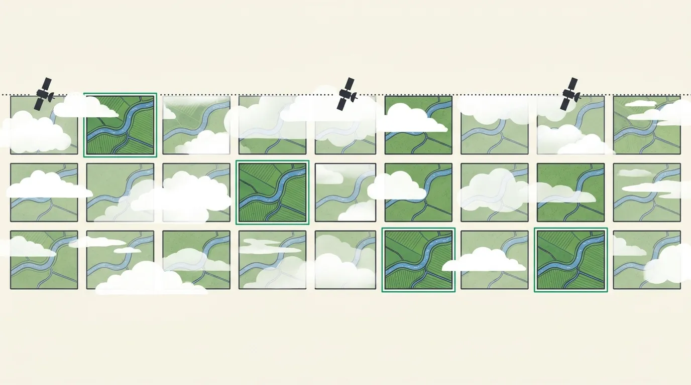
- Cloud, not the orbit, decides how fresh a usable image is. About two-thirds of Earth is under cloud at any moment. In 2017 Sentinel-2 data the average wait for a nearly cloud-free scene was two to six weeks across much of Europe, Asia and the Americas.
- For today’s ground, you task a satellite. Commercial constellations can look at some places several times a day, and a tasked capture usually arrives within 3 to 14 days, depending on weather and priority.
If you’re looking for up-to-date satellite images, you’re usually asking one of two things. What does this place look like right now? Or, less often said out loud: how old is the picture I’ve been trusting? Each has an exact answer, and neither is as comforting as the map apps suggest. We should say up front that Geopera sells the fresh end of this market, the recent commercial archive and the tasked captures, so weigh our view accordingly. But the finding that matters most doesn’t favour the paid side. For most places on Earth the satellite isn’t the bottleneck. The weather is.
Is There Live Satellite Imagery?
Not of anything as small as a house. The closest thing to live satellite imagery comes from geostationary weather satellites, parked 35,786 kilometres up so they turn with the Earth and stare at the same side of it all day. Japan’s Himawari-9, which covers Australia and Asia, images its full disk every 10 minutes. NOAA’s GOES-19 and GOES-18 do the same for the Americas, refreshing the continental United States every 5 minutes and small storm boxes every 30 to 60 seconds. Europe’s Meteosat-12 has run a 10-minute cycle since December 2024.
The catch is distance. From that height the finest pixel any of them makes is about 500 metres, and most bands are 1 to 2 kilometres. At 500 metres a pixel, a whole suburban block, with its roofs, gardens and parked cars, averages into one grey-green square. You can watch a cyclone wind up in real time. You can’t see whether your car is in the driveway.
High-resolution satellites have the opposite problem. They fly roughly 450 to 700 kilometres up, close enough for 30 cm pixels, and they cross the sky at about 7.5 kilometres a second, so any one of them sees your site for a few seconds per pass. Every “live satellite view” of a street is a stitched mosaic of earlier passes, sometimes with a weather layer laid over it. The trade is set by physics: a satellite far enough away to watch continuously is too far away to see a car, and one close enough to see the car is overhead for seconds.
How Up to Date Are Satellite Images? Source by Source
The figures below are the ones each operator publishes. “How fast you get it” is the delay between the satellite taking the picture and the picture being in your hands.
| Source | Pixel size | A new image every | How fast you get it | Cost |
|---|---|---|---|---|
| Weather satellites | 0.5 to 2 km | 10 minutes (5 over the US) | Minutes | Free |
| Sentinel-2 | 10 m | 5 days at the equator, 2 to 3 mid-latitude | 6 to 8 hours | Free |
| Landsat 8 and 9 | 30 m | 8 days combined | 4 to 6 hours | Free |
| Google Maps and Earth | Varies | Yearly in big cities, up to 3 in smaller ones | Months to years old | Free to view |
| Commercial archive | 0.15 to 0.75 m | Several passes a day possible | Often same day | From AUD $9/km² |
| Commercial tasking | 0.15 to 0.75 m | When you order it | Usually 3 to 14 days | From AUD $14/km² |
Weather satellites are Himawari-9, GOES-19 and GOES-18, and Meteosat-12. Sentinel-2 scenes arrive as Level-1C within about 6 hours and as atmospherically corrected Level-2A within 8. The Google cadence is the company’s stated aim, not a guarantee. Commercial prices are for sub-metre imagery as of October 2026, with processing included.
The free tier is fresher than most people assume. Over mid-latitude Europe, North America or southern Australia, Sentinel-2 photographs the ground every two or three days, and the processed scene is downloadable the same day. ESA has even kept its oldest Sentinel-2 satellite, 2A, flying beside the two operational ones until the end of 2026, in an orbit chosen to add passes over cloudy regions.
The familiar web maps are the stalest thing on the list. Google’s own explainer from 2020 gives its aim as roughly yearly refreshes for big cities, every two years for medium cities and up to every three years for smaller ones, and it publishes no schedule for the countryside. If you use Google Earth, check the imagery date at the bottom of the screen, and know that when the view spans several captures it shows the oldest one.
Why Cloud, Not the Orbit, Sets the Wait
A satellite pass only counts if the sky over your site is clear at that moment, and most of the time it isn’t. NASA’s MODIS instruments put the planet’s average cloud fraction at about 67%, and about 55% over land (King and colleagues, 2013). A separate 15-year analysis of MODIS data found a median cloud frequency of 51% across the land surface, rising to around 80% over tropical forests (Wilson and Jetz, 2016).
Think of each pass as a roll of a die. Revisit decides how often you roll, and cloud decides how many faces are blank. A satellite that comes back every 5 days to a site that’s cloudy 55% of the time rolls a clear face, on average, every 11 days. Shorten the revisit to a day and the same weather gives you a clear look roughly every two days. Set the numbers for your own site:
How long until a clear image?
Every day: first clear image in 2.2 days on average, half the time within 2 days, and a >99% chance within 30 days.
The calculator is generous, and it’s tagged as a model for a reason. It treats every pass as an independent roll, and real cloud doesn’t behave that way: it arrives in weather systems that sit for days, so one wet week blanks out several passes in a row. Measured waits run longer. Sudmanns and colleagues went through a year of 2017 Sentinel-2 scenes and counted the ones with less than 10% cloud. The average gap between them was under two weeks across Africa, the Near East and parts of Australia, and between two and six weeks across much of Europe, Asia and the Americas. Some places had one usable scene that year, or none.
It would be easy to read this as a case for buying whichever satellite has the best revisit. The arithmetic says something narrower. More passes help enormously where cloud comes and goes: at 55% cloud, a daily constellation cuts the average wait from about 11 days to about 2. They help much less in a monsoon or a northern winter, when the same cloud deck sits over a site for weeks and every optical satellite in orbit is blind beneath it. Radar sees through cloud, at a cost in how easily the picture reads, and KOMPSAT-5 radar tasking is available through us on request for exactly those cases. For most sites, then, the number to watch is how many of those passes this season’s weather lets through.
Where to Find the Latest Free Satellite Images
Free imagery is fresh enough for a surprising amount of work: watching a dam fill, a crop green up, a clearing spread or a flood recede. The sources worth knowing, freshest first:
- Weather satellites, for anything happening this hour. In Australia the Bureau of Meteorology publishes the Himawari-9 loop at 10-minute intervals, and NOAA and EUMETSAT publish the same kind of loop for the Americas and Europe. They’re good for smoke, storms and cloud, and no use at all for buildings.
- NASA Worldview, for same-day pictures of the whole planet at 250 m to 1 km from the MODIS and VIIRS instruments. Fires, floods and algal blooms show up within the day.
- Sentinel-2, for 10 m imagery every few days. The Pera Portal free tier gives unlimited Sentinel-2 viewing with spectral indices built in, and ESA’s Copernicus Browser lets you filter scenes by date and cloud cover.
- Landsat 8 and 9, for 30 m imagery every 8 days and the longest archive, through USGS EarthExplorer.
Before you trust any of them, read two numbers on the scene: the acquisition date and the cloud percentage. A “recent” scene that’s 40% cloud may have nothing useful over your site at all. Our roundup of free satellite data sources goes deeper on each, and there are local editions for free satellite imagery of Australia and the UK.
When Free Isn’t Recent Enough
Free imagery runs out in two directions. Ten-metre pixels can’t show a stockpile’s edge or a new fence line. And you can’t ask a free satellite to look at a particular place on a particular day: if nothing caught your site cloud free last week, there’s nothing to download.
Commercial imagery fixes the second problem more often than people expect, because the big constellations are collecting all the time. Vantor says its WorldView Legion fleet can revisit some locations up to 15 times a day, and PERASCOPE, our own 50 cm constellation, can revisit a site up to six times a day. Much of that collection lands in archives before anyone orders it, so the first step is always to search. In Pera Portal the archive search is free, each result carries its capture date and per-km² price, and sub-metre archive starts at AUD $9/km² as of October 2026, with orthorectification, pansharpening and atmospheric correction included at no extra cost. The full list, with each sensor’s minimum order area, is on our pricing page.
When the archive doesn’t have it, you task. Tasking means booking a satellite to collect your site inside a window you choose, with a cloud ceiling you set, and sub-metre optical tasking starts at AUD $14/km². Expect most captures within 3 to 14 days, and the spread is the weather again: the constellation keeps coming back, but it only delivers once the sky lets it through. Our guide to satellite tasking walks through the options, including priority collection when a deadline can’t move.
On most days a commercial satellite passes within reach of your site. Whether that pass becomes an up-to-date image of it is mostly up to the sky.
Frequently Asked Questions
Is there live satellite imagery of my house?
No satellite streams live imagery at house scale. Geostationary weather satellites refresh every 5 to 10 minutes, but their sharpest pixels are 500 m wide. Sub-metre satellites see a site for seconds per pass, so “live” street-level maps are mosaics of earlier captures.
How up to date are Google Maps satellite images?
Older than they look. Google has said it aims to refresh big cities about yearly, medium cities every two years and smaller cities up to every three, with no published schedule for rural areas. We compare it with commercial imagery in Google Earth vs commercial satellite imagery.
Where can I find the most recent satellite images for free?
For 10 m imagery a few days old, Sentinel-2, through Pera Portal’s free tier or ESA’s Copernicus Browser. For same-day pictures at 250 m to 1 km, NASA Worldview. For the last ten minutes, your national weather service’s geostationary satellite loop.
How often are satellite images updated?
It depends on the satellite. Weather satellites refresh every 10 minutes, Sentinel-2 every 2 to 5 days, Landsat 8 and 9 every 8 days, and commercial constellations can pass several times a day. How often you get a usable, cloud-free image is set mostly by local weather.
Can I get real-time satellite images of Australia?
Not at property scale. The Bureau of Meteorology’s Himawari-9 loop updates every 10 minutes, with weather-scale pixels. For ground detail the freshest free option is Sentinel-2, every 2 to 5 days at 10 m. Sub-metre imagery means commercial archive or a tasked capture.