Satellite Tasking Explained - A Practical Guide
Learn how satellite tasking works, when to use it, and how to get the most current imagery for your specific needs

Summary
Satellite tasking lets you request brand-new, custom imagery of your specific location instead of relying on archive imagery that might be weeks, months, or even years old. Here’s what you need to know:
- What It Is: Satellite tasking is the process of requesting a satellite to capture fresh imagery of your specific Area of Interest (AOI), giving you up-to-date data when you need it
- When To Use It: Ideal for monitoring changing situations like construction projects, natural disasters, environmental changes, or any scenario where recent imagery (within days, not months) is critical
- Available Options: Choose from optical imagery (30cm-2m resolution with WorldView Legion, SuperView Neo, JILIN-1) or radar imagery that can penetrate clouds and capture imagery regardless of weather or daylight conditions
- Tasking Timeline: From request to delivery, expect 3-14 days depending on satellite availability, weather conditions, and priority level (rush options available for time-sensitive applications)
- Budget Considerations: Starting from $1,400 for high resolution tasking (75cm) up to $4,000+ AUD for premium 30cm resolution with priority acquisition, while archive imagery typically costs 30-70% less
- Expert Planning: Maximise success rates (95%+ with Geopera’s Pera Portal) by considering cloud cover, revisit frequencies, incidence angles, and collection windows when placing your tasking request
- Processing Options: Raw imagery delivery or value-added services available including orthorectification, atmospheric correction, and advanced analytics to make your imagery immediately actionable
Introduction
In the past, getting your hands on satellite imagery was a bureaucratic nightmare. Even when commercial satellite imagery became available in the 1990s, the process was painfully slow and complex. By the time you finally received your imagery, it was often outdated and no longer useful for your needs.
Today, satellite tasking has revolutionised access to fresh, high-resolution imagery. Instead of being limited to whatever archive imagery might be available, you can request that satellites capture brand-new images of your exact area of interest, often delivered within days.
This guide will walk you through everything you need to know about satellite tasking: how it works, when you should use it, what options are available, and how to ensure you get the best possible results for your specific needs.
What Is Satellite Tasking?
Satellite tasking is the process of requesting a satellite operator to direct their satellite to capture fresh imagery of your specified Area of Interest (AOI). Unlike archive imagery, which consists of previously captured images stored in a database, tasked imagery is collected specifically for you based on your unique requirements.
How Satellite Tasking Evolved
The ability for commercial entities to task satellites is relatively recent in the history of remote sensing:
- Pre-1990s: Satellite imagery was exclusively controlled by governments and military agencies
- 1992: Russia began selling satellite imagery to commercial customers
- 1994: The US allowed private companies to build and launch commercial imaging satellites
- 1999: IKONOS-2 became the first high-resolution satellite available for commercial tasking
- 2010s: Web platforms began streamlining the satellite tasking process
- Today: Modern platforms like Geopera’s Pera Portal enable direct, user-friendly satellite tasking with delivery times measured in days, not months
Why Task a Satellite?
There are several compelling reasons to task a satellite rather than relying on archive imagery:
- Currency: You need the most up-to-date view of a location
- Specificity: You require imagery with exact parameters (resolution, angle, time of day)
- Availability: No suitable archive imagery exists for your area of interest
- Custom Collection: You need repeated captures over time to monitor changes
- Quality Control: You want to ensure cloud-free, high-quality imagery
Types of Satellite Tasking
When tasking a satellite, you’ll need to choose between two main types of imagery: optical and radar. Each has distinct advantages for different applications.
Optical Satellite Tasking
Optical satellites capture imagery similar to traditional cameras but with capabilities far beyond what the human eye can see.
Key Advantages:
- High-resolution imagery (as sharp as 30cm with WorldView Legion)
- Natural-looking images that are easy to interpret
- Multispectral capabilities including visible and invisible bands (RGB, NIR, SWIR)
- Ideal for visual assessment, mapping, and monitoring visible changes
Limitations:
- Cannot penetrate clouds (success depends on clear weather)
- Requires daylight for collection
- May require multiple collection attempts in cloudy regions
Best For:
- Urban monitoring and planning
- Infrastructure inspection
- Agricultural assessment
- Land use classification
- Environmental change detection
Available Sensors Through Geopera:
- WorldView Legion: 30cm resolution, 6-satellite constellation
- SuperView Neo: 30cm resolution, 4-satellite constellation
- JILIN-1 50cm: 50cm resolution, frequent revisits
- WorldView-3: 30cm resolution with 16 spectral bands
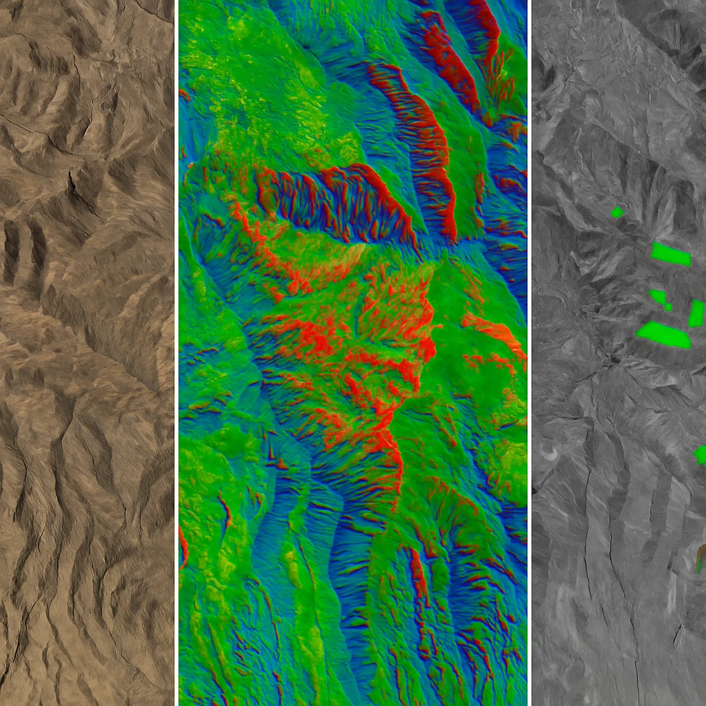
Radar Satellite Tasking
Radar satellites emit their own energy pulses and measure the return signal, creating images based on the reflected data.
Key Advantages:
- All-weather imaging capability (can penetrate clouds, rain, and smoke)
- Day and night operation (doesn’t require sunlight)
- Guaranteed acquisition on first attempt
- Provides unique data on structure, elevation, and surface characteristics
Limitations:
- Lower resolution than optical imagery
- More complex to interpret visually
- Typically more expensive than optical imagery
Best For:
- Monitoring during monsoon seasons or in frequently cloudy regions
- Emergency response during storms or poor visibility conditions
- Infrastructure monitoring regardless of weather conditions
- Surface deformation and subsidence detection
- Maritime surveillance and ship detection
Available Through Geopera:
- SAR (Synthetic Aperture Radar) options available upon request
How to Task a Satellite
The satellite tasking process has been dramatically simplified through Geopera’s portal, but understanding each step will help ensure you get exactly the imagery you need.
1. Define Your Area of Interest (AOI)
Your first step is to precisely define the geographical area you want captured:
- Web Interface: Draw a polygon directly on the map in Pera Portal
- Upload Option: Upload a KML, GeoJSON, or Shapefile of your AOI
- API Integration: Define your AOI programmatically through Geopera’s API
Best Practices for AOI Definition:
- Keep your AOI as compact as possible to minimise costs
- Ensure your polygon has no self-intersections or topology errors
- Limit complexity to under 1,000 vertices for optimal processing
- Include a small buffer around critical features to ensure complete coverage
2. Specify Your Requirements
After defining your AOI, you’ll need to specify your collection parameters:
- Satellite Selection: Choose specific satellites or let Geopera recommend the best option
- Resolution: Select the spatial resolution needed (30cm, 50cm, 75cm, 1m, 2m, etc.)
- Collection Window: Set the time period during which imagery should be captured
- Cloud Cover: Specify maximum acceptable cloud coverage percentage (typically 15-20% or less)
- Off-Nadir Angle: Define acceptable viewing angles (affects image quality)
- Spectral Bands: Specify which bands you need (RGB, NIR, SWIR, etc.)
- Priority Level: Set standard or rush priority (affects price and timeline)
3. Review Feasibility and Pricing
After submitting your requirements, Geopera’s team will:
- Assess the feasibility of your request based on satellite availability and conditions
- Calculate the probability of successful acquisition within your timeframe
- Provide a detailed quote based on your specifications
- Suggest alternatives if your original requirements present challenges
Typical Pricing Factors:
- AOI size (larger areas cost more)
- Resolution (higher resolution commands premium pricing)
- Priority level (rush tasking costs more than standard)
- Specific satellites requested (some sensors have premium pricing)
- Special processing requirements
4. Confirm and Track Your Order
Once you’ve approved the quote:
- Your tasking request enters the collection queue
- You’ll receive updates on planned acquisition dates
- You can track the status of your order through the Pera Portal dashboard
- You’ll be notified when the satellite successfully captures your imagery
5. Receive and Utilise Your Imagery
Upon successful collection:
- Your imagery undergoes quality control and processing
- The data is delivered through Pera Portal in your preferred format
- Additional processing options are available (orthorectification, analytics, etc.)
- Cloud storage and API access options are available for enterprise users
Maximising Satellite Tasking Success
To ensure the highest probability of successful acquisition, consider these expert tips:
Understand Revisit Rates
Different satellites have different revisit capabilities, which affects how quickly they can capture your AOI:
- Daily Revisit: WorldView Legion (constellation of 6 satellites)
- 2-3 Day Revisit: SuperView Neo (constellation of 4 satellites)
- Multiple Daily Passes: JILIN-1 75cm (constellation of 50+ satellites)
Plan Around Weather Patterns
For optical imagery, cloud cover is the primary challenge:
- Cloud Cover Assessment: Geopera provides historical cloud cover analysis to choose optimal collection windows
- Seasonal Planning: Time your tasking requests during typically clear seasons for your region
- Extended Collection Windows: For challenging areas, set longer collection windows to increase success probability
- Radar Alternative: Consider radar imagery for consistently cloudy regions
Consider Collection Angles
The satellite’s angle relative to your AOI affects image quality:
- Near-Nadir (0-20°): Provides the least distortion but may have limited availability
- Off-Nadir (20-30°): Good balance of quality and availability
- Extreme Off-Nadir (>30°): May have significant distortion but enables quicker acquisition
Set Realistic Timeframes
Understanding typical timelines helps set proper expectations:
- Rush Tasking: 3-7 days from order to delivery (weather permitting)
- Standard Tasking: 7-14 days from order to delivery
- Complex AOIs or Specific Requirements: May require additional time
Common Applications for Satellite Tasking
Satellite tasking is particularly valuable for these applications:
Construction and Development Monitoring
Track progress, verify timelines, and document site conditions with regular updates:
- Initial Site Assessment: Capture pre-construction conditions
- Progress Monitoring: Task satellites bi-weekly or monthly to document development
- Compliance Verification: Document adherence to permits and regulations
- Dispute Resolution: Maintain a visual timeline of project evolution
Disaster Response and Assessment
Get current imagery immediately following natural disasters:
- Damage Assessment: Quantify affected areas after floods, fires, or storms
- Response Planning: Guide emergency teams with current ground conditions
- Insurance Documentation: Provide evidence for claims processing
- Recovery Monitoring: Track reconstruction efforts over time
Agricultural Management
Monitor crop conditions throughout the growing season:
- Pre-Planting Assessment: Evaluate field conditions before planting
- Growth Monitoring: Track crop development at critical stages
- Stress Detection: Identify irrigation issues or disease outbreaks early
- Harvest Planning: Optimise timing based on current crop conditions
Environmental Monitoring
Document changes to sensitive ecosystems:
- Deforestation Tracking: Monitor forest clearing activities
- Pollution Events: Document spills or contamination
- Habitat Changes: Track wildlife habitat modifications
- Climate Impact Assessment: Document effects of climate change on specific regions
Satellite Tasking vs. Archive Imagery
Understanding when to use each option will help optimise your imagery budget:
When to Use Archive Imagery
- Historical Analysis: When you need to understand past conditions
- Budget Constraints: Archive imagery typically costs 30-70% less than tasked imagery
- Immediate Needs: When you need imagery right away (instant delivery)
- Low-Change Areas: For regions where conditions change slowly
- Initial Assessment: For preliminary analysis before deciding on tasking
When to Choose Satellite Tasking
- Current Conditions: When you need to see exactly what’s happening now
- Specific Parameters: When you need precise angles, times, or conditions
- Monitoring Programs: For consistent, scheduled imaging of the same area
- Recent Changes: Following construction, natural events, or other modifications
- Quality Requirements: When you need guaranteed cloud-free, high-quality imagery
Processing Options for Tasked Imagery
Once your imagery is captured, Geopera offers various processing levels to suit your needs:
Basic Processing
- Radiometric Correction: Adjusting for sensor characteristics
- Geometric Correction: Basic alignment and distortion removal
- Band Composites: Standard RGB, Color-Infrared, or custom band combinations
Advanced Processing
- Orthorectification: Precise geometric correction using elevation models
- Atmospheric Correction: Removing atmospheric effects for true reflectance values
- Pansharpening: Enhancing resolution by combining panchromatic and multispectral data
- Mosaicking: Seamlessly combining multiple images
Value-Added Analytics
- Change Detection: Automated comparison with previous imagery
- Feature Extraction: Identifying specific objects or infrastructure
- Vegetation Indices: NDVI, EVI, and other indicators of plant health
- Classification: Land use/land cover mapping
- 3D Products: Digital Surface Models and elevation products
Conclusion
Satellite tasking has transformed how organisations access current, high-quality imagery. By understanding the process, options, and best practices outlined in this guide, you can make informed decisions about when and how to use this powerful capability.
Whether you’re monitoring construction, responding to disasters, tracking environmental changes, or managing agricultural operations, the ability to request brand-new satellite imagery tailored to your exact specifications provides unprecedented insight and decision-making power.
Ready to task a satellite for your specific area of interest? Contact our expert team for guidance or visit Pera Portal to start the process today.
FAQs About Satellite Tasking
Q: How much does satellite tasking typically cost?
A: Costs range from approximately $1,400 AUD for standard resolution (2m) imagery covering a small area to $4,000+ AUD for premium 30cm resolution with priority acquisition. The final price depends on AOI size, resolution requirements, urgency, and processing needs.
Q: How long does the satellite tasking process take?
A: Standard tasking typically takes 7-14 days from order to delivery, while rush tasking can be completed in 3-7 days, weather permitting. The timeline depends on satellite availability, weather conditions, and your specified parameters.
Q: What if clouds obstruct my area of interest during collection?
A: For optical imagery, Geopera will continue collection attempts until acceptable imagery is obtained or your collection window closes. Our feasibility analysis includes cloud cover prediction to maximise success. Alternatively, radar imagery can be used for cloud-penetrating capabilities.
Q: Can I task satellites for any location on Earth?
A: While commercial satellites can image most of the Earth, some restrictions apply based on international regulations and security considerations. Geopera will advise you if your AOI falls under any restrictions. See our supported countries page for more details.
Q: What’s the difference between satellite tasking and satellite data subscriptions?
A: Tasking is a one-time request for new imagery of a specific area, while subscriptions provide regular, scheduled imagery of your areas of interest over time. For consistent monitoring needs, subscriptions typically offer better value. Learn more about our subscription options.