
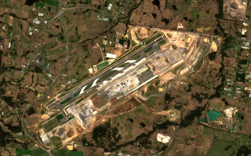
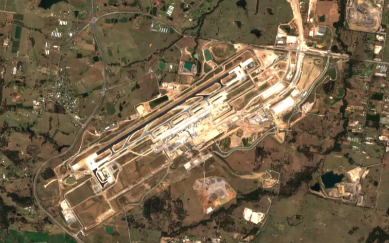
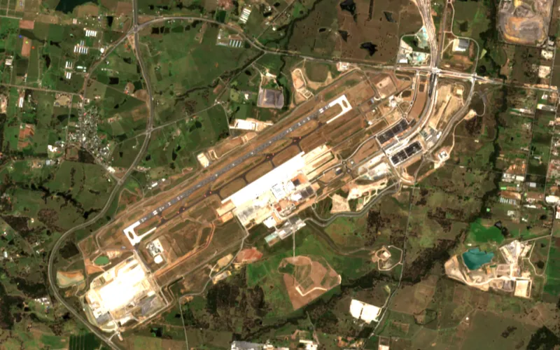
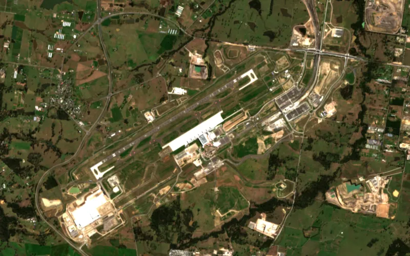
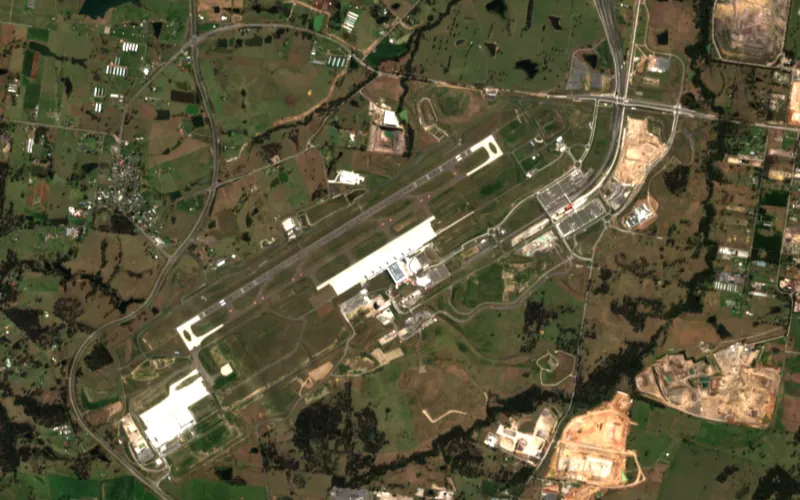
Oct 2018
Site monitoring
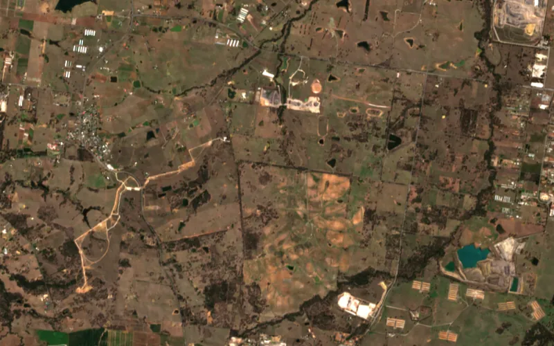
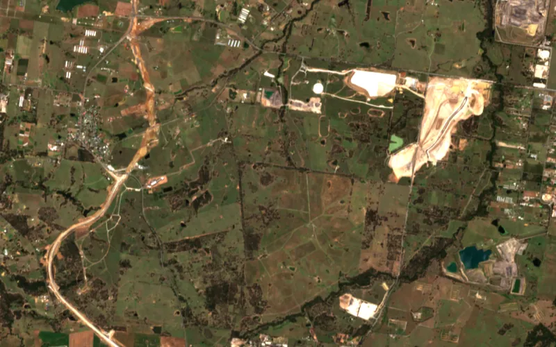
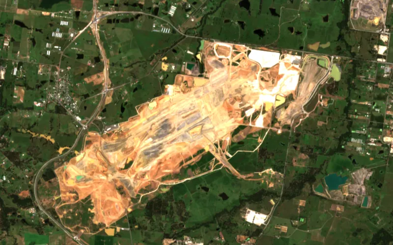
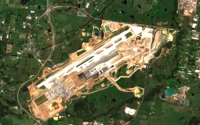
See your site change, on a schedule you set
Book new satellite captures over your area every week, month or quarter, each priced at the published tasking rate and processed like any other order. Or set an alert, and we'll tell you when new imagery of your area arrives.
Three ways to keep watch, from free to booked
Start with what the satellites already collect. Book captures when you need detail on a schedule.
Free Sentinel-2
- What you get
- Every Sentinel-2 pass over your area, in Pera Portal
- Detail
- 10 m
- How often
- A new pass every few days, cloud permitting
- Cost
- Free and unlimited
- How it arrives
- In the portal, alongside your other imagery
Imagery alerts
- What you get
- An email and an in-portal notice when new imagery of your area reaches the catalogue
- Detail
- Any sensor in the catalogue
- How often
- Checked daily, weekly or monthly
- Cost
- You pay only for the scenes you choose to order
- How it arrives
- Order from the map; processed like any archive order
Recurring tasking
- What you get
- New captures booked over your area on a fixed schedule
- Detail
- 15 cm to 75 cm optical
- How often
- Weekly, every two weeks, monthly, every two months or quarterly, to an end date
- Cost
- The sensor's tasking rate per km², once per capture
- How it arrives
- Each capture processed and delivered to your project in Pera Portal
How a booked programme runs
A person checks every capture before it's booked and before it's delivered.
- 01
You set the area, sensor, cadence and end date
In Pera Portal, or with our team if the programme needs more than one satellite.
- 02
We check each capture is feasible and book it
Our team confirms the satellites can collect your area on that schedule, then books each capture with the operator.
- 03
Every capture is processed and signed off
Orthorectified, cloud-masked, pansharpened and colour-balanced like any other order, then approved by an analyst before delivery.
- 04
It lands in your project, next to the last one
Compare dates side by side in the portal, or pull each capture into your own GIS.
You know what a year costs before you book it
Each capture is priced at the sensor's published tasking rate per km² of your area. The programme total is that price times the number of captures.
Monthly for a year
A$16,500
12 captures · Vantor WorldView 30 cm · 25 km² at A$55 / km²
Every two months for a year
A$9,900
6 captures · BJ3A 50 cm · 50 km² at A$33 / km²
Quarterly for a year
A$15,200
4 captures · PERASCOPE 30 cm · 100 km² at A$38 / km²
Australian dollars, excluding tax. Each capture is billed at no less than the sensor's minimum area. Rates step down for larger areas.
What procurement will ask
- Account and invoicing
- One account and one invoice across archive, tasking, elevation and radar. We invoice NET-30 against your purchase order, and contracted rates are available.
- Volume
- Published rates are the ceiling. Per-km² rates step down as your area grows, so send us the area and we will quote it.
- Booking by API
- Recurring tasking can also be booked through the API, including daily cadences the portal does not offer.
- Integration
- Files arrive as Cloud-Optimised GeoTIFF with STAC metadata, by download or streamed over WMTS, or through the API with Python and TypeScript SDKs.
- Evaluation
- A processed sample over your own site, by application. Tell us about the project, we arrange a short call, and then we prepare the sample.
Questions about monitoring
How is a monitoring programme priced?
Each capture is priced at the sensor's published tasking rate per km² of your area, at no less than the sensor's minimum area. Twelve monthly captures cost twelve times one. The programme has an end date, so you know the total before you book.
Can we get daily captures?
The portal books weekly and longer cadences. Daily tasking can be booked through the API or with our team, subject to what the satellites can collect over your area.
Do alerts order imagery automatically?
No. An alert tells you that new imagery of your area has reached the catalogue, by email and in the portal. You choose which scenes to order.
Can we monitor for free?
Yes, at 10 m. Sentinel-2 is free and unlimited in Pera Portal, with a new pass every few days when the sky is clear. Commercial imagery is for when 10 m is too coarse.
Can we monitor ground movement?
Yes, with InSAR: repeat radar passes over your site, compared to show how far the ground moved and when. It is scoped as its own job, so tell us the area and the period you need to watch.
Can one programme use more than one satellite?
Yes, by booking it with our team. Mixing sensors improves the odds of a clear capture in each period, and each image is processed onto the same footing so dates compare cleanly.
Tell us the site and how often you need to see it
Send us the area, the detail you need and how long you need to watch it. We will check which satellites can collect it on that schedule and price the programme.