
01Area and date range
Draw the area or pick one you saved, then set the window. The search runs across the suppliers we hold agreements with, so finding out what exists does not mean an account per operator.
Archive
Search what 100+ satellites have already taken over your area, read each scene on its own numbers, and buy only the ones that answer the question. Often delivered within hours.
Draw the area or pick one you saved, then set the window. The search runs across the suppliers we hold agreements with, so finding out what exists does not mean an account per operator.
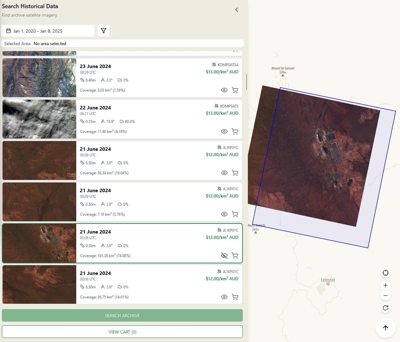
Every result carries the fields in the table below, so the decision happens before the money does.
Any result can be drawn on the map against your area, so you can see where the footprint falls and where the cloud sits. Scenes that miss the part of the site you care about get dropped instead of bought.
The scenes you keep go to the cart and are ordered together. An archive order has nothing to wait for in orbit, so it is often delivered within hours.
| On the result | Why it matters |
|---|---|
| Acquisition date and UTC time | Whether the scene is recent enough for the question you are answering. |
| Sensor | Which satellite took it, linked to its specification page. |
| Resolution | What you will actually be able to see, from 30 cm to 2 m. |
| Off-nadir angle | How obliquely it was captured. Lower is truer to the map. |
| Cloud cover | How much of the scene is cloud before you commit to it. |
| Coverage of your AOI | In km² and as a percentage, so partial scenes are obvious. |
| Rate per km² | The price, on the result itself, before anything goes in a cart. |
Archive across 100+ satellites at resolutions from 30 cm to 2 m, plus open data that is searchable in the same place: Sentinel-2, Landsat, and NAIP.
Archive orders run through the same automated chain as everything else: ortho correction, alignment, pansharpening, colour balancing, and mosaicing. That work is inside the per-km² rate rather than billed on top.
Deliveries are Cloud Optimized GeoTIFFs. Download them, stream them as WMTS or XYZ tiles into QGIS or ArcGIS with an API key, or pull them from the STAC 1.0 catalogue.
Get started
Draw the area in the portal and read the results, or talk to us about what you need to measure.