How to Add Satellite Imagery to GeoLibre (2026 Guide)
Four ways to add satellite imagery to GeoLibre, and why a cloud-native GIS only pays off when your imagery ships as a proper COG.
Summary
- GeoLibre loads satellite imagery four ways: a built-in basemap, a remote COG URL, a STAC catalogue search, or a local raster dragged onto the map. The remote-URL path is the one that changes how you work
- New to the tool? Start with what GeoLibre is. This post assumes you already have it open
- Its raster reader “reads range requests for the tile containing the pixel rather than the whole scene.” So a 1.15 GB image can paint from roughly 4.6 MB of traffic
- That saving is not free. It needs a real Cloud Optimized GeoTIFF: internally tiled, with an overview pyramid. Point GeoLibre at a flat GeoTIFF and the whole file comes down before you see anything
- 1,000+ geoprocessing tools run locally in WebAssembly, 154 of them remote sensing. Band math and change detection now happen in the browser tab, with no server and nothing uploaded
A GIS that opens a 1.15 GB satellite scene by pulling about 4.6 MB of it sounds like a rounding error. Or a lie.
It’s neither, and the trick behind it decides whether GeoLibre is a genuine upgrade to your workflow or an annoying way to watch a progress bar. If you want to add satellite imagery to GeoLibre and have it feel instant, the app is only half the story. The other half is how your imagery was written to disk, which is a sentence most providers would rather you never think about.
The Thirty-Second Version
GeoLibre is a free, MIT-licensed GIS that runs in a browser tab and installs as a native app on desktop and mobile. Our separate post covers what GeoLibre is and what’s inside it properly.
The pitch that matters for imagery work: your data stays on your machine. GeoLibre Web has no server account and no analytics, and files you load are processed client-side. For anyone who has ever had to explain to a client why their pre-tender site imagery got uploaded to someone else’s cloud to make a map, that’s not a small feature.
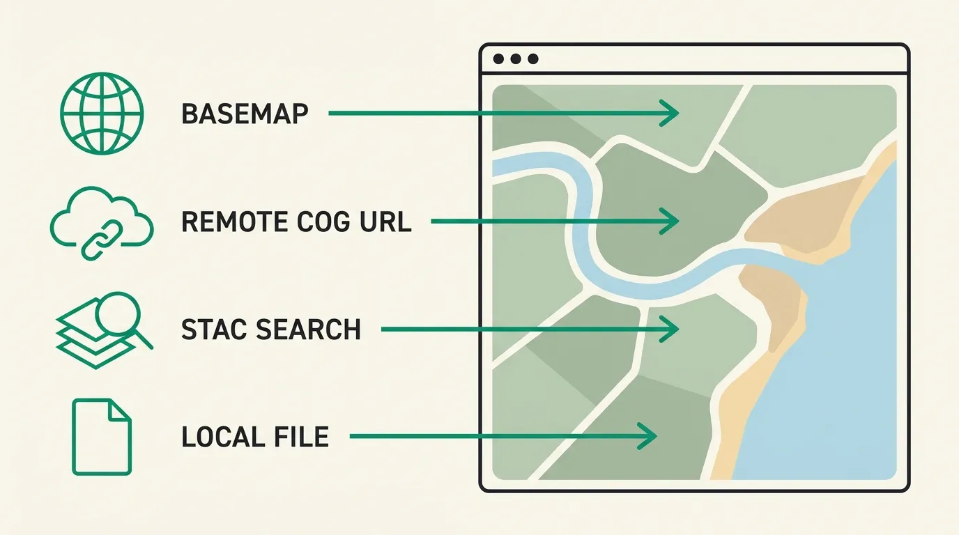
The Four Ways to Get Satellite Imagery onto a GeoLibre Map
Every method comes down to one of these, and they are not interchangeable.
1. The built-in basemaps. Open the Layers panel and pick one. OpenFreeMap for streets, EOX Sentinel-2 cloudless for a gap-free global satellite backdrop. Zero effort, zero control. The Sentinel-2 cloudless annual layers are licensed CC-BY-NC-SA 4.0, which means non-commercial, so check that before it ends up under a paid deliverable. (There’s also a planet switcher with Moon, Mars and Titan basemaps, which has nothing to do with your job and is worth ten minutes of your afternoon anyway.)
2. A remote COG URL. Paste an https:// link to a Cloud Optimized GeoTIFF and GeoLibre streams it. Nothing lands on your disk and nothing needs converting first. This is the method that makes the app interesting, and most of this post is about it.
3. A STAC catalogue. GeoLibre speaks STAC, so you can point it at a catalogue, search by area and date, and pull the matching scenes as layers. Search and load, rather than download-then-load.
4. A local raster. Drag a GeoTIFF onto the map. It works exactly as you’d expect, it needs no network, and on the desktop build you also get local MBTiles and filesystem reads. When the imagery is already sitting on your drive, this is still the right answer.
| Method | You control the date? | Streams or downloads? | Bands available | Best for |
|---|---|---|---|---|
| Built-in basemap | No, it’s a fixed mosaic | Streams tiles | RGB picture only | Context behind your vectors |
| Remote COG URL | Yes, it’s your scene | Streams byte ranges | Every band in file | Big scenes, shared projects |
| STAC search | Yes, filter by date | Streams matched scenes | Every band in file | Finding imagery by area and time |
| Local raster file | Yes, it’s your file | Already downloaded | Every band in file | Offline work, archived deliveries |
The Part the Tutorials Skip: Your File Has to Cooperate
Method 2 is where people get burned, so it’s worth understanding what the app is actually doing.
When GeoLibre opens a raster over HTTP, it doesn’t ask the server for the file. It asks for specific byte ranges: the header first, to learn how the image is laid out, then only the tiles covering what’s on screen at the zoom level you’re viewing. GeoLibre’s own documentation puts it plainly. It “reads range requests for the tile containing the pixel rather than the whole scene.”
That behaviour depends entirely on the file being structured for it. A Cloud Optimized GeoTIFF is a normal GeoTIFF with two extra properties: the pixels are arranged in internal tiles instead of long strips, and the file carries a pyramid of pre-computed lower-resolution copies. Zoom out and the reader grabs a small overview. Zoom in and it grabs a handful of full-resolution tiles. Either way it reads a sliver.
Take a modest commercial scene: 12,000 × 12,000 pixels, four bands, 16-bit. At 30 cm that’s about a 3.6 km square, a small site. Uncompressed it’s 12,000 × 12,000 × 4 × 2 = 1.15 GB.
Flat GeoTIFF no internal tiling, no overviews
1.15 GB before the first pixel paints
Cloud Optimized GeoTIFF tiled, with an overview pyramid
4.6 MB before the first pixel paints
Same URL, same app, and the same pixels on screen at the end. The difference in what crosses the wire is 256-fold, and that number isn’t a benchmark result. It’s just 16², the scale factor of the overview level the viewer picked.
This is why “we’ll email you a GeoTIFF” is a worse deal in 2026 than it was in 2016, and why the delivery format line on a quote deserves more attention than it usually gets. Plenty of the industry still hands over raw or minimally processed rasters and leaves conversion to you. Converting is possible (GDAL will do it, and GeoLibre’s own Conversion toolbox has 49 tools that translate to GeoParquet, PMTiles and COG), but it means downloading the whole 1.15 GB first, which is the cost you were trying to avoid.
Free Imagery That’s Actually Licensed for Work
You can do real work in GeoLibre without spending anything, as long as you’re honest about the resolution ceiling.
Sentinel-2, from the European Space Agency’s Copernicus programme, is free and open for commercial use with attribution: 13 bands, 10 m in the visible and near-infrared, a five-day revisit. Landsat is US public domain with an archive back to 1972. Both download from sources like the Copernicus Data Space Ecosystem and load straight into GeoLibre.
Ten metres per pixel is roughly a tennis court. Enough to watch a crop stress, a dam draw down, a burn scar spread. Not enough to see a vehicle, a fence line, or the edge of a disturbance boundary a regulator will argue about. We’ve ranked the archives properly in our roundup of the best free sources of satellite data.
What the Browser Can Now Do With Those Pixels
The genuinely surprising part of GeoLibre isn’t the map. It’s Processing → Whitebox Toolbox, which exposes 1,000+ geoprocessing tools compiled to WebAssembly and executed locally: 256 raster tools, 154 remote sensing tools, 99 terrain, 65 LiDAR.
Spectral indices, band math, classification and change detection, computed in a browser tab, with no Python environment to install and nothing sent to a server. Five years ago that was a desktop install, a licence key and an afternoon. If you’ve been putting off learning a scripting workflow just to calculate NDVI over one site, that excuse is gone.
Which brings the resolution question back around. Once analysis is this cheap to run, the constraint stops being your tooling and starts being your pixels. A 10 m index over a paddock tells you something. The same index over a single tree row or a 12-metre easement tells you nothing at all, because the feature is smaller than one pixel.
Where Geopera Fits
We deliver imagery the way a cloud-native GIS wants to read it, because that’s now the difference between a map that opens and a map that sulks.
Every order through Pera Portal is delivered as a Cloud Optimized GeoTIFF, orthorectified, pansharpened and atmospherically corrected at no extra cost. Paste the URL into GeoLibre and it streams. There’s also a STAC 1.0 GeoJSON catalogue for searching orders programmatically, and WMTS and XYZ tile endpoints behind an API key when imagery needs to sit under a dashboard or a design model rather than be copied around.
That processing matters as much as the container. A raster that hasn’t been orthorectified can put features tens of metres from their true position, which no amount of clever byte-range reading will fix. Our explainer on orthorectification covers where that error comes from and why we do it on every order.
You can search archive imagery from 30 cm to 2 m or task a fresh capture across WorldView, Beijing-3, Perascope, SuperView and Wyvern’s hyperspectral sensors, and the pricing is published so you can cost a job without booking a call. If you’re weighing up the market more broadly first, our guide to buying satellite imagery lists the questions worth asking anyone. Still on the desktop for most things? Our QGIS imagery guide covers the same ground for that canvas.
GeoLibre made its viewer cloud native in about eleven weeks. The imagery industry has had rather longer.
Frequently Asked Questions
How do I add satellite imagery to GeoLibre?
Four ways: pick a built-in basemap from the Layers panel, paste a remote Cloud Optimized GeoTIFF URL to stream a scene, search a STAC catalogue by area and date, or drag a local GeoTIFF onto the map. Remote COG URLs avoid downloading anything.
Can I use GeoLibre’s built-in basemaps for client work?
Check each one. The EOX Sentinel-2 cloudless annual layers are CC-BY-NC-SA 4.0, so non-commercial without a paid licence from EOX. Downloaded Sentinel-2 and Landsat data are both fine commercially, and OpenFreeMap is openly licensed.
Can GeoLibre open Cloud Optimized GeoTIFFs from a URL?
Yes, and it’s the format the app is built around. GeoLibre reads HTTP range requests for the tiles covering your view rather than the whole scene, so a 1.15 GB image can render from a few megabytes of traffic if the file is properly tiled with overviews.
GeoLibre vs QGIS: which should I use for satellite imagery?
QGIS remains the deeper desktop toolkit with a plugin catalogue built over two decades. GeoLibre wins on instant access, cloud-native streaming and sharing a project as a link. Plenty of people will run both, and imagery delivered as COGs opens in either.
Do I need commercial imagery, or will free Sentinel-2 do?
Sentinel-2 at 10 m is genuinely free and commercially licensed, and it’s enough for crop condition, water extent and broad change. Anything where you must resolve a vehicle, a boundary edge or an individual asset needs sub-metre commercial imagery.
