
SAR imagery · KOMPSAT-5
Radar imagery of your site, through cloud and at night
KOMPSAT-5 X-band radar at up to 85 cm, from the archive at A$9 per km² and up, or newly tasked over your area. Radar sends its own signal, so cloud and darkness don't stop it. We also measure ground movement from repeat passes, by InSAR.
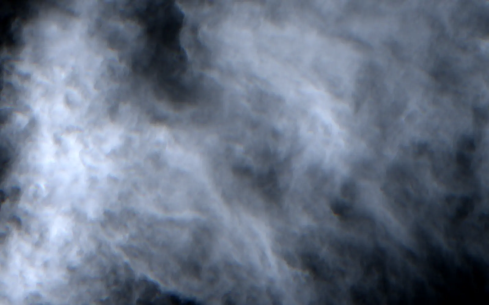
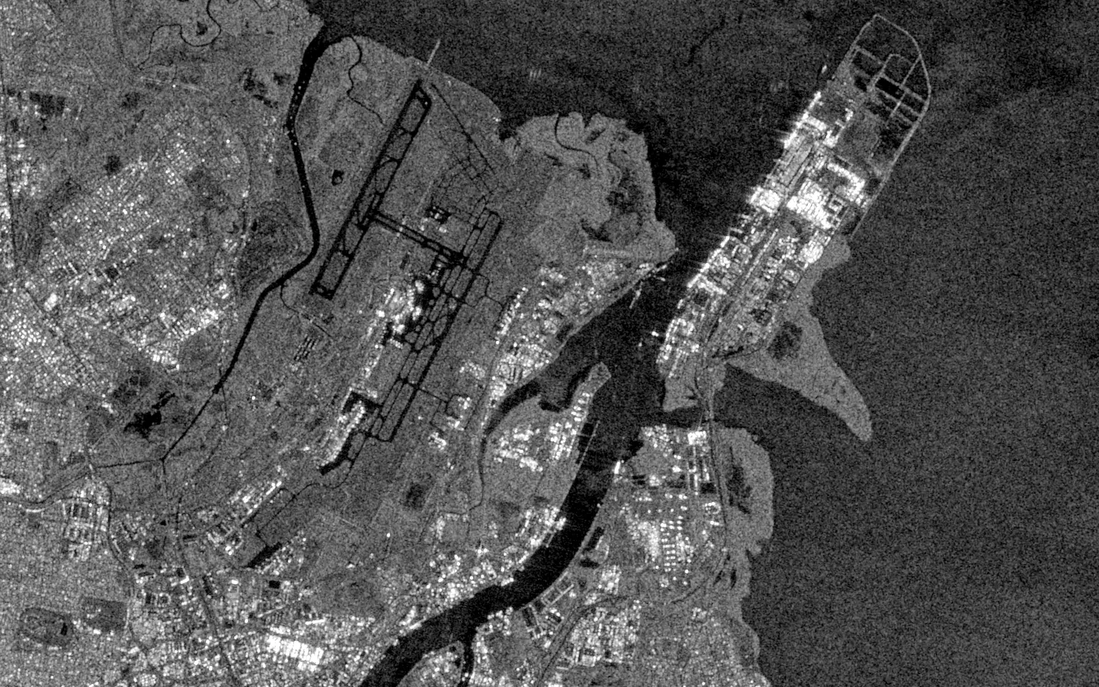
That week's storms flooded Brisbane. The optical satellite saw cloud; the radar saw the airport runways, the port and the river mouth. Both are free 10 m Copernicus satellites. KOMPSAT-5 sees the same way, at up to 85 cm.
Choose the mode by the smallest thing you need to see
Finer modes see smaller objects over a smaller footprint. Wider modes cover a region in one pass at coarser detail. All four are priced per km² of your area.
UH · Spotlight · 85 cm
Ships at berth, aircraft, building outlines
A$14 / km² · min 1 km² · tasking on request
EH / HR · Spotlight · 1 m
Port and plant layouts, roads, small structures
A$9 / km² · min 25 km² · tasking on request
ES / ST · Strip · 2.5 m
Field boundaries, flood edges along rivers
A$15 / km² · min 25 km² · tasking on request
EW / WS · ScanSAR · 20 m
Flood extent and shorelines across a region
A$15 / km² · min 1 km² · tasking on request
Australian dollars per km² of your area, excluding tax. An area smaller than the minimum is billed at the minimum. Tasking is quoted by our team for your area, dates and look angle.
When radar is the better buy, and when it isn't
We sell both, so we'd rather you buy the one that fits. Radar is harder to read than a photograph, and it costs you colour.
Choose radar when
- Your area sits under cloud for much of the year: the tropics, a monsoon, a wet season.
- You need an image on a given date, whatever the weather, such as during a flood.
- You need to see at night, or through a polar winter.
- You are watching water and ships: open water is dark in radar and metal hulls are bright.
- You need to measure ground movement, such as subsidence, settlement or slope creep. Repeat radar passes do that by interferometry (InSAR).
Choose optical when
- You need colour, or vegetation and water indices built from visible and infrared bands.
- Your area is usually clear. Optical is easier to read, and our optical list goes down to 15 cm.
- You want imagery processed end to end. Our processing chain is built for optical; radar is delivered as the operator supplies it.
We use radar in our own research. During the 2026 Bhote Koshi flood in Nepal, radar change detection helped us locate where the ice-rock avalanche broke away, under monsoon cloud. Read the analysis →
InSAR
See the ground move before it shows in a photograph
Compare two radar passes over the same ground and the difference shows how far it moved toward or away from the satellite in between. Repeat that over many passes and every point gets a time series, so movement far too small to see in an image shows up as a trend.
Where it helps
- Mining
- Pit walls, waste dumps and tailings dams
- Construction and tunnelling
- Settlement around excavations, tunnels and new fill
- Reclaimed and coastal land
- Subsidence under ports, reclaimed ground and coastal suburbs
- Slopes and corridors
- Creep on slopes above roads, rail and pipelines
Each job is scoped with you. Tell us the area, the period, the movement you are worried about and whether you have ground survey points. We check the radar archive over your site and tell you whether existing passes are enough or a tasked stack is needed.
What you receive
- Product levels
- L1A, L1C or L1D. L1A needs export approval.
- Formats
- GeoTIFF or HDF
- Polarisation
- HH, HV, VH or VV, chosen when you task
- Look angle
- 20° to 55° off nadir, ascending or descending passes
- Tasking
- Standard or priority, and repeat passes for InSAR or monitoring
- Processing
- Imagery is delivered as the operator supplies it. Ground-movement analysis (InSAR) is scoped as its own job.
What procurement will ask
- Licence
- The operator's licence is priced by how many people will use the data, from a single team up to a whole organisation. Tell us the headcount and we will quote the right tier.
- Account and invoicing
- One account and one invoice across archive, tasking, elevation and radar. We invoice NET-30 against your purchase order, and contracted rates are available.
- Export rules
- KOMPSAT-5 is a Korean satellite, and its licence binds you to Korea's export rules as well as your own.
- Security and export control
- Send security questionnaires and export-control questions to us directly. They go to the people who answer them.
Questions about radar
Why does radar imagery look grainy?
The grain is speckle, the interference pattern of a coherent radar signal. It is in every SAR image. Analysts reduce it by averaging neighbouring pixels or several dates, which trades some detail for a smoother picture.
What do HH, HV, VH and VV mean?
The orientation of the radar wave when it is sent and when it comes back: H for horizontal, V for vertical. The co-polarised VV and HH are the usual choice for water, flooding and ships. The cross-polarised HV and VH respond more to vegetation.
Can radar really see through cloud and rain?
Through cloud and darkness, yes: radar supplies its own signal and its wavelength passes through cloud. KOMPSAT-5 is an X-band radar, and very heavy rain cells can still leave faint marks in X-band images.
Is Sentinel-1 radar free?
Yes. Sentinel-1 is a Copernicus satellite with a 10 m pixel, free from the Copernicus Data Space Ecosystem, and it is what the image on this page shows. Buy KOMPSAT-5 when 10 m is too coarse, or when you need a new pass over your area.
What does InSAR measure?
How far the ground moved toward or away from the satellite between two radar passes, along the satellite's line of sight. Over many passes, each point gets a time series, which is how slow subsidence, settlement and slope creep become visible.
Do you analyse the radar for us?
Yes, for ground movement: we run InSAR on repeat radar passes over your site, scoped as its own job. KOMPSAT-5 imagery bought on its own is delivered as the operator supplies it, at the product level you choose. Our Legato processing chain is built for optical imagery.
Tell us the area and the dates
Send us your area of interest, the dates you need and the smallest thing you need to see. We will check the archive, quote tasking if it's needed, and tell you if optical would do the job for less.