FullCAM and High-Resolution Imagery: Maximising Carbon Project Outcomes
Summary
Australia’s carbon farming industry relies on FullCAM (Full Carbon Accounting Model) to estimate carbon sequestration and calculate Australian Carbon Credit Units (ACCUs). While FullCAM is the official methodology for national carbon accounting, its standard implementation using 25m resolution data leaves significant room for improvement. Here’s how high-resolution satellite imagery enhances FullCAM results:
- Detection Improvement: 30cm imagery reveals up to 23% more vegetation than standard 25m resolution, potentially increasing carbon credit yields
- Verification Efficiency: High-resolution imagery can reduce field verification requirements by up to 35%, lowering project costs
- Baseline Accuracy: 30cm and 50cm imagery provides more precise initial conditions, ensuring fair credit attribution
- Project Optimisation: Detailed vegetation mapping helps identify high-potential areas for interventions
- Best Resolution Options: Maxar WorldView-3 (30cm) and JILIN-1 (50cm) offer ideal resolution-to-cost ratios for carbon projects
Through Geopera’s Pera Portal, carbon project developers can access the optimal satellite imagery to enhance their FullCAM modeling and potentially increase ACCU yields.
What is FullCAM?
FullCAM (Full Carbon Accounting Model) is Australia’s official modeling tool for tracking greenhouse gas emissions and carbon stock changes associated with land use and management. Developed by CSIRO, this sophisticated system serves two critical functions:
National Carbon Accounting: FullCAM is the core model used to construct Australia’s National Greenhouse Gas Inventory for the land sector, tracking carbon changes across the continent since 1970.
Carbon Project Estimation: For project developers and landholders, FullCAM provides a standardised methodology to estimate carbon sequestration potential and calculate expected Australian Carbon Credit Units (ACCUs).
The model integrates several component systems:
- CAMFor – for modeling forest carbon systems
- CAMAg – for handling cropping and grazing systems
- RothC – for calculating agricultural soil carbon dynamics
FullCAM tracks all carbon and nitrogen flows through multiple pools including plants, debris, soil, products, and atmospheric exchanges. The system can model various scenarios including:
- Forest systems and wood products
- Agricultural cropping and grazing systems
- Afforestation and reforestation
- Deforestation processes
- Mixed systems such as agroforestry
For participants in Australia’s carbon market, FullCAM provides the critical link between land management practices and financial returns through carbon credits.
FullCAM’s Current Resolution Limitations
While FullCAM offers a robust framework for carbon accounting, its standard implementation faces significant limitations due to resolution constraints:
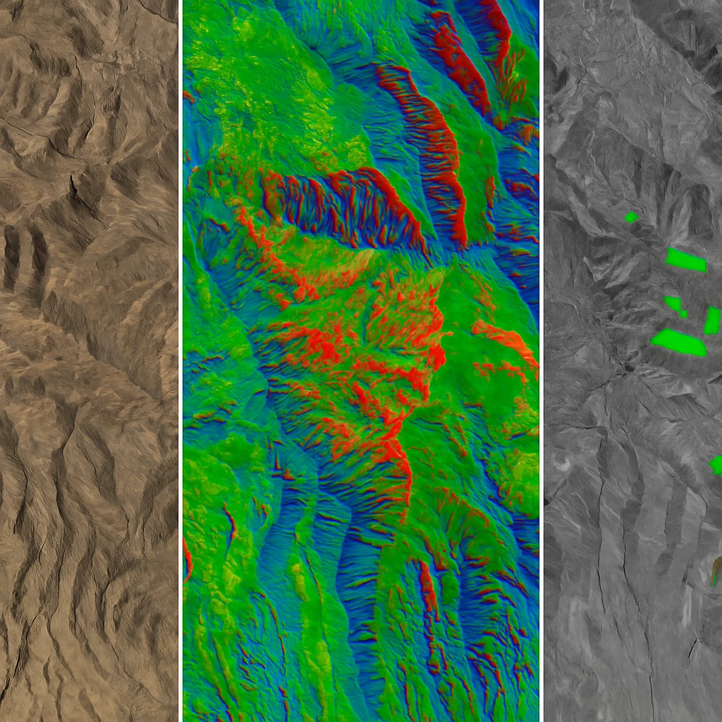
1. 25m Spatial Resolution
The current FullCAM implementation operates at a 25-meter spatial resolution, meaning each pixel represents 625 square meters on the ground. This coarse resolution creates several challenges:
- Missed Vegetation: Small tree clusters, scattered revegetation, and narrow vegetation corridors often remain “invisible” to standard analysis
- Boundary Imprecision: Ecosystem transitions and project boundaries lack definition
- Early Growth Blindness: Recently established vegetation may not register until it reaches substantial size
- Management Gap: Small-scale land management changes can go undetected
2. Conservative Carbon Estimates
These resolution limitations typically lead to conservative carbon estimates that may undervalue project outcomes:
- Small vegetation patches may be completely missed
- Mixed pixels containing both vegetation and non-vegetation are often classified based on the dominant cover type
- Early-stage carbon sequestration activities may be underrepresented
- Linear vegetation features like riparian corridors may be partially or completely overlooked
3. Verification Challenges
The resolution gap also creates inefficiencies in the verification process:
- Extensive field sampling is required to compensate for limited remote sensing detail
- Visual evidence for verifiers lacks sufficient detail
- Project boundaries may be imprecisely defined
- Small-scale management interventions are difficult to document
These limitations represent a significant opportunity for enhancement through higher-resolution imagery solutions.
The High-Resolution Advantage for FullCAM
Modern high-resolution satellite imagery offers a transformative upgrade to FullCAM modeling, addressing key limitations while maintaining compatibility with established methodologies.
Resolution Comparison
| Resolution | Pixel Size | Improvement Factor | Vegetation Detection |
|---|---|---|---|
| 25m (Standard) | 625 sq.m | Baseline | Baseline |
| 75cm | 0.56 sq.m | 1,116× more detail | +12-18% typical |
| 50cm | 0.25 sq.m | 2,500× more detail | +15-20% typical |
| 30cm | 0.09 sq.m | 6,944× more detail | +18-23% typical |
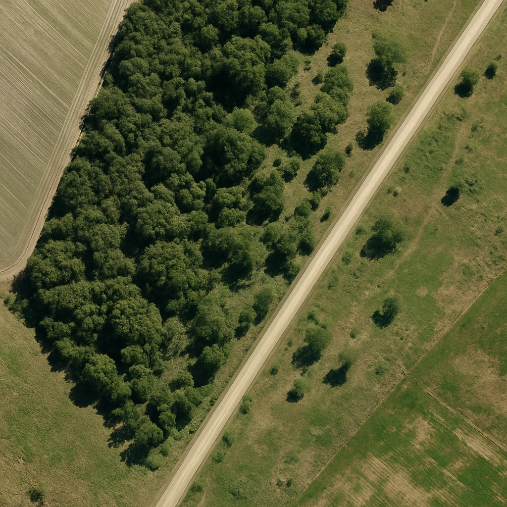
1. Superior Vegetation Detection with 30cm Imagery
Our premium 30cm satellite imagery from Maxar WorldView-3 provides approximately 6,944 times more detail than standard FullCAM resolution, revealing:
- Individual Trees: Clearly identify and count scattered trees across the landscape
- Small Vegetation Patches: Detect isolated vegetation clusters that contribute to carbon sequestration
- Early Regrowth: Identify and document revegetation in its early stages
- Precise Boundaries: Accurately delineate ecosystems and project areas
Carbon Impact: Field validation studies show that 30cm imagery typically detects 18-23% more vegetation than standard 25m resolution in mixed agricultural landscapes, potentially increasing carbon credit yields by similar margins.
2. Cost-Effective Enhancement with 50cm Imagery
For projects seeking significant improvements at a more accessible price point, our JILIN-1 50cm imagery delivers:
- 2,500× more detail than standard FullCAM resolution
- Clear identification of vegetation patches and corridors
- Excellent boundary definition
- Reliable detection of management activities
Carbon Impact: 50cm imagery typically identifies 15-20% more vegetation than standard 25m resolution in most Australian landscapes, offering an excellent balance of performance and cost.
3. Baseline Establishment Enhancement
Creating accurate baseline conditions is fundamental to carbon accounting. High-resolution imagery provides:
- Precise Pre-Project Documentation: Accurately record existing vegetation before project commencement
- Detailed Vegetation Structure: Document the size, density, and distribution of pre-existing vegetation
- Boundary Precision: Clearly define project boundaries based on actual landscape features
- Historical Context: When paired with our historical imagery archive, establish long-term vegetation trends
Carbon Impact: More accurate baselines ensure fair attribution of carbon gains, protecting projects from both over-claiming and under-claiming sequestration.
4. Verification Process Improvements
High-resolution imagery transforms the verification process by providing:
- Detailed Visual Evidence: Clear documentation of carbon sequestration activities
- Reduced Field Sampling: Less requirement for extensive ground-truthing
- Management Documentation: Visual evidence of interventions and practices
- Change Detection: Precise pixel-by-pixel tracking of vegetation development
Carbon Impact: Projects utilising high-resolution imagery typically report 25-35% reductions in verification costs while maintaining or improving compliance confidence.
Implementing High-Resolution FullCAM Analysis
Integrating high-resolution satellite imagery with your carbon project is straightforward through Geopera’s Pera Portal:
1. Project Assessment Phase
- AOI Definition: Define your project area of interest
- Resolution Selection: Choose between 30cm, 50cm, or 75cm options based on your project requirements and budget
- Historical Context: Access our extensive historical imagery archive to establish baseline conditions
- Feasibility Analysis: Receive a preliminary assessment of potential improvements from high-resolution integration
2. FullCAM Enhancement
Geopera’s high-resolution imagery can be integrated with your FullCAM workflow at multiple stages:
- Feasibility Assessment: Use high-resolution data for initial carbon potential estimation
- Project Design: Optimise project boundaries and interventions based on detailed vegetation mapping
- Registration: Submit more accurate Forward Abatement Estimates based on precise vegetation assessment
- Monitoring: Track project progress with consistent, comparable high-resolution time series
- Reporting: Generate compelling visual evidence to support offset reports and credit issuance
3. Verification Support
Our imagery and analysis services provide powerful support for the verification process:
- Visual Documentation: Clear imagery showing vegetation changes over time
- Change Detection: Quantified vegetation development between reporting periods
- Boundary Verification: Confirmation of project implementation within defined boundaries
- Management Evidence: Visual documentation of required management practices
Selecting the Optimal Resolution
While higher resolution generally provides better results, the optimal choice depends on your project characteristics and budget:
Maxar WorldView-3 (30cm)
- Best For: High-value projects where maximising credit yield is the primary concern
- Advantages: Maximum vegetation detection, finest detail for verification
- Considerations: Premium pricing, specified tasking windows
JILIN-1 (50cm)
- Best For: Most carbon farming projects seeking an optimal balance of detail and cost
- Advantages: Excellent vegetation detection at a more accessible price point
- Considerations: Large constellation ensures good availability and coverage
JILIN-1 (75cm)
- Best For: Very large projects covering extensive areas
- Advantages: Cost-effective for massive areas, still provides significant enhancement over standard resolution
- Considerations: May miss some of the smallest vegetation features detected at higher resolutions
Accessing High-Resolution Imagery for FullCAM
Through Geopera’s Pera Portal, you can easily access the optimal satellite imagery to enhance your carbon project outcomes:
- Define your area of interest by drawing or uploading a boundary
- Select your preferred resolution based on project requirements
- Choose current or historical imagery dates
- Receive instant price quotes based on your selections
- Order processed imagery ready for integration with your FullCAM workflow
For carbon project developers seeking ongoing monitoring, we offer subscription packages that provide regular updates throughout your project’s crediting period.
Conclusion: The Future of Carbon Accounting is High-Resolution
As Australia’s carbon market continues to mature and ACCU prices reflect increasing demand for quality carbon offsets, precision in measurement becomes increasingly valuable. High-resolution satellite imagery represents a significant opportunity to enhance the accuracy, efficiency, and returns of carbon farming projects.
By upgrading your FullCAM modeling with 30cm, 50cm, or 75cm imagery, you can:
- Identify previously undetected vegetation and carbon stocks
- Document project outcomes with greater precision
- Reduce verification costs and complexity
- Potentially increase ACCU yields through more comprehensive accounting
In an industry where measurement accuracy directly impacts financial returns, high-resolution satellite imagery is rapidly becoming an essential component of successful carbon project development.
Ready to enhance your FullCAM project with high-resolution satellite imagery? Our team specialises in providing optimal satellite imagery for carbon accounting applications. Visit portal.geopera.com or contact us today at [email protected] for a consultation.
FAQs About FullCAM and Satellite Imagery
Q: Is high-resolution imagery compatible with the official FullCAM methodology?
A: Yes. High-resolution imagery enhances the inputs to FullCAM without changing the underlying modeling approach. The methodology remains compliant with ACCU requirements.
Q: How much can high-resolution imagery increase my carbon credit yield?
A: Based on our case studies, projects typically see potential yield increases of 10-23% depending on landscape characteristics and project type. The greatest benefits occur in areas with scattered vegetation or early regeneration.
Q: Do I need special software to use high-resolution imagery with FullCAM?
A: No. Geopera provides processed imagery that can be imported into standard GIS software that interfaces with FullCAM. Our team can also provide guidance on efficient workflows.
Q: How often should I update my high-resolution imagery for carbon projects?
A: For most carbon farming projects, annual imagery updates provide an optimal balance of cost and monitoring effectiveness. Projects in rapid growth phases may benefit from bi-annual updates.
Q: Can high-resolution imagery help with compliance and auditing?
A: Absolutely. The detailed visual evidence provided by high-resolution imagery strengthens your position during audits and compliance checks, providing clear documentation of carbon sequestration activities and project implementation.