GEOPERA
Product
Solutions
Resources
Company
Pricing
Why Geopera
Try Pera Portal
Talk To Us
Toggle menu
Home
Case Studies
Categories
Satellite Imagery
Satellite Imagery
Mineral Exploration,Remote Sensing,Satellite Imagery
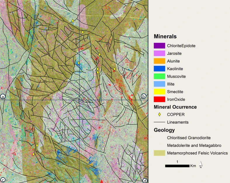
Using WorldView-3 SWIR to Enable Individual Alteration Mineral Mapping
5/26/2025
Read More
Carbon Assessment,Remote Sensing,Satellite Imagery
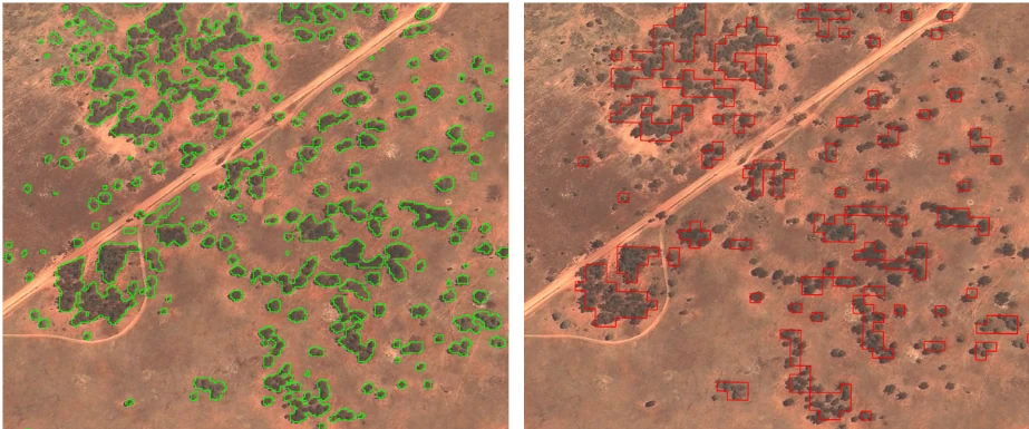
Scaling Carbon Stock Assessment by Leveraging High-Resolution Satellite Imagery
3/28/2025
Read More
All Categories
Carbon Assessment
1
Mineral Exploration
1
Remote Sensing
2
Satellite Imagery
2
Back to Case Studies