ESA's Biomass Mission Explained: Peering Inside the World's Forests
Explore ESA's groundbreaking Biomass mission, using novel P-band radar technology to measure forest carbon storage and unlock secrets of the global carbon cycle.
Summary: ESA’s Biomass Mission
ESA’s Biomass mission, launched on April 29, 2025, is a pioneering Earth Explorer satellite designed to provide unprecedented insights into the world’s forests. Key aspects include:
- Unique Technology: It carries the first-ever spaceborne P-band synthetic aperture radar (SAR).
- Deep Penetration: The long wavelength (P-band) radar can see through dense forest canopies to measure the woody biomass (trunks, branches) where most carbon is stored.
- Carbon Cycle Focus: The primary goal is to reduce uncertainties in how much carbon is stored in forests and how this changes over time, improving our understanding of the global carbon cycle and its role in climate change.
- Global Mapping: The mission will create detailed global maps of forest biomass and height.
- Advanced Techniques: It uses both tomographic (3D imaging) and interferometric phases to gather comprehensive data.
- Beyond Forests: P-band radar also offers unique capabilities for measuring glacier/ice sheet velocity, mapping sub-surface geology in arid regions, and determining topography beneath dense vegetation.
ESA’s Biomass Mission: A New Eye on Global Forests
Forests cover nearly a third of our planet’s land surface and are indispensable players in the Earth’s climate system. Through photosynthesis, they draw vast amounts of carbon dioxide (CO₂) from the atmosphere, storing carbon primarily in their woody biomass – the trunks, branches, and stems. This natural process is critical for regulating atmospheric CO₂ levels and maintaining climate stability.
However, accurately quantifying the total carbon stored in global forests and tracking its changes over time remains a significant challenge. Factors like deforestation, land-use change, forest degradation, and regrowth, compounded by climate change impacts, create large uncertainties in our understanding of the forest carbon cycle.
To address these critical knowledge gaps, the European Space Agency (ESA) developed the Biomass mission. As one of ESA’s innovative Earth Explorer missions, Biomass employs groundbreaking technology to deliver crucial data on forest biomass, height, and carbon stocks, enhancing our grasp of forests’ role in the complex global carbon cycle.
The Carbon Cycle Challenge
Human activities, mainly burning fossil fuels and changing land use, have increased atmospheric CO₂ levels by 50% compared to pre-industrial times, significantly impacting our climate. While reducing emissions is paramount, a precise understanding of the natural carbon cycle – how carbon moves between the atmosphere, oceans, and land – is vital for accurate climate modelling and effective mitigation strategies.
Currently, the terrestrial components of the carbon cycle, especially emissions from land-use change and the carbon uptake by land ecosystems, are the least certain parts of the equation. The Biomass mission directly targets this uncertainty by providing accurate, consistent, global measurements of forest biomass, a key indicator of stored carbon on land.
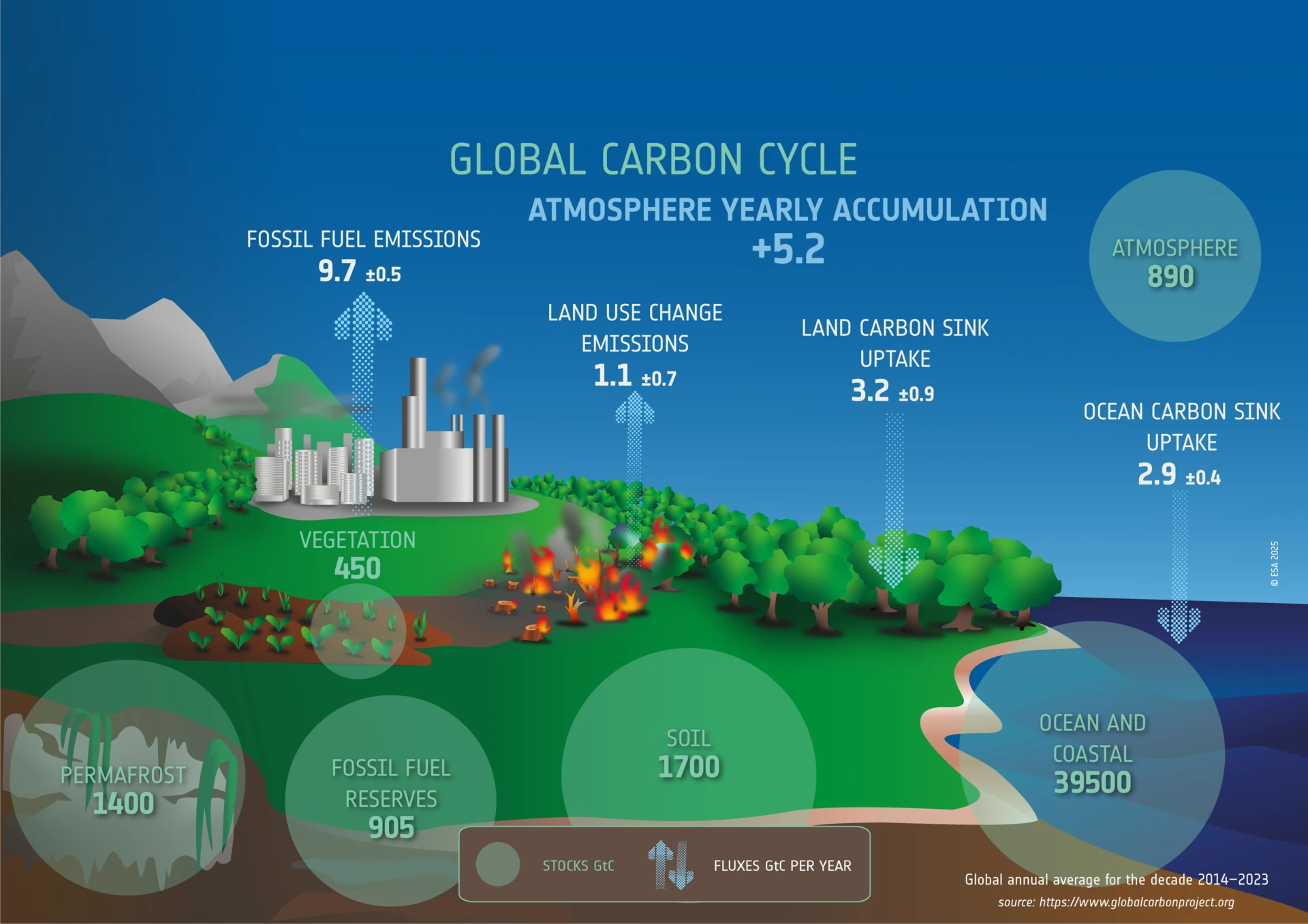 The global carbon cycle, showing average annual carbon stocks (GtC) and fluxes (GtC per year) for 2014–2023. Terrestrial components show significant uncertainty. (Adapted from Global Carbon Project)
What Makes the Biomass Mission Unique? P-Band Radar
Measuring the mass of forests from space is incredibly complex. Traditional optical sensors see the top of the canopy, while shorter-wavelength radar interacts mainly with leaves and smaller branches. The Biomass mission’s breakthrough is its use of P-band synthetic aperture radar (SAR) – the first of its kind in space.
Why P-Band?
- Long Wavelength: P-band radar uses a long wavelength (around 70 cm / 435 MHz) that can penetrate deep into the forest canopy, reaching the main trunks and larger branches where the majority (around 75%) of a tree’s biomass is stored.
- All-Weather Capability: Like other radar systems, P-band can acquire imagery day and night, regardless of cloud cover or weather conditions, ensuring consistent data collection.
- Structural Information: By analysing how the P-band signal interacts with and reflects off different parts of the forest structure, scientists can estimate not just biomass but also forest height.
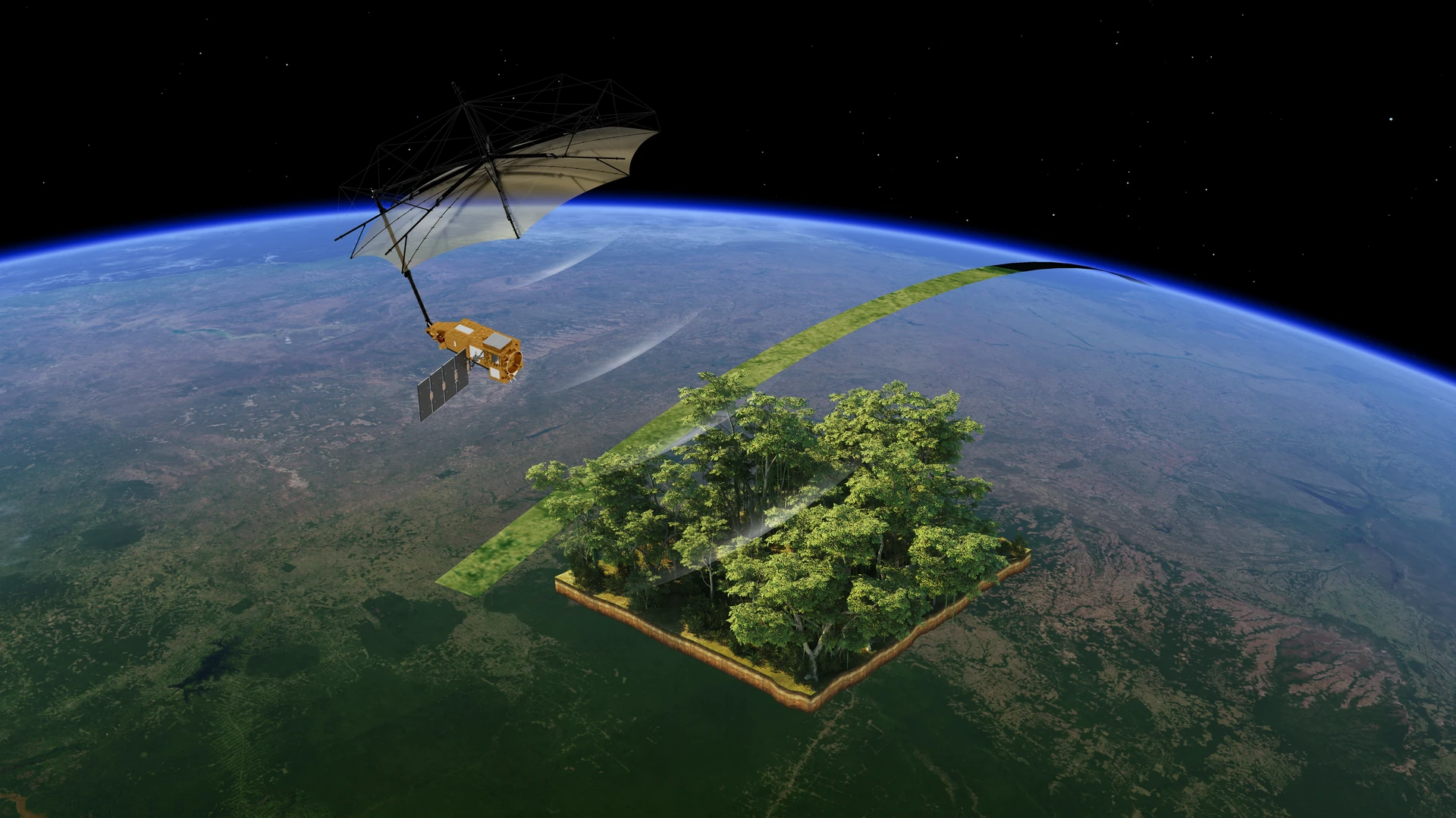
To effectively focus this long-wavelength radar signal onto Earth’s surface, the Biomass satellite is equipped with a large 12-metre diameter deployable reflector antenna.
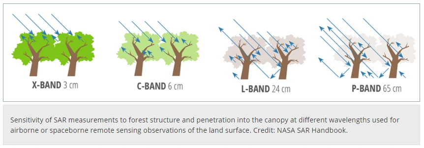 Illustration showing how the long wavelength of P-band radar penetrates the forest canopy to interact with trunks and branches, unlike shorter wavelengths.
How Biomass Measures Forests: Tomography and Interferometry
To achieve its ambitious goals over its planned 5.5-year lifespan, the Biomass mission operates in two distinct phases:
Tomographic Phase (First ~18 months):
- This phase uses techniques similar to a medical CT scan. Multiple images are taken from slightly different orbital positions over the same area.
- Combining these images allows scientists to create a 3D map of the forest structure, revealing information about the vertical distribution of biomass.
- This results in a single, detailed global map with a vertical resolution of 15-20 metres and a spatial resolution of 200 metres. Biomass is the first mission to systematically apply this technique from space for forest mapping.
Interferometric Phase (Remaining ~4 years):
- During this phase, the satellite repeatedly observes the same areas. By comparing the phase of the radar signals from different passes (interferometry), scientists can estimate forest height and track changes in above-ground biomass over time.
- This phase aims to produce around five global maps, allowing for the quantification of carbon fluxes – the crucial variable needed to understand how forest carbon storage is changing and impacting the climate.
Beyond the Forest: Expanding Earth Observation Frontiers
While forests are the primary focus, the unique capabilities of P-band radar open up exciting possibilities for other areas of Earth observation:
- Ice Sheets and Glaciers: P-band can penetrate deeper into ice than shorter wavelengths, making it less susceptible to surface melt or snowfall distortions. This allows for more accurate measurements of glacier and ice-sheet velocities, especially in challenging regions like Antarctica, which Biomass will map using P-band for the first time.
- Sub-surface Geology: In arid environments, P-band radar can penetrate dry sand up to several metres deep. This enables the mapping of hidden geological features like ancient riverbeds or palaeolakes, offering insights into past climates and potential fossil water resources.
- Topography Beneath Vegetation: By penetrating dense forest canopies, Biomass can reveal the true ground elevation, helping to correct biases present in digital elevation models (DEMs) created using shorter-wavelength radar or optical methods.
Mission Status and Launch
The ESA Biomass satellite embarked on its mission on April 29, 2025. It was launched aboard a Vega-C rocket from ESA’s Spaceport in Kourou, French Guiana. This mission represents a significant collaborative effort involving hundreds of people across Europe, Canada, and the USA, with Airbus UK as the prime contractor and Airbus DE leading the development of the P-band radar instrument.
Conclusion: A Vital Tool for Climate Science
ESA’s Biomass mission stands as a testament to innovation in Earth observation. By deploying the first-ever spaceborne P-band radar, it promises to dramatically reduce uncertainties surrounding the role of forests in the global carbon cycle. The data gathered will be invaluable for climate scientists, policymakers, and forest managers worldwide, providing a clearer picture of forest carbon stocks and fluxes.
Beyond its primary objective, Biomass pushes the boundaries of radar remote sensing, offering new ways to study ice dynamics, uncover hidden geological features, and accurately map terrain under dense vegetation. This pioneering mission will undoubtedly enhance our understanding of Earth’s complex systems and provide critical information for tackling the challenges of climate change.
Related Articles
Red Edge in Remote Sensing: Applications and Advantages
Discover how Red Edge bands revolutionise vegetation monitoring through advanced remote sensing techniques.
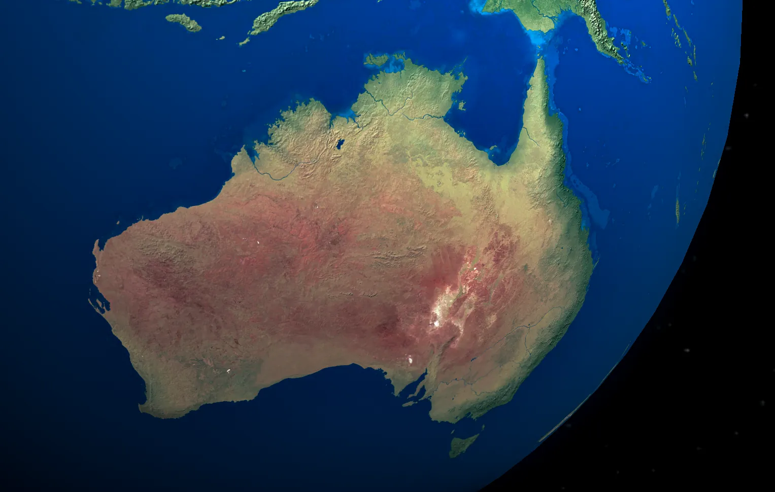
10 Best Free Sources of Satellite Data for Australia
Discover the best free satellite imagery sources available for Australian projects and research.
